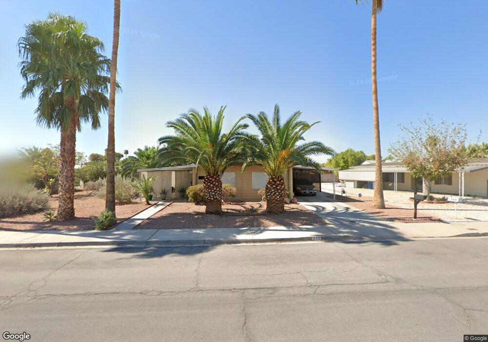
277 Sir Phillip St Las Vegas, NV 89110
Estimated Value: $248,250 - $289,000
3
Beds
2
Baths
1,425
Sq Ft
$186/Sq Ft
Est. Value
About This Home
This home is located at 277 Sir Phillip St, Las Vegas, NV 89110 and is currently estimated at $265,313, approximately $186 per square foot. 277 Sir Phillip St is a home located in Clark County with nearby schools including Charlotte & Jerry Keller Elementary School, Richard J. Rundle Elementary School, and Duane D. Keller Middle School.
Ownership History
Date
Name
Owned For
Owner Type
Purchase Details
Closed on
Oct 18, 2018
Sold by
Lpr Llc
Bought by
Mccanch Prathom
Current Estimated Value
Home Financials for this Owner
Home Financials are based on the most recent Mortgage that was taken out on this home.
Original Mortgage
$129,293
Outstanding Balance
$103,263
Interest Rate
4.5%
Mortgage Type
New Conventional
Estimated Equity
$162,050
Purchase Details
Closed on
Dec 19, 2017
Sold by
Cantu George E
Bought by
Lpr Llc
Home Financials for this Owner
Home Financials are based on the most recent Mortgage that was taken out on this home.
Original Mortgage
$85,000
Interest Rate
3.9%
Mortgage Type
Commercial
Purchase Details
Closed on
Oct 22, 1998
Sold by
Cantu George E and Cantu Melody
Bought by
Cantu George E
Home Financials for this Owner
Home Financials are based on the most recent Mortgage that was taken out on this home.
Original Mortgage
$63,750
Interest Rate
6.61%
Create a Home Valuation Report for This Property
The Home Valuation Report is an in-depth analysis detailing your home's value as well as a comparison with similar homes in the area
Home Values in the Area
Average Home Value in this Area
Purchase History
| Date | Buyer | Sale Price | Title Company |
|---|---|---|---|
| Mccanch Prathom | $154,900 | Ticor Title Las Vegas 8 | |
| Lpr Llc | $70,000 | Fidelity National Title | |
| Cantu George E | -- | Lawyers Title |
Source: Public Records
Mortgage History
| Date | Status | Borrower | Loan Amount |
|---|---|---|---|
| Open | Mccanch Prathom | $129,293 | |
| Previous Owner | Lpr Llc | $85,000 | |
| Previous Owner | Cantu George E | $63,750 |
Source: Public Records
Tax History Compared to Growth
Tax History
| Year | Tax Paid | Tax Assessment Tax Assessment Total Assessment is a certain percentage of the fair market value that is determined by local assessors to be the total taxable value of land and additions on the property. | Land | Improvement |
|---|---|---|---|---|
| 2025 | $390 | $38,612 | $22,400 | $16,212 |
| 2024 | $380 | $38,612 | $22,400 | $16,212 |
| 2023 | $558 | $33,074 | $18,550 | $14,524 |
| 2022 | $369 | $27,651 | $14,700 | $12,951 |
| 2021 | $358 | $25,700 | $13,650 | $12,050 |
| 2020 | $345 | $24,652 | $12,250 | $12,402 |
| 2019 | $340 | $22,479 | $9,800 | $12,679 |
| 2018 | $325 | $21,105 | $8,400 | $12,705 |
| 2017 | $515 | $17,114 | $6,650 | $10,464 |
| 2016 | $558 | $15,911 | $5,250 | $10,661 |
| 2015 | $556 | $15,968 | $4,900 | $11,068 |
| 2014 | $547 | $10,223 | $4,200 | $6,023 |
Source: Public Records
Map
Nearby Homes
- 280 Sir Phillip St
- 332 Sir Jeffery Cir
- 360 Sir Richard Dr E
- 179 Sir George Dr
- 147 N Christy Ln
- 153 Sir Thomas Dr
- 136 Sir George Dr
- 5330 E Charleston Blvd Unit 2
- 5330 E Charleston Blvd Unit 113
- 140 Sir David Way
- 5564 Orchard Ln Unit 133
- 130 Bel Port Dr Unit 133
- 5583 Orchard Ln Unit 152
- 5600 Orchard Ln
- 0 E Charleston Blvd
- 5364 Awbury Ave
- 522 Wheaties Way
- 111 Sir Arthur Dr
- 316 Linn Ln
- 5529 Cedar Ave
- 277 Sir Phillip St
- 271 Sir Phillip Ct
- 289 Sir Phillip St
- 260 Sir George Dr
- 304 Sir Phillip St
- 312 Sir Phillip St
- 320 Sir Phillip St
- 5390 S Sir Richard Dr
- 5356 S Sir Richard Dr
- 5344 S Sir Richard Dr
- 328 Sir George Dr
- 321 Sir Jeffery St
- 329 Sir Jeffery St
- 275 Sir George Dr
- 334 Sir George Dr
- 272 Sir Phillip St
- 299 Sir George Dr
- 264 Sir Phillip St
- 340 Sir George Dr