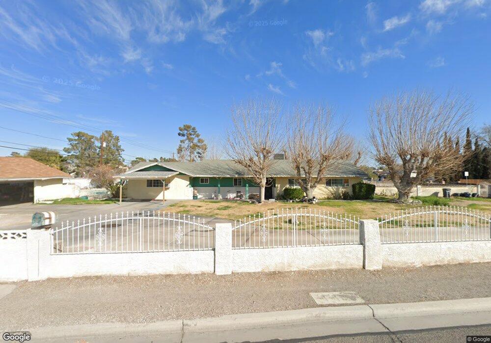
2770 N Jones Blvd Las Vegas, NV 89108
Michael Way NeighborhoodEstimated Value: $611,000 - $660,000
3
Beds
3
Baths
2,263
Sq Ft
$277/Sq Ft
Est. Value
About This Home
This home is located at 2770 N Jones Blvd, Las Vegas, NV 89108 and is currently estimated at $626,863, approximately $277 per square foot. 2770 N Jones Blvd is a home located in Clark County with nearby schools including Doris M. Reed Elementary School, J. Harold Brinley Middle School, and Cimarron Memorial High School.
Ownership History
Date
Name
Owned For
Owner Type
Purchase Details
Closed on
Apr 17, 2007
Sold by
Savage Raquel and Savage Roosevelt
Bought by
Savage Raquel and Savage Roosevelt
Current Estimated Value
Home Financials for this Owner
Home Financials are based on the most recent Mortgage that was taken out on this home.
Original Mortgage
$185,000
Interest Rate
6.1%
Mortgage Type
New Conventional
Create a Home Valuation Report for This Property
The Home Valuation Report is an in-depth analysis detailing your home's value as well as a comparison with similar homes in the area
Home Values in the Area
Average Home Value in this Area
Purchase History
| Date | Buyer | Sale Price | Title Company |
|---|---|---|---|
| Savage Raquel | -- | First Amer Title Co Of Nv |
Source: Public Records
Mortgage History
| Date | Status | Borrower | Loan Amount |
|---|---|---|---|
| Closed | Savage Raquel | $185,000 |
Source: Public Records
Tax History Compared to Growth
Tax History
| Year | Tax Paid | Tax Assessment Tax Assessment Total Assessment is a certain percentage of the fair market value that is determined by local assessors to be the total taxable value of land and additions on the property. | Land | Improvement |
|---|---|---|---|---|
| 2025 | $1,002 | $95,090 | $52,500 | $42,590 |
| 2024 | $973 | $95,090 | $52,500 | $42,590 |
| 2023 | $973 | $88,778 | $50,750 | $38,028 |
| 2022 | $945 | $77,202 | $43,050 | $34,152 |
| 2021 | $918 | $76,886 | $45,150 | $31,736 |
| 2020 | $888 | $68,586 | $37,800 | $30,786 |
| 2019 | $877 | $60,804 | $31,150 | $29,654 |
| 2018 | $837 | $55,345 | $27,300 | $28,045 |
| 2017 | $1,496 | $54,853 | $26,950 | $27,903 |
| 2016 | $785 | $48,776 | $22,050 | $26,726 |
| 2015 | $825 | $41,954 | $16,100 | $25,854 |
| 2014 | $802 | $40,445 | $14,000 | $26,445 |
Source: Public Records
Map
Nearby Homes
- 5905 Paseo Montana
- 2879 N Jones Blvd
- 5807 Madre Mesa Dr
- 5854 Alfred Dr
- 5710 Madre Mesa Dr
- 5705 Mossman Ave
- 6100 W Brooks Ave
- 2499 N Jones Blvd
- 6216 Molino St
- 2915 Maverick St
- 5500 Avenida Vaquero
- 5921 San Fernando Dr
- 2829 N Michael Way
- 5486 Alfred Dr
- 2913 N Michael Way
- 5537 Cleary Ct
- 5705 Stallion Ave
- 5905 Smoke Ranch Rd Unit A
- 6165 Smoke Ranch Rd
- 5917 Smoke Ranch Rd Unit B
- 5960 Sheila Ave
- 5913 Paseo Montana
- 2780 Mickey Mantle Ct Unit Lot 2007
- 2780 Mickey Mantle Ct
- 5909 Paseo Montana
- 2790 Mickey Mantle Ct Unit 2008
- 2790 Mickey Mantle Ct
- 2770 Mickey Mantle Ct Unit Lot 2006
- 5934 Sheila Ave
- 2760 Mickey Mantle Ct
- 5949 Sheila Ave
- 2815 N Jones Blvd
- 5901 Paseo Montana
- 2750 Mickey Mantle Ct Unit Lot 2004
- 2750 Mickey Mantle Ct
- 2785 Mickey Mantle Ct
- 5925 Sheila Ave
- 5910 Sheila Ave
- 2816 N Jones Blvd
- 5813 Paseo Montana