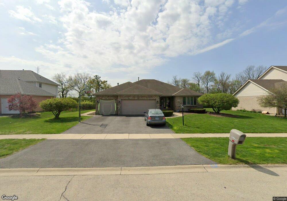
2770 Southwind Dr New Lenox, IL 60451
Estimated Value: $511,030 - $546,000
4
Beds
3
Baths
--
Sq Ft
8,712
Sq Ft Lot
About This Home
This home is located at 2770 Southwind Dr, New Lenox, IL 60451 and is currently estimated at $531,258. 2770 Southwind Dr is a home located in Will County with nearby schools including Spencer Trail, Spencer Pointe, and Spencer Crossing Intermediate School.
Ownership History
Date
Name
Owned For
Owner Type
Purchase Details
Closed on
Oct 14, 2005
Sold by
Yaeger Frank E and Yaeger Debra J
Bought by
Sabo Dennis L and Sabo Carol A
Current Estimated Value
Home Financials for this Owner
Home Financials are based on the most recent Mortgage that was taken out on this home.
Original Mortgage
$200,000
Outstanding Balance
$107,454
Interest Rate
5.82%
Mortgage Type
Fannie Mae Freddie Mac
Estimated Equity
$423,804
Purchase Details
Closed on
Dec 5, 1997
Sold by
Marquette National Bank
Bought by
Yaeger Frank E and Yaeger Debra J
Home Financials for this Owner
Home Financials are based on the most recent Mortgage that was taken out on this home.
Original Mortgage
$176,000
Interest Rate
7.36%
Create a Home Valuation Report for This Property
The Home Valuation Report is an in-depth analysis detailing your home's value as well as a comparison with similar homes in the area
Home Values in the Area
Average Home Value in this Area
Purchase History
| Date | Buyer | Sale Price | Title Company |
|---|---|---|---|
| Sabo Dennis L | $355,000 | Ticor Title | |
| Yaeger Frank E | $225,000 | -- |
Source: Public Records
Mortgage History
| Date | Status | Borrower | Loan Amount |
|---|---|---|---|
| Open | Sabo Dennis L | $200,000 | |
| Previous Owner | Yaeger Frank E | $176,000 |
Source: Public Records
Tax History Compared to Growth
Tax History
| Year | Tax Paid | Tax Assessment Tax Assessment Total Assessment is a certain percentage of the fair market value that is determined by local assessors to be the total taxable value of land and additions on the property. | Land | Improvement |
|---|---|---|---|---|
| 2024 | $13,052 | $168,829 | $36,393 | $132,436 |
| 2023 | $13,052 | $153,901 | $33,175 | $120,726 |
| 2022 | $11,748 | $141,779 | $30,562 | $111,217 |
| 2021 | $11,160 | $133,339 | $28,743 | $104,596 |
| 2020 | $10,847 | $128,581 | $27,717 | $100,864 |
| 2019 | $10,385 | $124,594 | $26,858 | $97,736 |
| 2018 | $10,150 | $120,299 | $25,932 | $94,367 |
| 2017 | $9,647 | $116,840 | $25,186 | $91,654 |
| 2016 | $9,368 | $113,713 | $24,512 | $89,201 |
| 2015 | $9,028 | $110,133 | $23,740 | $86,393 |
| 2014 | $9,028 | $108,773 | $23,447 | $85,326 |
| 2013 | $9,028 | $110,239 | $23,763 | $86,476 |
Source: Public Records
Map
Nearby Homes
- 2848 Southwind Dr
- 2758 Bluestone Bay Dr
- 21606 Skyway Dr
- 651 Schooner Dr
- 1587 Glenbrooke Ln
- 1591 Glenbrooke Ln
- 1595 Glenbrooke Ln
- 1583 Glenbrooke Ln
- 1579 Glenbrooke Bldg 60 Ln
- 21359 Saddle Ln
- 2667 E Lincoln Hwy
- 1738 Orchard Ln
- 11826 Leigh Ct
- 190 Pottawatomie Ln
- Avalon Plan at Leigh Creek - Townhome
- Hampton Plan at Leigh Creek - Townhome
- 21244 Sage Brush Ln
- 1781 Orchard Ln
- 1515 Glenbrooke Ln
- 21170 Sage Brush Ln
- 2780 Southwind Dr Unit 3
- 2750 Southwind Dr
- 2790 Southwind Dr
- 898 Spinnaker Dr
- 897 Bristol Ln
- 2740 Southwind Dr
- 2802 Southwind Dr
- 893 Bristol Ln
- 892 Spinnaker Dr
- 895 Spinnaker Dr Unit 3
- 2824 Southwind Dr
- 2730 Southwind Dr
- 887 Bristol Ln
- 884 Spinnaker Dr
- 887 Spinnaker Dr
- 2720 Southwind Dr
- 2836 Southwind Dr
- 2802 Passage Ln
- 2829 Southwind Dr
- 883 Bristol Ln