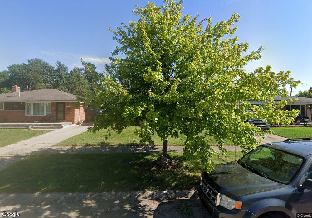
27700 Mackenzie Dr Westland, MI 48185
Estimated Value: $258,000 - $373,000
5
Beds
3
Baths
2,000
Sq Ft
$149/Sq Ft
Est. Value
About This Home
This home is located at 27700 Mackenzie Dr, Westland, MI 48185 and is currently estimated at $297,002, approximately $148 per square foot. 27700 Mackenzie Dr is a home located in Wayne County with nearby schools including Cleveland Elementary School, Cooper Upper Elementary School, and Emerson Middle School.
Ownership History
Date
Name
Owned For
Owner Type
Purchase Details
Closed on
Dec 30, 2009
Sold by
Mcinnis Mike and Mcinnis Kelly
Bought by
Applebaum Stephen
Current Estimated Value
Purchase Details
Closed on
Dec 28, 2009
Sold by
Bessey Brent and Bessey Rebecca D
Bought by
Mcinnis Mike
Purchase Details
Closed on
Sep 19, 2007
Sold by
Ward Michaelline
Bought by
National City Bank
Purchase Details
Closed on
May 17, 2005
Sold by
Salame Joseph and Salame Joann
Bought by
Ward Michaeline
Purchase Details
Closed on
Nov 10, 2003
Sold by
Ward Michaeline M
Bought by
Salame Joseph
Purchase Details
Closed on
Oct 20, 2003
Sold by
Ameriquest Mortgage Co
Bought by
Bankers Trust Co Of Ca and Ameriquest Mortgage Securities Inc
Purchase Details
Closed on
Sep 25, 2003
Sold by
Ward Michaeline M
Bought by
Ameriquest Mortgage Co
Create a Home Valuation Report for This Property
The Home Valuation Report is an in-depth analysis detailing your home's value as well as a comparison with similar homes in the area
Home Values in the Area
Average Home Value in this Area
Purchase History
| Date | Buyer | Sale Price | Title Company |
|---|---|---|---|
| Applebaum Stephen | $107,000 | Hometown One Title Agency Ll | |
| Mcinnis Mike | -- | Hometown One Title Agency Ll | |
| National City Bank | $119,941 | None Available | |
| Ward Michaeline | $189,000 | Multiple | |
| Salame Joseph | $189,000 | First American Title | |
| Bankers Trust Co Of Ca | -- | -- | |
| Ameriquest Mortgage Co | $137,045 | -- |
Source: Public Records
Tax History Compared to Growth
Tax History
| Year | Tax Paid | Tax Assessment Tax Assessment Total Assessment is a certain percentage of the fair market value that is determined by local assessors to be the total taxable value of land and additions on the property. | Land | Improvement |
|---|---|---|---|---|
| 2025 | $2,658 | $124,400 | $0 | $0 |
| 2024 | $2,658 | $114,000 | $0 | $0 |
| 2023 | $2,538 | $103,600 | $0 | $0 |
| 2022 | $2,926 | $93,400 | $0 | $0 |
| 2021 | $2,852 | $88,700 | $0 | $0 |
| 2020 | $2,822 | $90,300 | $0 | $0 |
| 2019 | $2,689 | $89,100 | $0 | $0 |
| 2018 | $2,143 | $77,600 | $0 | $0 |
| 2017 | $928 | $75,400 | $0 | $0 |
| 2016 | $2,562 | $70,600 | $0 | $0 |
| 2015 | $5,216 | $61,490 | $0 | $0 |
| 2013 | $5,053 | $52,920 | $0 | $0 |
| 2012 | $2,275 | $50,660 | $0 | $0 |
Source: Public Records
Map
Nearby Homes
- 27753 Trailbrooke Cir
- 8916 Deering St
- 8537 Mercedes St
- 9301 Cardwell St
- 9137 San Jose
- 26760 Joy Rd Unit E3
- 27047 Clairview Dr
- 7641 N Inkster Rd
- 29000 Joy Rd
- 9555 Arcola St
- 9327 Columbia
- 9001 Leverne
- 8139 Bristol St Unit 170
- 29047 Manchester St Unit 83
- 29156 Manchester St
- 29248 Manchester St
- 28926 Ann Arbor Trail
- 29069 Grandon Ave
- 9619 Mercedes
- 9608 Mercedes
- 27640 Mackenzie Dr
- 27710 Mackenzie Dr
- 27720 Mackenzie Dr
- 27730 Mackenzie Dr
- 27691 Mackenzie Dr Unit Bldg-Unit
- 27691 Mackenzie Dr
- 27645 Mackenzie Dr
- 27610 Mackenzie Dr
- 27740 Mackenzie Dr
- 27729 Mackenzie Dr
- 27619 Mackenzie Dr
- 27600 Mackenzie Dr
- 27741 Mackenzie Dr
- 27683 Mackenzie Ct
- 27653 Mackenzie Ct
- 27609 Mackenzie Dr
- 8678 Cardwell St
- 8668 Cardwell St
- 27586 Mackenzie Dr
- 27677 Mackenzie Ct