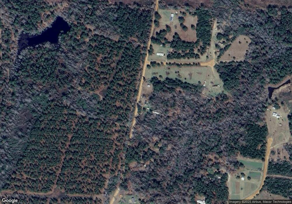
2774 Spurlock Rd Alapaha, GA 31622
Estimated Value: $44,000 - $129,000
--
Bed
--
Bath
924
Sq Ft
$78/Sq Ft
Est. Value
About This Home
This home is located at 2774 Spurlock Rd, Alapaha, GA 31622 and is currently estimated at $72,370, approximately $78 per square foot. 2774 Spurlock Rd is a home with nearby schools including Berrien Primary School, Berrien Elementary School, and Berrien Middle School.
Ownership History
Date
Name
Owned For
Owner Type
Purchase Details
Closed on
May 7, 2024
Sold by
Dotson Donna F
Bought by
Dotson Donna F and Dotson Harry James
Current Estimated Value
Purchase Details
Closed on
Sep 13, 2011
Sold by
Medders Enterprises Inc
Bought by
Dotson Donna F
Purchase Details
Closed on
May 10, 2007
Sold by
Land Comapny and Land Comapny M
Bought by
Medders Enterprises Inc
Purchase Details
Closed on
May 2, 2007
Sold by
Medders Enterprises Inc
Bought by
Land Comapny and Land Comapny M
Purchase Details
Closed on
Sep 5, 2006
Sold by
Jones Donald W
Bought by
Jwic Inc
Purchase Details
Closed on
Jan 31, 2001
Sold by
Jwic Inc
Bought by
Jones Donald W and Jones Jr
Create a Home Valuation Report for This Property
The Home Valuation Report is an in-depth analysis detailing your home's value as well as a comparison with similar homes in the area
Home Values in the Area
Average Home Value in this Area
Purchase History
| Date | Buyer | Sale Price | Title Company |
|---|---|---|---|
| Dotson Donna F | -- | -- | |
| Dotson Donna F | $26,500 | -- | |
| Medders Enterprises Inc | $250,000 | -- | |
| Land Comapny | $115,000 | -- | |
| Jwic Inc | -- | -- | |
| Jones Donald W | $37,800 | -- |
Source: Public Records
Tax History Compared to Growth
Tax History
| Year | Tax Paid | Tax Assessment Tax Assessment Total Assessment is a certain percentage of the fair market value that is determined by local assessors to be the total taxable value of land and additions on the property. | Land | Improvement |
|---|---|---|---|---|
| 2024 | $277 | $8,868 | $6,555 | $2,313 |
| 2023 | $279 | $8,868 | $6,555 | $2,313 |
| 2022 | $279 | $8,868 | $6,555 | $2,313 |
| 2021 | $281 | $8,868 | $6,555 | $2,313 |
| 2020 | $259 | $8,168 | $6,555 | $1,613 |
| 2019 | $259 | $8,168 | $6,555 | $1,613 |
| 2018 | $252 | $8,168 | $6,555 | $1,613 |
| 2017 | $259 | $8,168 | $6,555 | $1,613 |
| 2016 | $252 | $8,168 | $6,555 | $1,613 |
| 2015 | -- | $8,168 | $6,555 | $1,613 |
| 2014 | -- | $8,168 | $6,555 | $1,613 |
| 2013 | -- | $8,168 | $6,555 | $1,613 |
Source: Public Records
Map
Nearby Homes
- 2264 Spurlock Rd
- 49 Quail Ln
- 0 Quail Ln
- . Alapaha River Dr
- 1922 Turner Church Rd
- 395 Harris St
- 2242 U S 82
- 525 Church St
- 339 Chapel Hill Cir Unit 15
- 339 Chapel Hill Cir
- 21803 Main St
- 287 Brookfield Nashville Rd
- 204 Brookfield Nashville Rd
- 3365 Chula Brookfield Rd
- 21 Brookfield-Lenox Rd
- 58 Honeysuckle Ln
- 0 Nashville Enigma Rd
- 0 Jacob Hall Rd Unit 131893
- 0 Baker Rd
- 2635 Brookfield-Lenox Rd
- 2808 Spurlock Rd
- 0 Deer Ct
- 225 Deer Ct
- 275 Big Buck Trail
- 139 Deer Ct
- 59 Big Buck Trail
- 430 Big Buck Trail
- 0 Big Buck Trail
- 180 Big Buck Trail
- 58 Big Buck Trail
- 424 Big Buck Trail
- 2332 Spurlock Rd
- 2300 Spurlock Rd
- 2264 Spurlock Rd
- 231 Fox Run
- 530 Ken Holyoak Rd
- 188 Quail Ln
- 74 Quail Ln
- 291 Fox Run
- 2011 Ken Holyoad Rd
