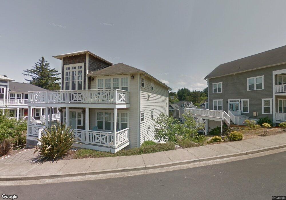
2774 SW Anchor Ave Lincoln City, OR 97367
Nelscott Beach NeighborhoodEstimated Value: $1,400,260 - $1,648,000
4
Beds
5
Baths
2,700
Sq Ft
$566/Sq Ft
Est. Value
About This Home
This home is located at 2774 SW Anchor Ave, Lincoln City, OR 97367 and is currently estimated at $1,527,815, approximately $565 per square foot. 2774 SW Anchor Ave is a home located in Lincoln County with nearby schools including Taft Elementary School, Oceanlake Elementary School, and Taft High School.
Ownership History
Date
Name
Owned For
Owner Type
Purchase Details
Closed on
Dec 14, 2011
Sold by
Olivia Beach Llc
Bought by
Clayton Stephen G and Clayton Susanne
Current Estimated Value
Home Financials for this Owner
Home Financials are based on the most recent Mortgage that was taken out on this home.
Original Mortgage
$31,000
Outstanding Balance
$25,182
Interest Rate
3.94%
Mortgage Type
Credit Line Revolving
Estimated Equity
$1,502,633
Create a Home Valuation Report for This Property
The Home Valuation Report is an in-depth analysis detailing your home's value as well as a comparison with similar homes in the area
Home Values in the Area
Average Home Value in this Area
Purchase History
| Date | Buyer | Sale Price | Title Company |
|---|---|---|---|
| Clayton Stephen G | $640,000 | Western Title & Escrow |
Source: Public Records
Mortgage History
| Date | Status | Borrower | Loan Amount |
|---|---|---|---|
| Open | Clayton Stephen G | $31,000 | |
| Open | Clayton Stephen G | $417,000 |
Source: Public Records
Tax History Compared to Growth
Tax History
| Year | Tax Paid | Tax Assessment Tax Assessment Total Assessment is a certain percentage of the fair market value that is determined by local assessors to be the total taxable value of land and additions on the property. | Land | Improvement |
|---|---|---|---|---|
| 2024 | $11,608 | $680,890 | -- | -- |
| 2023 | $11,288 | $661,060 | $0 | $0 |
| 2022 | $10,973 | $641,810 | $0 | $0 |
| 2021 | $10,453 | $623,120 | $0 | $0 |
| 2020 | $10,213 | $604,980 | $0 | $0 |
| 2019 | $9,865 | $587,360 | $0 | $0 |
| 2018 | $9,643 | $570,260 | $0 | $0 |
| 2017 | $9,229 | $553,660 | $0 | $0 |
| 2016 | $8,656 | $537,540 | $0 | $0 |
| 2015 | $8,462 | $521,890 | $0 | $0 |
| 2014 | $8,247 | $506,690 | $0 | $0 |
| 2013 | -- | $491,940 | $0 | $0 |
Source: Public Records
Map
Nearby Homes
- 2764 SW Anchor Ave
- 2672 SW Anchor Ave
- 2746 SW Barnacle Ave
- 611 SW 27th Way
- 2900 SW Anchor Ave Parcel 1
- 2900 SW Anchor Ave Parcel 2
- 2900 SW Anchor Ave Parcels 1 & 2
- 2586 SW Anemone Ave
- 2200 SW Anchor Ave
- 2685 SW Beach Ave
- 2591 SW Barnacle Ave
- 2972 SW Anchor Ave
- 2518 SW Anemone Ave
- 2729 SW Coast Ave
- TL 5603 SW Anchor Ave
- TL#2200 SW Anchor Ave
- 2700 Blk Sw Coast Avenue Tl1300
- 2539 SW Coral Loop
- 2700 blk SW Dune Ct
- 2513 SW Dune Ave
- 2786 SW Anchor Ave
- 2200 SW Anchor Ct Unit 1
- 2200 SW Anchor Ct
- 2790 SW Anchor Ave
- 2804 SW Anchor Ct
- 2798 SW Anchor Ave
- 2729 SW Anchor Ave
- 2781 SW Anemone Ave
- 2742 SW Anchor Ave
- 2763 SW Anemone Ave
- 2783 SW Anemone Ave
- 2812 SW Anchor Ct
- 2720 SW Anchor Ave
- 2808 SW Anchor Ct
- 2713 SW Anchor Ave
- 2785 SW Anemone Ave
- 2751 SW Anemone Ave
- 2807 SW Anchor Ct
- 2713 SW Anchor Ave
- 2789 SW Anemone Ave