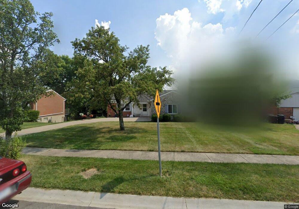
2775 Westonridge Dr Cincinnati, OH 45239
Mount Airy NeighborhoodEstimated Value: $243,000 - $261,000
3
Beds
2
Baths
1,463
Sq Ft
$174/Sq Ft
Est. Value
About This Home
This home is located at 2775 Westonridge Dr, Cincinnati, OH 45239 and is currently estimated at $253,843, approximately $173 per square foot. 2775 Westonridge Dr is a home located in Hamilton County with nearby schools including Mt. Airy Elementary School, Western Hills High School, and Gilbert A. Dater High School.
Ownership History
Date
Name
Owned For
Owner Type
Purchase Details
Closed on
Sep 14, 2021
Sold by
Given Not
Bought by
Hurt Rickie E and Hurt Barbara A
Current Estimated Value
Purchase Details
Closed on
Sep 1, 2021
Sold by
Given Not and Hurt Barbara A
Bought by
Hurt Rickie E and Hurt Barbara A
Purchase Details
Closed on
May 18, 1993
Sold by
Dittrich Gregory L
Bought by
Hurt Rickie E and Hurt Barbara A
Create a Home Valuation Report for This Property
The Home Valuation Report is an in-depth analysis detailing your home's value as well as a comparison with similar homes in the area
Home Values in the Area
Average Home Value in this Area
Purchase History
| Date | Buyer | Sale Price | Title Company |
|---|---|---|---|
| Hurt Rickie E | -- | -- | |
| Hurt Rickie E | -- | None Available | |
| Hurt Rickie E | $95,000 | -- |
Source: Public Records
Tax History Compared to Growth
Tax History
| Year | Tax Paid | Tax Assessment Tax Assessment Total Assessment is a certain percentage of the fair market value that is determined by local assessors to be the total taxable value of land and additions on the property. | Land | Improvement |
|---|---|---|---|---|
| 2024 | $4,261 | $71,163 | $10,035 | $61,128 |
| 2023 | $4,357 | $71,163 | $10,035 | $61,128 |
| 2022 | $2,627 | $38,364 | $8,274 | $30,090 |
| 2021 | $2,524 | $38,364 | $8,274 | $30,090 |
| 2020 | $2,598 | $38,364 | $8,274 | $30,090 |
| 2019 | $2,449 | $33,072 | $7,133 | $25,939 |
| 2018 | $2,453 | $33,072 | $7,133 | $25,939 |
| 2017 | $2,330 | $33,072 | $7,133 | $25,939 |
| 2016 | $2,607 | $36,506 | $7,809 | $28,697 |
| 2015 | $2,351 | $36,506 | $7,809 | $28,697 |
| 2014 | $2,368 | $36,506 | $7,809 | $28,697 |
| 2013 | $2,616 | $39,680 | $8,488 | $31,192 |
Source: Public Records
Map
Nearby Homes
- 5306 Fox Rd
- 2730 Bristol Hill Ct
- 2773 W North Bend Rd
- 2969 Orchardtree Ct
- 2949 N Bend Rd
- 5350 Orchardcreek Ct
- 5277 Orchardridge Ct
- 2601 Kathleen Ct
- 4771 Shepherd Creek Rd
- 3072 N Bend Rd
- 5587 Vogel Rd
- 5360 Colerain Ave
- 0 Samver Rd Unit 1841558
- 3076 Hoock Ct
- 5618 Leumas Rd
- 5607 Leumas Dr
- 5610 Samver Rd
- 5607 Samver Rd
- 0 N Bend Rd
- 5523 Kirby Ave
- 2769 Westonridge Dr
- 2785 Westonridge Dr
- 2795 Westonridge Dr
- 5259 Horizonvue Dr
- 2801 Westonridge Dr
- 5255 Horizonvue Dr
- 2772 Westonridge Dr
- 2778 Westonridge Dr
- 2768 Westonridge Dr
- 2782 Westonridge Dr
- 5251 Horizonvue Dr
- 2786 Westonridge Dr
- 2805 Westonridge Dr
- 2790 Westonridge Dr
- 5295 Fox Rd
- 5245 Horizonvue Dr
- 2811 Westonridge Dr
- 2750 Westonridge Dr
- 2802 Westonridge Dr
- 2798 Westonridge Dr