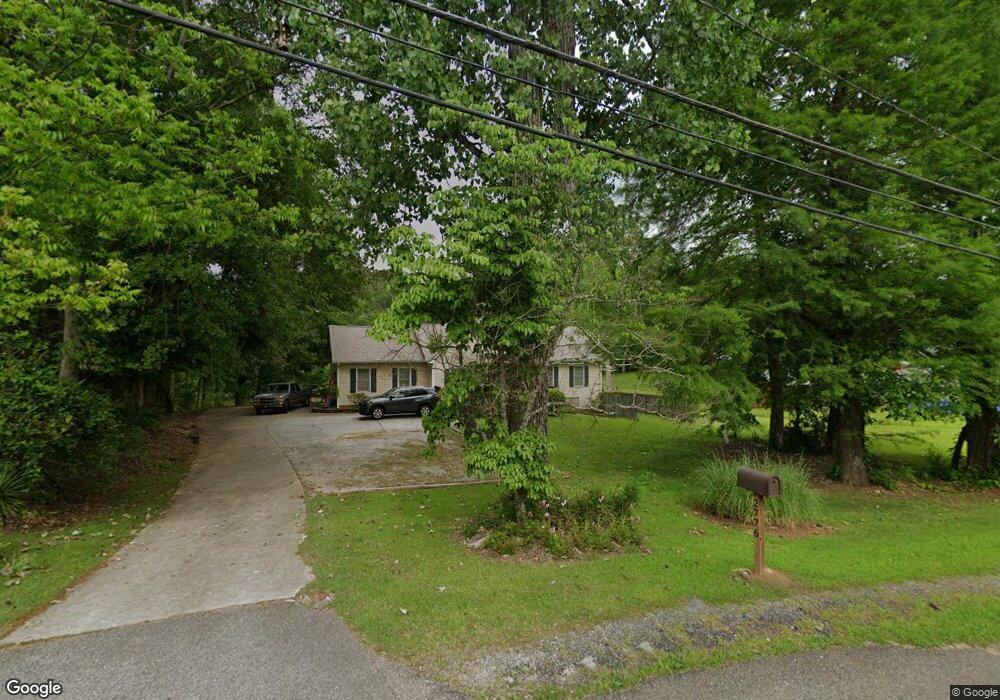
2776 S Highway 29 Moreland, GA 30259
Estimated Value: $269,000 - $345,000
3
Beds
2
Baths
1,297
Sq Ft
$224/Sq Ft
Est. Value
About This Home
This home is located at 2776 S Highway 29, Moreland, GA 30259 and is currently estimated at $291,092, approximately $224 per square foot. 2776 S Highway 29 is a home located in Coweta County with nearby schools including Moreland Elementary School, Smokey Road Middle School, and Newnan High School.
Ownership History
Date
Name
Owned For
Owner Type
Purchase Details
Closed on
Nov 8, 2002
Sold by
Westbrooke Daisy B
Bought by
Carroll Steven F and Carroll Kiesha M
Current Estimated Value
Home Financials for this Owner
Home Financials are based on the most recent Mortgage that was taken out on this home.
Original Mortgage
$76,702
Interest Rate
5.93%
Mortgage Type
New Conventional
Purchase Details
Closed on
Apr 4, 1996
Bought by
Collier Sherry D and Collier B
Purchase Details
Closed on
Jun 4, 1990
Bought by
Duffey Sherry D
Purchase Details
Closed on
Jan 31, 1981
Bought by
Duffey Steven A and Duffey Sh
Create a Home Valuation Report for This Property
The Home Valuation Report is an in-depth analysis detailing your home's value as well as a comparison with similar homes in the area
Home Values in the Area
Average Home Value in this Area
Purchase History
| Date | Buyer | Sale Price | Title Company |
|---|---|---|---|
| Carroll Steven F | $60,000 | -- | |
| Collier Sherry D | -- | -- | |
| Duffey Sherry D | -- | -- | |
| Duffey Steven A | $8,900 | -- |
Source: Public Records
Mortgage History
| Date | Status | Borrower | Loan Amount |
|---|---|---|---|
| Closed | Carroll Steven F | $76,702 |
Source: Public Records
Tax History Compared to Growth
Tax History
| Year | Tax Paid | Tax Assessment Tax Assessment Total Assessment is a certain percentage of the fair market value that is determined by local assessors to be the total taxable value of land and additions on the property. | Land | Improvement |
|---|---|---|---|---|
| 2025 | $953 | $90,048 | $16,140 | $73,908 |
| 2024 | $1,528 | $98,913 | $16,140 | $82,773 |
| 2023 | $1,528 | $79,634 | $16,140 | $63,494 |
| 2022 | $1,006 | $75,019 | $16,140 | $58,879 |
| 2021 | $933 | $69,273 | $16,140 | $53,133 |
| 2020 | $956 | $69,273 | $16,140 | $53,133 |
| 2019 | $935 | $53,223 | $8,056 | $45,167 |
| 2018 | $1,651 | $53,223 | $8,056 | $45,167 |
| 2017 | $1,651 | $53,223 | $8,056 | $45,167 |
| 2016 | $1,644 | $53,223 | $8,056 | $45,167 |
| 2015 | $1,621 | $53,223 | $8,056 | $45,167 |
| 2014 | $1,480 | $53,223 | $8,056 | $45,167 |
Source: Public Records
Map
Nearby Homes
- 15 Couch St
- 202 Victoria Dr
- 145 E Camp St
- 8 Cameron St
- 188 Ball St
- 0 Teasley Trail Unit 10600969
- 885 Alex Stephens Rd Unit LOT 1
- 837 Alex Stephens Rd Unit 2
- 757 Alex Stephens Rd Unit 5
- 743 Alex Stephens Rd Unit LOT 6
- 779 Alex Stephens Rd Unit LOT 4
- 803 Alex Stephens Rd Unit LOT 3
- 3486 S Highway 29
- 114 Dingler Rd
- 79 Lamb Rd
- 0 Lamb Rd Unit 10571369
- 04 Bears Bend
- 120 Bexton Rd
- 1495 Martin Mill Rd
- LOT 1 Joe Roberts Rd
- 2794 S Highway 29
- 2756 S Highway 29
- 133 Church St
- 145 Church St
- 15 Tidwell St
- 2817 S Highway 29
- 2730 S Highway 29
- 200 Church St
- 144 Church St
- 124 Church St
- 48 Couch St
- 2710 S Highway 29
- 64 Couch St
- 134 Victoria Dr
- 2711 S Highway 29
- 0 Church St Unit 8826664
- 45 Couch St
- 118 Victoria Dr
- 67 Couch St
- 85 Church St