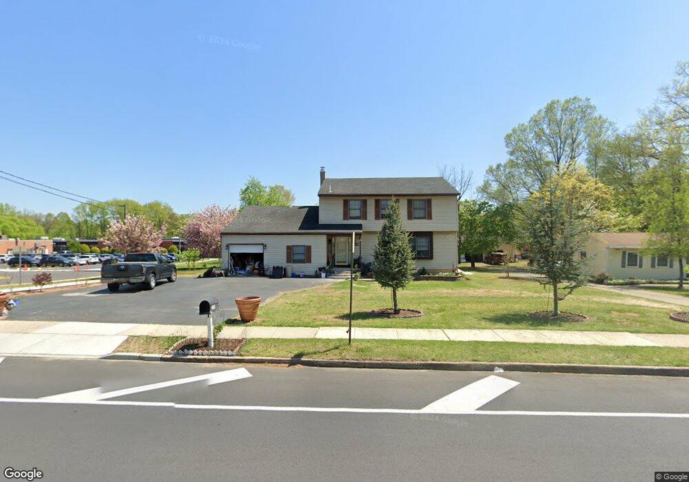
278 Conrow Rd Delran, NJ 08075
Estimated Value: $494,330 - $512,000
4
Beds
3
Baths
2,376
Sq Ft
$213/Sq Ft
Est. Value
About This Home
This home is located at 278 Conrow Rd, Delran, NJ 08075 and is currently estimated at $505,833, approximately $212 per square foot. 278 Conrow Rd is a home located in Burlington County with nearby schools including Millbridge Elementary School, Delran Intermediate School, and Delran Middle School.
Ownership History
Date
Name
Owned For
Owner Type
Purchase Details
Closed on
Apr 29, 2019
Sold by
Han Alexander and Han Young Y
Bought by
Han Alexander and Han Young Y
Current Estimated Value
Purchase Details
Closed on
Oct 10, 2008
Sold by
Jewell Elizabeth A
Bought by
Han Sung U
Home Financials for this Owner
Home Financials are based on the most recent Mortgage that was taken out on this home.
Original Mortgage
$186,250
Outstanding Balance
$120,901
Interest Rate
5.94%
Mortgage Type
Purchase Money Mortgage
Estimated Equity
$384,932
Create a Home Valuation Report for This Property
The Home Valuation Report is an in-depth analysis detailing your home's value as well as a comparison with similar homes in the area
Home Values in the Area
Average Home Value in this Area
Purchase History
| Date | Buyer | Sale Price | Title Company |
|---|---|---|---|
| Han Alexander | -- | None Available | |
| Han Sung U | $286,250 | Landamerica Nj Title Ins Co | |
| -- | $286,300 | -- |
Source: Public Records
Mortgage History
| Date | Status | Borrower | Loan Amount |
|---|---|---|---|
| Open | -- | $186,250 | |
| Closed | -- | $186,250 |
Source: Public Records
Tax History Compared to Growth
Tax History
| Year | Tax Paid | Tax Assessment Tax Assessment Total Assessment is a certain percentage of the fair market value that is determined by local assessors to be the total taxable value of land and additions on the property. | Land | Improvement |
|---|---|---|---|---|
| 2025 | $9,554 | $240,300 | $49,600 | $190,700 |
| 2024 | $9,468 | $240,300 | $49,600 | $190,700 |
| 2023 | $9,468 | $240,300 | $49,600 | $190,700 |
| 2022 | $9,345 | $240,300 | $49,600 | $190,700 |
| 2021 | $9,350 | $240,300 | $49,600 | $190,700 |
| 2020 | $9,331 | $240,300 | $49,600 | $190,700 |
| 2019 | $9,244 | $240,300 | $49,600 | $190,700 |
| 2018 | $9,091 | $240,300 | $49,600 | $190,700 |
| 2017 | $8,946 | $240,300 | $49,600 | $190,700 |
| 2016 | $8,814 | $240,300 | $49,600 | $190,700 |
| 2015 | $8,668 | $240,300 | $49,600 | $190,700 |
| 2014 | $8,290 | $240,300 | $49,600 | $190,700 |
Source: Public Records
Map
Nearby Homes
- 31 Cornell Dr
- 0 0 Swarthmore Dr
- 139 Patricia Ave
- 53 Hartford Rd
- 60 Notre Dame Dr
- 342 Huntington Dr Unit 342
- 110 Kathleen Ave
- 29 Haines Mill Rd
- 4327 Bridgeboro Rd
- 53 Princeton Dr
- 103 Congressional Ct
- 128 Dorado Dr
- 3 Dewberry Ln
- 144 Natalie Rd
- 148 Natalie Rd Unit 148
- 751 Garwood Rd
- 8 Woodrush Ct
- 1 Weatherly Rd
- 7016 Route 130
- 3 Firethorn Ln