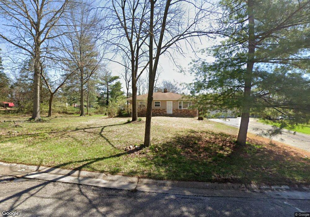
278 E Skyline Dr Ballwin, MO 63011
Estimated Value: $240,000 - $260,359
3
Beds
1
Bath
925
Sq Ft
$268/Sq Ft
Est. Value
About This Home
This home is located at 278 E Skyline Dr, Ballwin, MO 63011 and is currently estimated at $248,090, approximately $268 per square foot. 278 E Skyline Dr is a home located in St. Louis County with nearby schools including Westridge Elementary School, Crestview Middle School, and Marquette Sr. High School.
Ownership History
Date
Name
Owned For
Owner Type
Purchase Details
Closed on
Mar 1, 2018
Sold by
Farr Timothy C and Sorbie Heather
Bought by
Farr Timothy C
Current Estimated Value
Purchase Details
Closed on
Oct 18, 2011
Sold by
Federal National Mortgage Association
Bought by
Farr Timothy C and Farr Heather N
Home Financials for this Owner
Home Financials are based on the most recent Mortgage that was taken out on this home.
Original Mortgage
$88,350
Outstanding Balance
$60,345
Interest Rate
4.13%
Mortgage Type
New Conventional
Estimated Equity
$187,745
Purchase Details
Closed on
Apr 26, 2011
Sold by
Stech Evelyn N
Bought by
Federal National Mortgage Association
Create a Home Valuation Report for This Property
The Home Valuation Report is an in-depth analysis detailing your home's value as well as a comparison with similar homes in the area
Home Values in the Area
Average Home Value in this Area
Purchase History
| Date | Buyer | Sale Price | Title Company |
|---|---|---|---|
| Farr Timothy C | -- | Stewart Title Company | |
| Farr Timothy C | $93,000 | None Available | |
| Federal National Mortgage Association | $158,686 | None Available |
Source: Public Records
Mortgage History
| Date | Status | Borrower | Loan Amount |
|---|---|---|---|
| Open | Farr Timothy C | $88,350 |
Source: Public Records
Tax History
| Year | Tax Paid | Tax Assessment Tax Assessment Total Assessment is a certain percentage of the fair market value that is determined by local assessors to be the total taxable value of land and additions on the property. | Land | Improvement |
|---|---|---|---|---|
| 2025 | $2,776 | $46,170 | $33,840 | $12,330 |
| 2024 | $2,776 | $39,520 | $24,170 | $15,350 |
| 2023 | $2,774 | $39,520 | $24,170 | $15,350 |
| 2022 | $2,593 | $34,290 | $26,580 | $7,710 |
| 2021 | $2,574 | $34,290 | $26,580 | $7,710 |
| 2020 | $2,420 | $30,720 | $18,620 | $12,100 |
| 2019 | $2,430 | $30,720 | $18,620 | $12,100 |
| 2018 | $2,316 | $27,590 | $14,800 | $12,790 |
| 2017 | $2,261 | $27,590 | $14,800 | $12,790 |
| 2016 | $1,864 | $21,810 | $10,410 | $11,400 |
Source: Public Records
Map
Nearby Homes
- 351 Greenbriar Ln
- 816 Crestland Dr
- 913 Crestland Dr
- 288 Geremma Dr
- 131 Romine Cir
- 416 Caprice Gardens Ct
- 945 Warwick Ln
- 160 Cumberland Park Ct Unit G
- 107 Falmouth Dr
- 128 Shadalane Walk Unit A
- 815 Wendevy Ct Unit 16B
- 557 Happy Ct
- 837 Wendevy Ct Unit 11A
- 845 Wendevy Ct Unit 12B
- 832 Wendevy Ct Unit 8B
- 842 Wendevy Ct
- 839 Lilybud Ct Unit 5A
- 101 Half Moon Bay Ln
- 1019 Claytonbrook Dr Unit 1019
- 112 Shirley Ln
- 276 E Skyline Dr
- 280 E Skyline Dr
- 271 E Skyline Dr
- 714 Kehrs Mill Rd
- 266 W Skyline Dr
- 267 E Skyline Dr
- 273 E Skyline Dr
- 274 E Skyline Dr
- 269 W Skyline Dr
- 712 Kehrs Mill Rd
- 264 W Skyline Dr
- 272 E Skyline Dr
- 323 Sudbury Ln
- 349 Norwood Cir
- 265 E Skyline Dr
- 805 Ganahl Dr
- 804 Kehrs Mill Rd
- 350 Norwood Cir
- 262 W Skyline Dr
- 802 Ganahl Dr
Your Personal Tour Guide
Ask me questions while you tour the home.