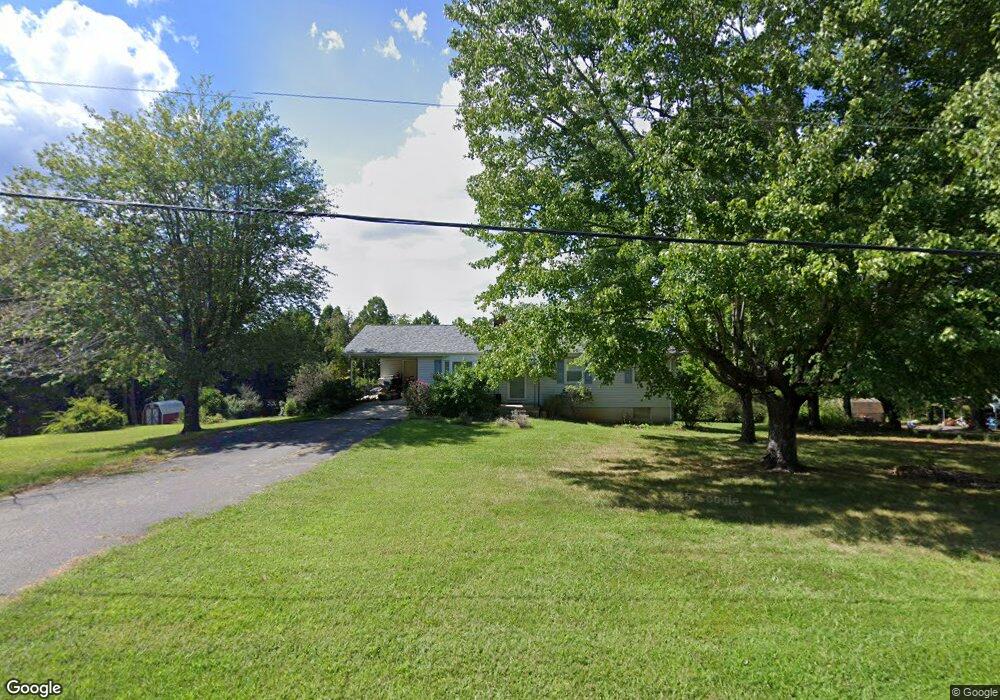
278 Poor House Rd Rustburg, VA 24588
Estimated Value: $213,000 - $341,000
3
Beds
2
Baths
1,546
Sq Ft
$173/Sq Ft
Est. Value
About This Home
This home is located at 278 Poor House Rd, Rustburg, VA 24588 and is currently estimated at $267,260, approximately $172 per square foot. 278 Poor House Rd is a home located in Campbell County with nearby schools including Rustburg Elementary School, Rustburg Middle School, and Rustburg High School.
Ownership History
Date
Name
Owned For
Owner Type
Purchase Details
Closed on
Feb 24, 2012
Sold by
Secretary Of Hud
Bought by
Baker Kathy Lynn
Current Estimated Value
Home Financials for this Owner
Home Financials are based on the most recent Mortgage that was taken out on this home.
Original Mortgage
$97,000
Outstanding Balance
$66,696
Interest Rate
3.89%
Mortgage Type
New Conventional
Estimated Equity
$200,564
Purchase Details
Closed on
Nov 29, 2011
Sold by
Wells Fargo Bank Na
Bought by
The Secretary Of Hud
Purchase Details
Closed on
Nov 3, 2011
Sold by
Equity Trustees Llc and Hood Laurie A
Bought by
Wells Fargo Bank Na
Create a Home Valuation Report for This Property
The Home Valuation Report is an in-depth analysis detailing your home's value as well as a comparison with similar homes in the area
Home Values in the Area
Average Home Value in this Area
Purchase History
| Date | Buyer | Sale Price | Title Company |
|---|---|---|---|
| Baker Kathy Lynn | $100,000 | -- | |
| The Secretary Of Hud | $118,931 | -- | |
| Wells Fargo Bank Na | $118,931 | -- |
Source: Public Records
Mortgage History
| Date | Status | Borrower | Loan Amount |
|---|---|---|---|
| Open | Wells Fargo Bank Na | $97,000 |
Source: Public Records
Tax History Compared to Growth
Tax History
| Year | Tax Paid | Tax Assessment Tax Assessment Total Assessment is a certain percentage of the fair market value that is determined by local assessors to be the total taxable value of land and additions on the property. | Land | Improvement |
|---|---|---|---|---|
| 2025 | $735 | $163,300 | $25,000 | $138,300 |
| 2024 | $735 | $163,300 | $25,000 | $138,300 |
| 2023 | $735 | $163,300 | $25,000 | $138,300 |
| 2022 | $732 | $140,700 | $25,000 | $115,700 |
| 2021 | $732 | $140,700 | $25,000 | $115,700 |
| 2020 | $732 | $127,100 | $21,000 | $106,100 |
| 2019 | $732 | $140,700 | $25,000 | $115,700 |
| 2018 | $661 | $127,100 | $21,000 | $106,100 |
| 2017 | $661 | $127,100 | $21,000 | $106,100 |
| 2016 | -- | $127,100 | $21,000 | $106,100 |
| 2015 | -- | $127,100 | $21,000 | $106,100 |
| 2014 | -- | $127,000 | $21,000 | $106,000 |
Source: Public Records
Map
Nearby Homes
- 197 Cricket Ln
- 83 Luke Ct
- 61 Luke Ct
- 87 Luke Ct
- 18 Faith Ct
- 57 Luke Ct
- 41 Piedmont Rd
- 0 Bellevue Rd Unit 2526138
- Block 1 Zion Place
- 4 Smoky Hollow Rd
- 1 Smoky Hollow Rd
- 3 Smoky Hollow Rd
- 3426 Village Hwy
- 415 Kershaw Dr
- 3541 Village Hwy
- 271 Candlemakers Ln
- 2443 Sunnymeade Rd
- 3588 Depot Rd
- 819 Cresthill Rd
- 0 Rocky Rd
- 294 Poor House Rd
- 294 Poor House Rd
- 246 Poor House Rd
- 184 Poor House Rd
- 43 Trestle Rd
- 119 Trestle Rd
- 422 Poor House Rd
- 143 Trestle Rd
- 385 Poor House Rd
- 56 Trestle Rd
- 392 Poor House Rd
- 522 Poor House Rd
- 525 Poor House Rd
- 264 Trestle Rd
- 285 Trestle Rd
- 533 Poor House Rd
- 530 Poor House Rd
- 542 Poor House Rd
- 539 Poor House Rd
- 1225 Campbell Hwy