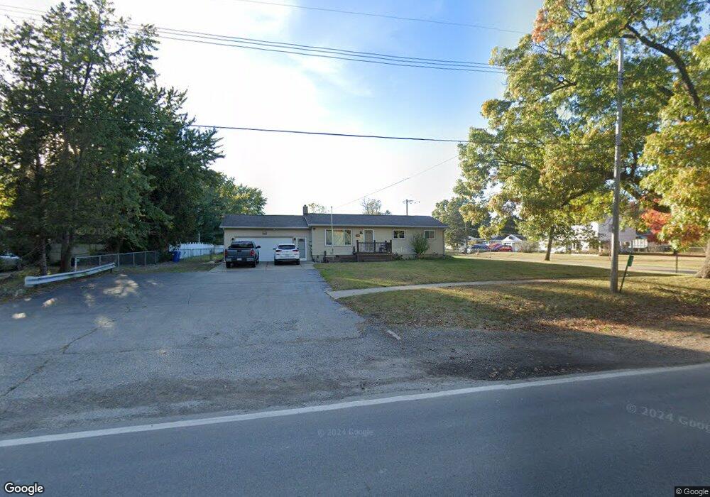
278 S Hospital Rd Waterford, MI 48327
Waterford Township NeighborhoodEstimated Value: $214,000 - $248,451
3
Beds
2
Baths
1,092
Sq Ft
$219/Sq Ft
Est. Value
About This Home
This home is located at 278 S Hospital Rd, Waterford, MI 48327 and is currently estimated at $239,113, approximately $218 per square foot. 278 S Hospital Rd is a home located in Oakland County with nearby schools including Beaumont Elementary School, Pierce Middle School, and Waterford Mott High School.
Ownership History
Date
Name
Owned For
Owner Type
Purchase Details
Closed on
Aug 7, 2024
Sold by
Potter Dale E
Bought by
Barber Ashley and Barber Joel
Current Estimated Value
Home Financials for this Owner
Home Financials are based on the most recent Mortgage that was taken out on this home.
Original Mortgage
$100,000
Outstanding Balance
$98,838
Interest Rate
6.73%
Mortgage Type
New Conventional
Estimated Equity
$140,275
Create a Home Valuation Report for This Property
The Home Valuation Report is an in-depth analysis detailing your home's value as well as a comparison with similar homes in the area
Home Values in the Area
Average Home Value in this Area
Purchase History
| Date | Buyer | Sale Price | Title Company |
|---|---|---|---|
| Barber Ashley | $200,000 | None Listed On Document |
Source: Public Records
Mortgage History
| Date | Status | Borrower | Loan Amount |
|---|---|---|---|
| Open | Barber Ashley | $100,000 |
Source: Public Records
Tax History Compared to Growth
Tax History
| Year | Tax Paid | Tax Assessment Tax Assessment Total Assessment is a certain percentage of the fair market value that is determined by local assessors to be the total taxable value of land and additions on the property. | Land | Improvement |
|---|---|---|---|---|
| 2024 | $1,130 | $102,000 | $0 | $0 |
| 2023 | $1,078 | $98,360 | $0 | $0 |
| 2022 | $1,926 | $92,380 | $0 | $0 |
| 2021 | $1,677 | $91,540 | $0 | $0 |
| 2020 | $987 | $83,720 | $0 | $0 |
| 2019 | $1,607 | $72,810 | $0 | $0 |
| 2018 | $1,593 | $70,110 | $0 | $0 |
| 2017 | $1,464 | $70,110 | $0 | $0 |
| 2016 | $1,462 | $61,790 | $0 | $0 |
| 2015 | -- | $52,860 | $0 | $0 |
| 2014 | -- | $48,620 | $0 | $0 |
| 2011 | -- | $42,090 | $0 | $0 |
Source: Public Records
Map
Nearby Homes
- 437 Cove View Dr
- 7014 Marco Dr
- 59 Lochaven Rd
- 6866 Fox Ln
- 329 Fountain Park Dr
- 290 Evanston St
- 393 Deer Path Trail
- 0000 Williams Lake Rd
- 7846 Fawn Ct
- 5760 Copper Tree Park
- 0000 Tamson St
- 000 Elizabeth Lake Rd
- Doyon Ct Lot 16 Ct
- 5741 Copper Tree Park
- 5745 Copper Tree Park
- 468 Woodstone Rd
- 470 Woodstone Rd Unit 33
- 149 N Williams Lake Rd
- 8165 Sequoia Ln Unit 92
- 411 Clayburn Blvd
- 7055 Wedworth St
- 254 S Hospital Rd
- 290 S Hospital Rd
- 279 S Hospital Rd
- 289 S Hospital Rd
- 7050 Wedworth St
- 7115 Wedworth St
- 244 S Hospital Rd
- 7100 Wedworth St
- 330 S Hospital Rd
- 7132 Wedworth St
- 7137 Wedworth St
- 224 S Hospital Rd
- 247 S Hospital Rd
- 7116 Wedworth St Unit Bldg-Unit
- 7116 Wedworth St
- 7148 Wedworth St
- 221 S Hospital Rd
- 7055 Wade St
- 7081 Wade St