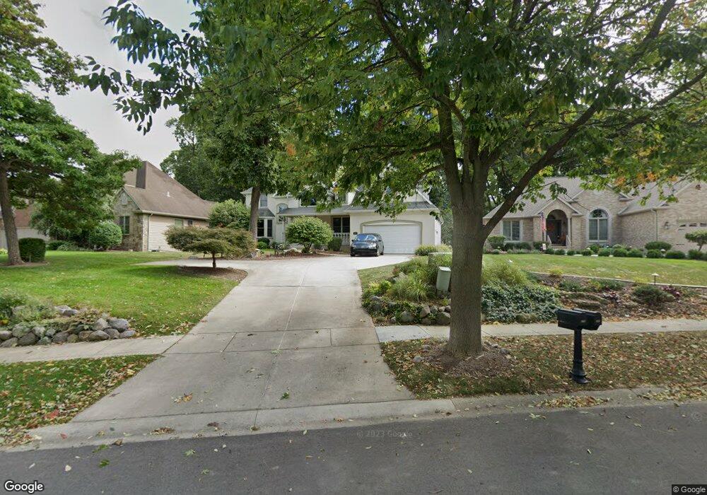
278 Scotscraig Dr Valparaiso, IN 46385
Porter County NeighborhoodEstimated Value: $697,000 - $820,000
5
Beds
5
Baths
4,334
Sq Ft
$177/Sq Ft
Est. Value
About This Home
This home is located at 278 Scotscraig Dr, Valparaiso, IN 46385 and is currently estimated at $767,243, approximately $177 per square foot. 278 Scotscraig Dr is a home located in Porter County with nearby schools including Ben Franklin Middle School and Valparaiso High School.
Ownership History
Date
Name
Owned For
Owner Type
Purchase Details
Closed on
Jul 28, 2017
Sold by
Stahlman Valerie Dale and Top Valerie D
Bought by
Stahlman Valerie Dale and Top Valerie D
Current Estimated Value
Purchase Details
Closed on
Jun 5, 2008
Sold by
Top Sherwyn G and Top Land Trust One
Bought by
Top Valerie D and Top Land Trust One
Purchase Details
Closed on
Dec 6, 2006
Sold by
Top Valerie D and Top Sherwyn G
Bought by
Top Valerie D and Top Sherwyn G
Create a Home Valuation Report for This Property
The Home Valuation Report is an in-depth analysis detailing your home's value as well as a comparison with similar homes in the area
Home Values in the Area
Average Home Value in this Area
Purchase History
| Date | Buyer | Sale Price | Title Company |
|---|---|---|---|
| Stahlman Valerie Dale | -- | None Available | |
| Top Valerie D | -- | None Available | |
| Top Valerie D | -- | None Available |
Source: Public Records
Tax History Compared to Growth
Tax History
| Year | Tax Paid | Tax Assessment Tax Assessment Total Assessment is a certain percentage of the fair market value that is determined by local assessors to be the total taxable value of land and additions on the property. | Land | Improvement |
|---|---|---|---|---|
| 2024 | $7,788 | $830,400 | $104,800 | $725,600 |
| 2023 | $7,222 | $789,900 | $97,700 | $692,200 |
| 2022 | $7,053 | $712,800 | $97,700 | $615,100 |
| 2021 | $7,120 | $618,300 | $97,700 | $520,600 |
| 2020 | $6,973 | $589,100 | $97,700 | $491,400 |
| 2019 | $6,985 | $571,400 | $97,700 | $473,700 |
| 2018 | $6,781 | $552,200 | $97,700 | $454,500 |
| 2017 | $6,879 | $571,700 | $97,700 | $474,000 |
| 2016 | $6,242 | $554,600 | $92,900 | $461,700 |
| 2014 | $5,433 | $565,500 | $92,400 | $473,100 |
| 2013 | -- | $520,300 | $90,300 | $430,000 |
Source: Public Records
Map
Nearby Homes
- 83 Scotscraig Dr
- 65 Larwick Cir
- 265 Westport Rd
- 274 Westport Rd
- 59 Larwick Cir
- 59 Sanctuary Dr
- 61 Sanctuary Dr
- 63 Sanctuary Dr
- 65 Sanctuary Dr
- 77 Sanctuary Dr
- 281 Larwick Cir
- 49 Larwick Cir
- 47 Larwick Cir
- 45 Larwick Cir
- 50 N Prairie Pkwy
- 19 Kincraig Dr
- 110 Wheatridge Rd
- 10 Kincraig Dr
- 68 Braemar Dr
- 66 Braemar Dr
- 276 Bruntfield Ct
- 276 Bruntfield Ct
- 280 Scotscraig Dr
- 274 Bruntfield Ct
- 282 Scotscraig Dr
- 281 Scotscraig Dr
- 279 Scotscraig Dr
- 284 Muirfield Dr
- 283 Scotscraig Dr
- 272 Bruntsfield Ct
- 272 Bruntfield Ct
- 80 Scotscraig Dr
- 285 Muirfield Dr
- 286 Muirfield Dr
- 277 Bruntfield Ct
- 275 Bruntfield Ct
- 273 Bruntfield Ct
- 82 Scotscraig Dr
- 79 Scotscraig Dr
- 287 Muirfield Dr