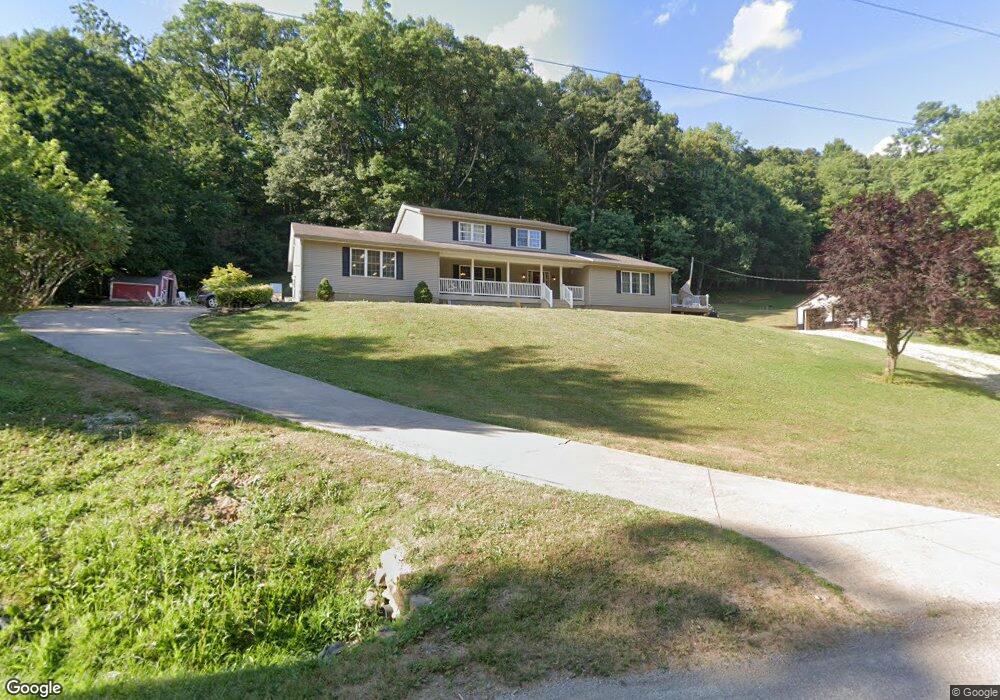
278 Scott Rd Chillicothe, OH 45601
Estimated Value: $298,000 - $403,000
5
Beds
4
Baths
2,584
Sq Ft
$139/Sq Ft
Est. Value
About This Home
This home is located at 278 Scott Rd, Chillicothe, OH 45601 and is currently estimated at $359,758, approximately $139 per square foot. 278 Scott Rd is a home located in Ross County with nearby schools including Paint Valley Elementary School, Paint Valley Middle School, and Paint Valley High School.
Ownership History
Date
Name
Owned For
Owner Type
Purchase Details
Closed on
Jun 11, 2010
Sold by
Degarmo Daniel and Degarmo Serena
Bought by
Degarmo Daniel and Degarmo Serena
Current Estimated Value
Purchase Details
Closed on
Jan 17, 2006
Sold by
Norman Ricky L and Norman Cheryl L
Bought by
Degarmo Daniel and Degarmo Serena
Home Financials for this Owner
Home Financials are based on the most recent Mortgage that was taken out on this home.
Original Mortgage
$134,910
Outstanding Balance
$76,501
Interest Rate
6.42%
Mortgage Type
Purchase Money Mortgage
Estimated Equity
$283,257
Create a Home Valuation Report for This Property
The Home Valuation Report is an in-depth analysis detailing your home's value as well as a comparison with similar homes in the area
Home Values in the Area
Average Home Value in this Area
Purchase History
| Date | Buyer | Sale Price | Title Company |
|---|---|---|---|
| Degarmo Daniel | -- | Attorney | |
| Degarmo Daniel | $149,900 | Title First Agency Inc |
Source: Public Records
Mortgage History
| Date | Status | Borrower | Loan Amount |
|---|---|---|---|
| Open | Degarmo Daniel | $134,910 |
Source: Public Records
Tax History Compared to Growth
Tax History
| Year | Tax Paid | Tax Assessment Tax Assessment Total Assessment is a certain percentage of the fair market value that is determined by local assessors to be the total taxable value of land and additions on the property. | Land | Improvement |
|---|---|---|---|---|
| 2024 | $2,783 | $79,150 | $7,830 | $71,320 |
| 2023 | $2,783 | $79,150 | $7,830 | $71,320 |
| 2022 | $2,725 | $79,150 | $7,830 | $71,320 |
| 2021 | $2,391 | $64,950 | $6,220 | $58,730 |
| 2020 | $2,388 | $64,950 | $6,220 | $58,730 |
| 2019 | $2,435 | $64,950 | $6,220 | $58,730 |
| 2018 | $2,239 | $58,120 | $5,800 | $52,320 |
| 2017 | $2,244 | $55,360 | $5,800 | $49,560 |
| 2016 | $2,080 | $55,360 | $5,800 | $49,560 |
| 2015 | $2,166 | $57,700 | $5,800 | $51,900 |
| 2014 | $2,113 | $57,700 | $5,800 | $51,900 |
| 2013 | $2,149 | $57,700 | $5,800 | $51,900 |
Source: Public Records
Map
Nearby Homes
- 14933 Us Highway 50
- 2371 Owl Creek Rd
- 2139 Poplar Ridge Rd
- 11511 Taylor St
- 11524 U S 50
- 4878 Black Run Rd
- 10792 State Route 28
- 0 State Route 28
- 7535 State Route 28
- 10605 State Route 28
- 10597 State Route 28
- 0 N Sd Rt 28
- 0 N Sd St Rt 28
- 0 N Sd Rt 28 Unit 225026807
- 5678 Lower Twin Rd
- 10830 Lower Twin Rd
- 2719 Sulphur Lick Rd
- 3272 Black Run Rd
- 7885 Upper Twin Rd
- 263 Queen Dr