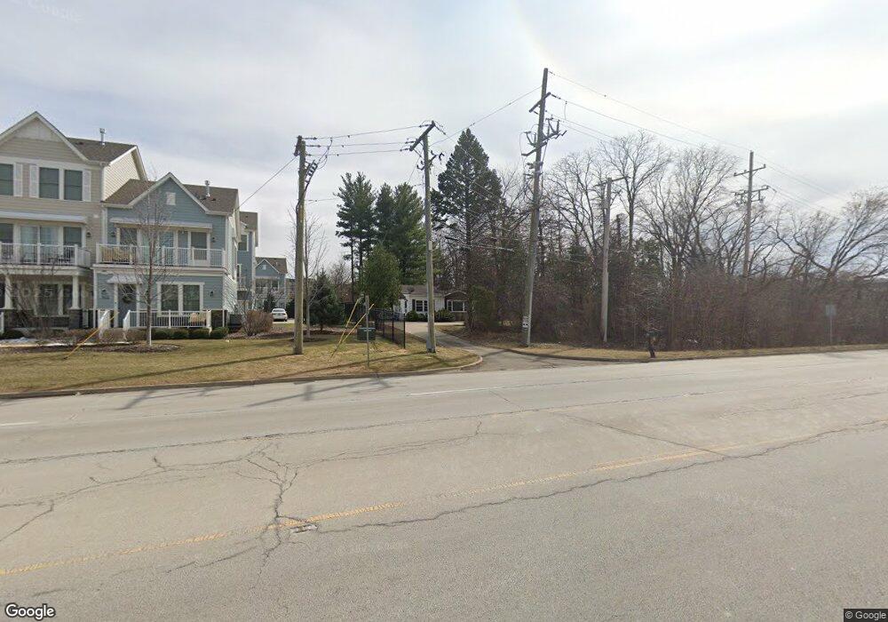
278 W Butterfield Rd Elmhurst, IL 60126
Estimated Value: $387,000 - $505,000
--
Bed
--
Bath
1,124
Sq Ft
$375/Sq Ft
Est. Value
About This Home
This home is located at 278 W Butterfield Rd, Elmhurst, IL 60126 and is currently estimated at $421,083, approximately $374 per square foot. 278 W Butterfield Rd is a home located in DuPage County with nearby schools including Salt Creek Elementary School, Stella May Swartz Elementary School, and John E Albright Middle School.
Ownership History
Date
Name
Owned For
Owner Type
Purchase Details
Closed on
Dec 8, 2016
Sold by
Burnier Rebecca L and Burnier Becky L
Bought by
Burnier David R
Current Estimated Value
Home Financials for this Owner
Home Financials are based on the most recent Mortgage that was taken out on this home.
Original Mortgage
$270,000
Outstanding Balance
$226,605
Interest Rate
4.87%
Mortgage Type
New Conventional
Estimated Equity
$194,478
Purchase Details
Closed on
Jan 13, 1995
Sold by
Egner George J and Egner Lorraine
Bought by
Burnier David R and Burnier Becky L
Home Financials for this Owner
Home Financials are based on the most recent Mortgage that was taken out on this home.
Original Mortgage
$123,150
Interest Rate
9.25%
Mortgage Type
Purchase Money Mortgage
Create a Home Valuation Report for This Property
The Home Valuation Report is an in-depth analysis detailing your home's value as well as a comparison with similar homes in the area
Home Values in the Area
Average Home Value in this Area
Purchase History
| Date | Buyer | Sale Price | Title Company |
|---|---|---|---|
| Burnier David R | -- | Multiple | |
| Burnier David R | $164,500 | -- |
Source: Public Records
Mortgage History
| Date | Status | Borrower | Loan Amount |
|---|---|---|---|
| Open | Burnier David R | $270,000 | |
| Closed | Burnier David R | $123,150 |
Source: Public Records
Tax History Compared to Growth
Tax History
| Year | Tax Paid | Tax Assessment Tax Assessment Total Assessment is a certain percentage of the fair market value that is determined by local assessors to be the total taxable value of land and additions on the property. | Land | Improvement |
|---|---|---|---|---|
| 2024 | $5,964 | $110,195 | $58,104 | $52,091 |
| 2023 | $5,141 | $101,900 | $53,730 | $48,170 |
| 2022 | $4,862 | $97,960 | $51,650 | $46,310 |
| 2021 | $4,954 | $95,530 | $50,370 | $45,160 |
| 2020 | $4,907 | $93,440 | $49,270 | $44,170 |
| 2019 | $4,727 | $88,830 | $46,840 | $41,990 |
| 2018 | $5,827 | $106,620 | $62,360 | $44,260 |
| 2017 | $5,414 | $101,600 | $59,420 | $42,180 |
| 2016 | $5,097 | $95,720 | $55,980 | $39,740 |
| 2015 | $5,022 | $89,170 | $52,150 | $37,020 |
| 2014 | $4,394 | $75,390 | $75,310 | $80 |
| 2013 | $4,350 | $76,450 | $76,370 | $80 |
Source: Public Records
Map
Nearby Homes
- 1005 S Mitchell Ave
- 995 S Swain Ave
- 991 S Swain Ave
- 963 S Saylor Ave
- 2 S Atrium Way Unit 203
- 936 S Mitchell Ave
- 1200 S Prospect Ave Unit 303
- 1200 S Prospect Ave Unit 108
- 175 W Brush Hill Rd Unit 404
- 110 W Butterfield Rd Unit 502S
- 100 W Butterfield Rd Unit 112N
- 1S045 Spring Rd Unit 1D
- 130 Crab Apple Ln
- 816 S Spring Rd
- 814 S Saylor Ave
- 1S150 Spring Rd Unit 5B
- 1S150 Spring Rd Unit 4L
- 805 S Spring Rd
- 801 S Spring Rd
- 162 E Hale St
- 262 W Butterfield Rd
- 1171 S Eldridge Ln
- 256 W Butterfield Rd
- 279 W Butterfield Rd
- 1101-1181 S Eldridge Ln
- 275 W Butterfield Rd
- 263 W Butterfield Rd
- 1034 S Swain Ave
- 1038 S Saylor Ave
- 1031 S Saylor Ave
- 1030 S Swain Ave
- 1034 S Saylor Ave
- 257 W Butterfield Rd
- 1027 S Saylor Ave
- 1026 S Swain Ave
- 1030 S Saylor Ave
- 253 W Butterfield Rd
- 1037 S Spring Rd
- 300 W Butterfield Rd
- 1023 S Saylor Ave
