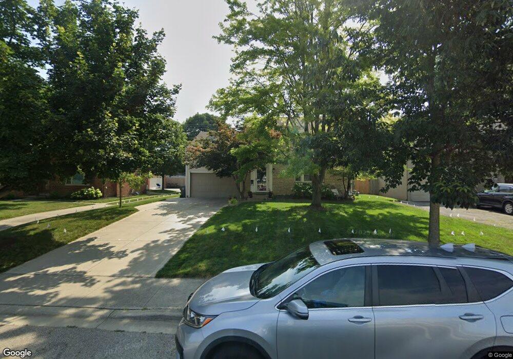
2780 Andover Rd Columbus, OH 43221
Estimated Value: $591,000 - $755,000
4
Beds
2
Baths
1,738
Sq Ft
$392/Sq Ft
Est. Value
About This Home
This home is located at 2780 Andover Rd, Columbus, OH 43221 and is currently estimated at $681,931, approximately $392 per square foot. 2780 Andover Rd is a home located in Franklin County with nearby schools including Tremont Elementary School, Jones Middle School, and Upper Arlington High School.
Ownership History
Date
Name
Owned For
Owner Type
Purchase Details
Closed on
Aug 7, 2007
Sold by
Dury Michael F and Dury Joan C
Bought by
Haskins Ashley G and Haskins Jason R
Current Estimated Value
Home Financials for this Owner
Home Financials are based on the most recent Mortgage that was taken out on this home.
Original Mortgage
$165,000
Outstanding Balance
$105,056
Interest Rate
6.77%
Mortgage Type
Purchase Money Mortgage
Estimated Equity
$576,875
Purchase Details
Closed on
Aug 4, 1977
Bought by
Dury Michael F
Create a Home Valuation Report for This Property
The Home Valuation Report is an in-depth analysis detailing your home's value as well as a comparison with similar homes in the area
Home Values in the Area
Average Home Value in this Area
Purchase History
| Date | Buyer | Sale Price | Title Company |
|---|---|---|---|
| Haskins Ashley G | $275,000 | Chicago Tit | |
| Dury Michael F | -- | -- |
Source: Public Records
Mortgage History
| Date | Status | Borrower | Loan Amount |
|---|---|---|---|
| Open | Haskins Ashley G | $165,000 |
Source: Public Records
Tax History Compared to Growth
Tax History
| Year | Tax Paid | Tax Assessment Tax Assessment Total Assessment is a certain percentage of the fair market value that is determined by local assessors to be the total taxable value of land and additions on the property. | Land | Improvement |
|---|---|---|---|---|
| 2024 | $12,638 | $218,300 | $86,000 | $132,300 |
| 2023 | $12,481 | $218,295 | $85,995 | $132,300 |
| 2022 | $12,344 | $176,650 | $42,420 | $134,230 |
| 2021 | $10,927 | $176,650 | $42,420 | $134,230 |
| 2020 | $7,725 | $126,000 | $42,420 | $83,580 |
| 2019 | $7,298 | $105,250 | $42,420 | $62,830 |
| 2018 | $6,807 | $105,250 | $42,420 | $62,830 |
| 2017 | $6,802 | $105,250 | $42,420 | $62,830 |
| 2016 | $6,362 | $96,220 | $36,610 | $59,610 |
| 2015 | $6,356 | $96,220 | $36,610 | $59,610 |
| 2014 | $6,364 | $96,220 | $36,610 | $59,610 |
| 2013 | $3,039 | $87,465 | $33,285 | $54,180 |
Source: Public Records
Map
Nearby Homes
- 2615 Northwest Blvd
- 2648 Chester Rd
- 1909 Inchcliff Rd
- 2569 Chester Rd
- 2585 Westmont Blvd
- 3015 Welsford Rd
- 2027-2033 Ridgeview Rd
- 1887-1891 Kentwell Rd
- 2593 Coventry Rd
- 1550 College Hill Dr
- 3175 Tremont Rd Unit 502
- 1764 Ridgecliff Rd Unit 1764
- 2276 Northwest Blvd
- 2063 Westover Rd
- 1565 Berkshire Rd
- 3156 Mt Holyoke Rd
- 3296 Leighton Rd
- 1932 Suffolk Rd Unit 1932
- 2227 Zollinger Rd
- 2979 Avalon Rd
- 2788 Andover Rd
- 2772 Andover Rd
- 2764 Andover Rd
- 2796 Andover Rd
- 2777 Welsford Rd
- 2785 Welsford Rd
- 2769 Welsford Rd
- 2793 Welsford Rd
- 2761 Welsford Rd
- 2756 Andover Rd
- 2804 Andover Rd
- 2801 Welsford Rd
- 2751 Welsford Rd
- 2812 Andover Rd
- 2748 Andover Rd
- 2809 Welsford Rd
- 2745 Welsford Rd
- 2774 Welsford Rd
- 2820 Andover Rd
- 2740 Andover Rd