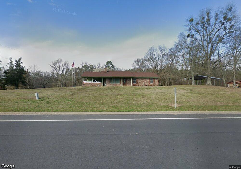
2780 Highway 270 E Mount Ida, AR 71957
Estimated Value: $179,000 - $270,000
Studio
2
Baths
1,560
Sq Ft
$133/Sq Ft
Est. Value
About This Home
This home is located at 2780 Highway 270 E, Mount Ida, AR 71957 and is currently estimated at $207,135, approximately $132 per square foot. 2780 Highway 270 E is a home located in Montgomery County with nearby schools including Bobby Barrett Elementary and Mount Ida High School.
Ownership History
Date
Name
Owned For
Owner Type
Purchase Details
Closed on
Dec 11, 2015
Bought by
Cole Wesley Brian
Current Estimated Value
Purchase Details
Closed on
Nov 6, 2015
Bought by
Wells Fargo Bank Na
Purchase Details
Closed on
Oct 29, 2015
Bought by
Talamonte Lance and Talamonte Heidi
Purchase Details
Closed on
Dec 4, 2009
Sold by
Jones Gilbert and Jones Rose Marie
Bought by
Talamonte Lance and Talamonte Heidi
Home Financials for this Owner
Home Financials are based on the most recent Mortgage that was taken out on this home.
Original Mortgage
$78,551
Interest Rate
5.5%
Mortgage Type
FHA
Purchase Details
Closed on
Aug 28, 2002
Bought by
Griffith Paul and Griffith Josephine
Purchase Details
Closed on
Jun 25, 2002
Bought by
State Land Commissioner
Purchase Details
Closed on
Jun 16, 1994
Bought by
Griffith Paul and Griffith Josephine
Purchase Details
Closed on
Jan 1, 1910
Bought by
Griffith Paul
Create a Home Valuation Report for This Property
The Home Valuation Report is an in-depth analysis detailing your home's value as well as a comparison with similar homes in the area
Purchase History
| Date | Buyer | Sale Price | Title Company |
|---|---|---|---|
| Cole Wesley Brian | $43,000 | -- | |
| Wells Fargo Bank Na | -- | -- | |
| Talamonte Lance | -- | -- | |
| Talamonte Lance | $80,000 | -- | |
| Griffith Paul | -- | -- | |
| State Land Commissioner | -- | -- | |
| Griffith Paul | -- | -- | |
| Griffith Paul | -- | -- |
Source: Public Records
Mortgage History
| Date | Status | Borrower | Loan Amount |
|---|---|---|---|
| Previous Owner | Talamonte Lance | $78,551 |
Source: Public Records
Tax History
| Year | Tax Paid | Tax Assessment Tax Assessment Total Assessment is a certain percentage of the fair market value that is determined by local assessors to be the total taxable value of land and additions on the property. | Land | Improvement |
|---|---|---|---|---|
| 2025 | $192 | $31,370 | $1,700 | $29,670 |
| 2024 | $367 | $31,370 | $1,700 | $29,670 |
| 2023 | $367 | $31,370 | $1,700 | $29,670 |
| 2022 | $427 | $18,950 | $1,800 | $17,150 |
| 2021 | $427 | $18,950 | $1,800 | $17,150 |
| 2020 | $427 | $18,950 | $1,800 | $17,150 |
| 2019 | $427 | $18,950 | $1,800 | $17,150 |
| 2018 | $436 | $18,590 | $1,800 | $16,790 |
| 2017 | $114 | $10,970 | $2,000 | $8,970 |
| 2016 | $740 | $17,500 | $2,000 | $15,500 |
| 2014 | $301 | $17,500 | $2,000 | $15,500 |
Source: Public Records
Map
Nearby Homes
- 2383 Highway 270 E
- 139 Garden Dr
- 36 Wildlife Ln
- 89 Bearce Cir
- 195 Bearce Cir
- 01 Yeaman Ln
- 163 Quail Run Ln
- TBD Silver Point Dr
- 90 Silver Point Dr
- 90 Silver Point Unit 4 Dr
- 138 Silver Point Dr
- 138 Silver Point Dr Unit 14D
- 61 Muscadine Ln
- 6 Miners Trail
- 260 Hall St
- 901 Highway 270 E
- 137 N Pine St
- 15 Big Bear Rd
- 29 Hidden Cove
- 229 Denby Cove Dr
- E 270 Hwy
- 2796 Highway 270 E
- 2772 Highway 270 E
- 12 Sunrise Hill Dr
- 2779 Highway 270 E
- 28 Sunrise Hill Dr
- 19 Sunrise Hill Dr
- 2742 Highway 270 E
- 60 Sunrise Hill Dr
- 2781 Highway 270 E
- 53 Sunrise Hill Dr
- 39 Sunrise Hills Dr
- 39 Sunrise Hill Dr
- 2719 Highway 270 E
- 2708 Highway 270 E
- 49 Jones Ln
- 2858 Highway 270 E
- TBD Highway 270 E Unit Off private road pas
- 61 Jones Ln
- 2690 Highway 270 E
Your Personal Tour Guide
Ask me questions while you tour the home.