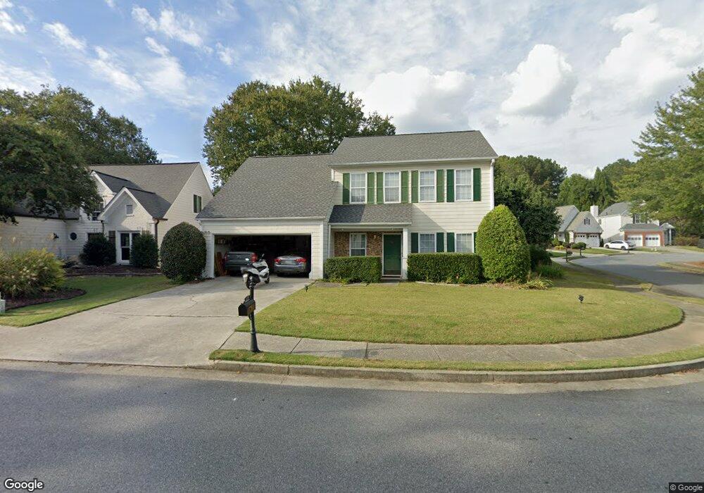
2780 Laurelwood Ln Unit 1 Alpharetta, GA 30009
Estimated Value: $563,000 - $832,167
4
Beds
3
Baths
2,308
Sq Ft
$308/Sq Ft
Est. Value
About This Home
This home is located at 2780 Laurelwood Ln Unit 1, Alpharetta, GA 30009 and is currently estimated at $710,292, approximately $307 per square foot. 2780 Laurelwood Ln Unit 1 is a home located in Fulton County with nearby schools including Manning Oaks Elementary School, Hopewell Middle School, and Alpharetta High School.
Ownership History
Date
Name
Owned For
Owner Type
Purchase Details
Closed on
Apr 17, 2021
Sold by
Gok Aysegul
Bought by
Alvite Sidney
Current Estimated Value
Purchase Details
Closed on
Jun 19, 2020
Sold by
Alvite Sidney
Bought by
Alvite Sidney and Gok Aysegul
Purchase Details
Closed on
Mar 16, 1999
Sold by
Skorb Michael A and Skorb Linda A
Bought by
Alvite Sidney F
Home Financials for this Owner
Home Financials are based on the most recent Mortgage that was taken out on this home.
Original Mortgage
$114,000
Interest Rate
6.74%
Mortgage Type
New Conventional
Purchase Details
Closed on
Jul 28, 1995
Sold by
Ellison James V Cindy T
Bought by
Skorb Michael A Linda S
Create a Home Valuation Report for This Property
The Home Valuation Report is an in-depth analysis detailing your home's value as well as a comparison with similar homes in the area
Home Values in the Area
Average Home Value in this Area
Purchase History
| Date | Buyer | Sale Price | Title Company |
|---|---|---|---|
| Alvite Sidney | -- | -- | |
| Alvite Sidney | -- | -- | |
| Alvite Sidney F | $147,200 | -- | |
| Skorb Michael A Linda S | $134,900 | -- |
Source: Public Records
Mortgage History
| Date | Status | Borrower | Loan Amount |
|---|---|---|---|
| Previous Owner | Alvite Sidney F | $114,000 | |
| Closed | Skorb Michael A Linda S | $0 |
Source: Public Records
Tax History Compared to Growth
Tax History
| Year | Tax Paid | Tax Assessment Tax Assessment Total Assessment is a certain percentage of the fair market value that is determined by local assessors to be the total taxable value of land and additions on the property. | Land | Improvement |
|---|---|---|---|---|
| 2025 | $477 | $321,200 | $132,560 | $188,640 |
| 2023 | $8,434 | $298,800 | $141,880 | $156,920 |
| 2022 | $2,120 | $212,080 | $82,880 | $129,200 |
| 2021 | $2,488 | $205,880 | $80,440 | $125,440 |
| 2020 | $2,561 | $264,280 | $170,200 | $94,080 |
| 2019 | $361 | $152,800 | $49,120 | $103,680 |
| 2018 | $3,212 | $149,240 | $47,960 | $101,280 |
| 2017 | $2,042 | $81,920 | $27,520 | $54,400 |
| 2016 | $2,039 | $81,920 | $27,520 | $54,400 |
| 2015 | $2,318 | $81,920 | $27,520 | $54,400 |
| 2014 | $2,063 | $81,920 | $27,520 | $54,400 |
Source: Public Records
Map
Nearby Homes
- 136 Sterling Ct
- 122 Sterling Ct Unit 122
- 208 Wade Creek Rd
- 5104 Woodland Ln
- 12225 Clairmonte Ave
- 396 Academy St
- 3107 Woodland Ln
- 2001 Woodland Ln
- 1118 Woodland Ln
- 12350 Clairmonte Ave
- 2600 Milford Ln
- 5206 Village Green Way
- 2540 Milford Ln
- 2555 Milford Ln
- 11945 Dancliff Trace
- 1519 Planters Ridge Ln
- 11715 Dancliff Trace
- 2770 Laurelwood Ln
- 0 Osprey Dr Unit 8192236
- 0 Osprey Dr Unit 8076303
- 0 Osprey Dr Unit 7603779
- 0 Osprey Dr Unit 7107326
- 0 Osprey Dr
- 12240 Osprey Dr
- 2800 Laurelwood Ln
- 2760 Laurelwood Ln
- 315 Gullwing Ct
- 2785 Laurelwood Ln
- 2775 Laurelwood Ln
- 12250 Osprey Dr
- 2810 Laurelwood Ln
- 2765 Laurelwood Ln
- 325 Gullwing Ct Unit 3
- 12260 Osprey Dr
- 2755 Laurelwood Ln Unit 3
- 12270 Osprey Dr
- 12150 Bluejay Terrace