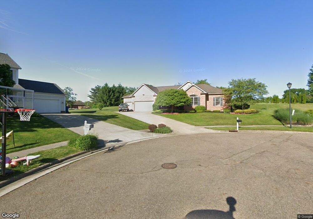
2780 Relda Cir SW Massillon, OH 44647
East Brookfield NeighborhoodEstimated Value: $324,346 - $381,000
3
Beds
2
Baths
1,896
Sq Ft
$182/Sq Ft
Est. Value
About This Home
This home is located at 2780 Relda Cir SW, Massillon, OH 44647 and is currently estimated at $345,087, approximately $182 per square foot. 2780 Relda Cir SW is a home located in Stark County with nearby schools including Tuslaw Elementary School, Tuslaw Middle School, and Tuslaw High School.
Ownership History
Date
Name
Owned For
Owner Type
Purchase Details
Closed on
Mar 25, 2004
Sold by
Jeeds Llc
Bought by
Wood Kenneth C and Wood Deborah L
Current Estimated Value
Home Financials for this Owner
Home Financials are based on the most recent Mortgage that was taken out on this home.
Original Mortgage
$156,940
Interest Rate
5.74%
Mortgage Type
Purchase Money Mortgage
Create a Home Valuation Report for This Property
The Home Valuation Report is an in-depth analysis detailing your home's value as well as a comparison with similar homes in the area
Home Values in the Area
Average Home Value in this Area
Purchase History
| Date | Buyer | Sale Price | Title Company |
|---|---|---|---|
| Wood Kenneth C | $35,500 | -- |
Source: Public Records
Mortgage History
| Date | Status | Borrower | Loan Amount |
|---|---|---|---|
| Closed | Wood Kenneth C | $156,940 |
Source: Public Records
Tax History Compared to Growth
Tax History
| Year | Tax Paid | Tax Assessment Tax Assessment Total Assessment is a certain percentage of the fair market value that is determined by local assessors to be the total taxable value of land and additions on the property. | Land | Improvement |
|---|---|---|---|---|
| 2025 | -- | $107,490 | $19,500 | $87,990 |
| 2024 | -- | $107,490 | $19,500 | $87,990 |
| 2023 | $3,489 | $92,540 | $13,510 | $79,030 |
| 2022 | $3,481 | $92,540 | $13,510 | $79,030 |
| 2021 | $2,023 | $92,540 | $13,510 | $79,030 |
| 2020 | $3,022 | $74,940 | $11,060 | $63,880 |
| 2019 | $2,983 | $74,940 | $11,060 | $63,880 |
| 2018 | $2,936 | $74,940 | $11,060 | $63,880 |
| 2017 | $2,966 | $72,140 | $7,210 | $64,930 |
| 2016 | $3,001 | $72,140 | $7,210 | $64,930 |
| 2015 | $3,037 | $72,140 | $7,210 | $64,930 |
| 2014 | $1,373 | $75,960 | $7,390 | $68,570 |
| 2013 | $1,699 | $75,960 | $7,390 | $68,570 |
Source: Public Records
Map
Nearby Homes
- 2760 Relda Cir SW
- 313 23rd St NW
- 2445 Pigeon Run Rd SW
- 104 16th St SW
- 1735 Woodruff Ave NW
- 315 14th St SW
- 2480 Deerford Ave SW
- 822 32nd St NW
- 485 Grosvenor Ave NW
- 3130 Lincoln Way W
- 429 18th St NW
- 2855 Poplar St NW
- 3241 Lincoln Way NW
- 1301 Lincoln Way NW
- 3069 Castle West Cir NW
- 429 11th St SW
- 324 Snyder Place SW
- 3056 Bent Creek Cir SW
- 1200 Kenyon Ave SW
- 830 Standish Cir NW
- 2765 Relda Cir SW
- 1225 Amanda St SW
- 2745 Relda Cir SW
- 2740 Relda Cir SW
- 1255 Amanda St SW
- 1230 Amanda St SW
- 10900 Millersburg Rd SW
- 10960 Millersburg Rd SW
- 1125 Vonnie Dr SW
- 2720 Relda Cir SW
- 1250 Amanda St SW
- 1025 Vonnie Dr SW
- 1285 Amanda St SW
- 1155 Vonnie Dr SW
- 2690 Linda Ln SW
- 1225 Benson St SW
- 1255 Benson St SW
- 1100 Vonnie Dr SW
- 1130 Vonnie Dr SW
- 1080 Vonnie Dr SW