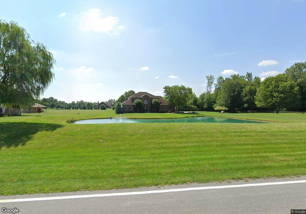
2781 Bunty Station Rd Delaware, OH 43015
Concord NeighborhoodEstimated Value: $707,000 - $733,000
3
Beds
3
Baths
2,454
Sq Ft
$293/Sq Ft
Est. Value
About This Home
This home is located at 2781 Bunty Station Rd, Delaware, OH 43015 and is currently estimated at $718,266, approximately $292 per square foot. 2781 Bunty Station Rd is a home located in Delaware County with nearby schools including Buckeye Valley High School and Delaware Christian School.
Ownership History
Date
Name
Owned For
Owner Type
Purchase Details
Closed on
Nov 18, 2011
Sold by
Auderheide Ronald C
Bought by
Thompson Keith E and Thompson Amy L
Current Estimated Value
Home Financials for this Owner
Home Financials are based on the most recent Mortgage that was taken out on this home.
Original Mortgage
$248,000
Outstanding Balance
$169,926
Interest Rate
4.12%
Mortgage Type
New Conventional
Estimated Equity
$548,340
Purchase Details
Closed on
Aug 29, 2002
Sold by
Davidson Bruce M
Bought by
Aufderheide Ronald C and Aufderheide Kimmy J
Create a Home Valuation Report for This Property
The Home Valuation Report is an in-depth analysis detailing your home's value as well as a comparison with similar homes in the area
Home Values in the Area
Average Home Value in this Area
Purchase History
| Date | Buyer | Sale Price | Title Company |
|---|---|---|---|
| Thompson Keith E | $310,000 | Talon Title D | |
| Aufderheide Ronald C | $44,450 | -- |
Source: Public Records
Mortgage History
| Date | Status | Borrower | Loan Amount |
|---|---|---|---|
| Open | Thompson Keith E | $248,000 |
Source: Public Records
Tax History Compared to Growth
Tax History
| Year | Tax Paid | Tax Assessment Tax Assessment Total Assessment is a certain percentage of the fair market value that is determined by local assessors to be the total taxable value of land and additions on the property. | Land | Improvement |
|---|---|---|---|---|
| 2024 | $7,014 | $202,240 | $45,540 | $156,700 |
| 2023 | $7,070 | $202,240 | $45,540 | $156,700 |
| 2022 | $5,584 | $143,360 | $31,780 | $111,580 |
| 2021 | $5,591 | $143,360 | $31,780 | $111,580 |
| 2020 | $5,592 | $143,360 | $31,780 | $111,580 |
| 2019 | $5,259 | $123,520 | $26,500 | $97,020 |
| 2018 | $5,446 | $123,520 | $26,500 | $97,020 |
| 2017 | $5,254 | $107,460 | $21,180 | $86,280 |
| 2016 | $4,470 | $107,460 | $21,180 | $86,280 |
| 2015 | $5,439 | $107,460 | $21,180 | $86,280 |
| 2014 | $5,055 | $107,460 | $21,180 | $86,280 |
| 2013 | $5,065 | $104,130 | $21,180 | $82,950 |
Source: Public Records
Map
Nearby Homes
- 0 Bunty Station Rd Unit 225036801
- 0 Ford Rd Unit Tract 8 225010624
- 0 Ford Rd Unit Tract 7 225010619
- 0 Ford Rd Unit Tract 6 225010615
- 0 Ford Rd Unit Tract 3 225010599
- 0 Ford Rd Unit 2 225010580
- 0 Ford Rd Unit 1 225010573
- 3226 Bean Oller Rd
- 0 Clark-Shaw Rd Unit 225020834
- 4040 Clark Shaw Rd
- 4754 Liberty Rd
- 3441 Crimson Stone Dr
- 4777 Liberty Rd
- 4161 Clark Shaw Rd
- 5310 S Section Line Rd
- 2770 Drycreek Ct
- 2762 Drycreek Ct
- 2746 Drycreek Ct
- 5515 Fawnsbury Ct
- 2753 Drycreek Ct
- 2737 Bunty Station Rd
- 2835 Bunty Station Rd
- 2699 Bunty Station Rd
- 2663 Bunty Station Rd
- 2344 Ford Rd
- 2380 Ford Rd
- 2362 Ford Rd
- 2561 Bunty Station Rd
- 2348 Ford Rd
- 2367 Ford Rd
- 3001 Bunty Station Rd
- 2341 Ford Rd
- 2530 Bunty Station Rd
- 2320 Ford Rd
- 3043 Bunty Station Rd
- 2333 Ford Rd
- 2325 Ford Rd
- 2304 Ford Rd
- 2315 Ford Rd
- 3115 Bunty Station Rd