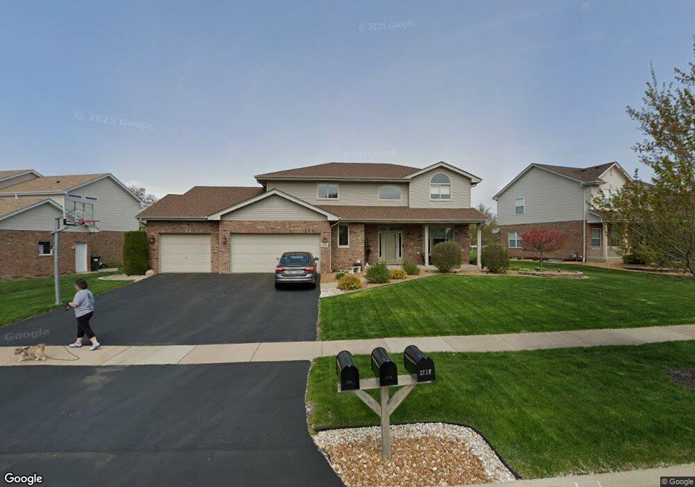
2783 Bluestone Bay Dr New Lenox, IL 60451
Estimated Value: $489,888 - $539,000
--
Bed
--
Bath
--
Sq Ft
0.26
Acres
About This Home
This home is located at 2783 Bluestone Bay Dr, New Lenox, IL 60451 and is currently estimated at $518,972. 2783 Bluestone Bay Dr is a home located in Will County with nearby schools including Spencer Trail, Spencer Pointe, and Spencer Crossing Intermediate School.
Ownership History
Date
Name
Owned For
Owner Type
Purchase Details
Closed on
Jun 22, 1998
Sold by
Marquette National Bank
Bought by
Watta Brian E and Watta Ginger M
Current Estimated Value
Home Financials for this Owner
Home Financials are based on the most recent Mortgage that was taken out on this home.
Original Mortgage
$184,126
Outstanding Balance
$36,835
Interest Rate
7.05%
Estimated Equity
$482,137
Create a Home Valuation Report for This Property
The Home Valuation Report is an in-depth analysis detailing your home's value as well as a comparison with similar homes in the area
Home Values in the Area
Average Home Value in this Area
Purchase History
| Date | Buyer | Sale Price | Title Company |
|---|---|---|---|
| Watta Brian E | $236,000 | Chicago Title Insurance Co |
Source: Public Records
Mortgage History
| Date | Status | Borrower | Loan Amount |
|---|---|---|---|
| Open | Watta Brian E | $184,126 |
Source: Public Records
Tax History Compared to Growth
Tax History
| Year | Tax Paid | Tax Assessment Tax Assessment Total Assessment is a certain percentage of the fair market value that is determined by local assessors to be the total taxable value of land and additions on the property. | Land | Improvement |
|---|---|---|---|---|
| 2024 | $12,382 | $160,573 | $36,393 | $124,180 |
| 2023 | $12,382 | $146,375 | $33,175 | $113,200 |
| 2022 | $11,149 | $134,846 | $30,562 | $104,284 |
| 2021 | $10,589 | $126,819 | $28,743 | $98,076 |
| 2020 | $10,291 | $122,294 | $27,717 | $94,577 |
| 2019 | $9,852 | $118,502 | $26,858 | $91,644 |
| 2018 | $9,627 | $114,417 | $25,932 | $88,485 |
| 2017 | $9,150 | $111,127 | $25,186 | $85,941 |
| 2016 | $8,884 | $108,153 | $24,512 | $83,641 |
| 2015 | $8,561 | $104,748 | $23,740 | $81,008 |
| 2014 | $8,561 | $103,455 | $23,447 | $80,008 |
| 2013 | $8,561 | $104,849 | $23,763 | $81,086 |
Source: Public Records
Map
Nearby Homes
- 2758 Bluestone Bay Dr
- 651 Schooner Dr
- 2848 Southwind Dr
- 2667 E Lincoln Hwy
- 190 Pottawatomie Ln
- 641 Lisson Grove
- 701 Bishops Gate
- 21606 Skyway Dr
- 21359 Saddle Ln
- 21170 Sage Brush Ln
- 21244 Sage Brush Ln
- 1535 Glenbrooke Ln
- 1595 Glenbrooke Ln
- 1591 Glenbrooke Ln
- 1587 Glenbrooke Ln
- 1583 Glenbrooke Ln
- 1579 Glenbrooke Bldg 60 Ln
- 1351 E Lincoln Hwy
- 21409 Foxtail Dr
- 1738 Orchard Ln
- 2767 Bluestone Bay Dr Unit 1
- 2793 Bluestone Bay Dr
- 2760 Bimini Ln
- 2736 Bimini Ln
- 2770 Bluestone Bay Dr
- 2746 Bluestone Bay Dr
- 2710 Bimini Ln
- 2733 Bluestone Bay Dr
- 2784 Bluestone Bay Dr Unit 1
- 2734 Bluestone Bay Dr
- 765 Bluestone Bay Dr
- 2779 Bimini Ln
- 2796 Bluestone Bay Dr
- 2694 Bimini Ln
- 2717 Bluestone Bay Dr
- 2747 Bimini Ln
- 2720 Bluestone Bay Dr
- 2763 Bimini Ln
- 2729 Bimini Ln
- 2713 Bimini Ln