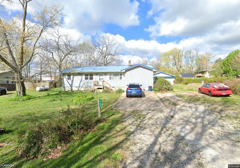
27853 Maple St Seligman, MO 65745
Estimated Value: $148,558 - $230,000
3
Beds
1
Bath
1,464
Sq Ft
$123/Sq Ft
Est. Value
About This Home
This home is located at 27853 Maple St, Seligman, MO 65745 and is currently estimated at $179,640, approximately $122 per square foot. 27853 Maple St is a home with nearby schools including Southwest Elementary School, Southwest Middle School, and Southwest High School.
Ownership History
Date
Name
Owned For
Owner Type
Purchase Details
Closed on
Jul 31, 2019
Sold by
Scannell Michael J and Scannell Mary F
Bought by
Trager Donald W and Trager Susan E
Current Estimated Value
Home Financials for this Owner
Home Financials are based on the most recent Mortgage that was taken out on this home.
Original Mortgage
$70,695
Outstanding Balance
$62,043
Interest Rate
3.8%
Mortgage Type
FHA
Estimated Equity
$117,597
Create a Home Valuation Report for This Property
The Home Valuation Report is an in-depth analysis detailing your home's value as well as a comparison with similar homes in the area
Purchase History
| Date | Buyer | Sale Price | Title Company |
|---|---|---|---|
| Trager Donald W | -- | Barry County Abstract & Ttl |
Source: Public Records
Mortgage History
| Date | Status | Borrower | Loan Amount |
|---|---|---|---|
| Open | Trager Donald W | $70,695 |
Source: Public Records
Tax History
| Year | Tax Paid | Tax Assessment Tax Assessment Total Assessment is a certain percentage of the fair market value that is determined by local assessors to be the total taxable value of land and additions on the property. | Land | Improvement |
|---|---|---|---|---|
| 2025 | $527 | $11,172 | $1,121 | $10,051 |
| 2024 | $5 | $10,260 | $1,121 | $9,139 |
| 2023 | $526 | $10,260 | $1,121 | $9,139 |
| 2022 | $506 | $9,861 | $722 | $9,139 |
| 2020 | $509 | $9,861 | $722 | $9,139 |
| 2018 | $484 | $9,861 | $722 | $9,139 |
| 2017 | $484 | $9,861 | $722 | $9,139 |
| 2016 | $455 | $9,139 | $608 | $8,531 |
| 2015 | -- | $9,139 | $608 | $8,531 |
| 2014 | -- | $9,139 | $608 | $8,531 |
| 2012 | -- | $0 | $0 | $0 |
Source: Public Records
Map
Nearby Homes
- 27876 Maple St
- 000 Walnut St
- 000 Blockade Village N
- 7754 N Blockade Village
- 7449 Farm Rd Unit 2280
- 27669 Ross Rd
- 7868 N Blockade Village
- 30495 State Highway 37
- 7977 Berry Ave
- 0000 State Highway Dd
- 27691 Longview Ln
- 000 Private Road 2274 (6 Acres)
- 000 Private Road 2274
- 32673 State Highway 112
- 32673 State Hwy 12
- 0 Walnut Unit 1328222
- 8747 Farm Road 2282
- 7593 Fr 2265
- Lot 3 Doc Meyer Rd
- Lot 1 Doc Meyer Rd
Your Personal Tour Guide
Ask me questions while you tour the home.