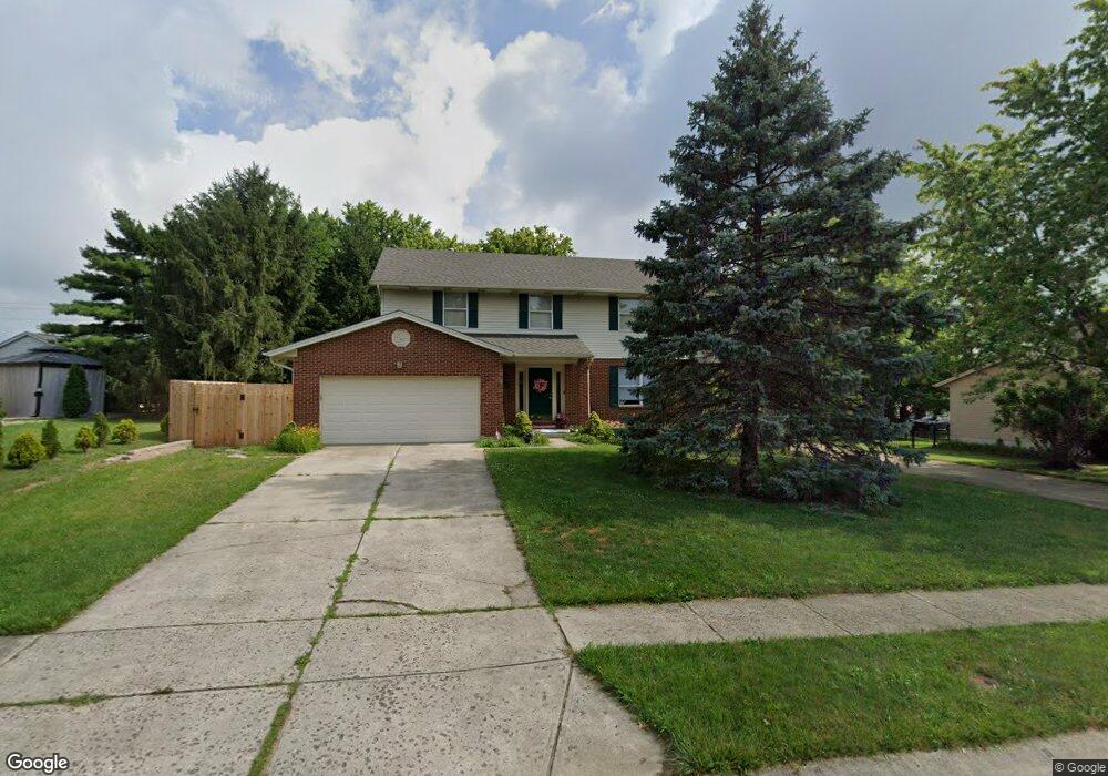
2786 Matthew Ct Loveland, OH 45140
Landen NeighborhoodEstimated Value: $389,336 - $504,000
4
Beds
3
Baths
2,057
Sq Ft
$214/Sq Ft
Est. Value
About This Home
This home is located at 2786 Matthew Ct, Loveland, OH 45140 and is currently estimated at $440,834, approximately $214 per square foot. 2786 Matthew Ct is a home located in Warren County with nearby schools including Kings Junior High School, Kings High School, and St. Margaret of York School.
Ownership History
Date
Name
Owned For
Owner Type
Purchase Details
Closed on
Aug 18, 1992
Sold by
J Hassman Construction &
Bought by
Lawson and Lawson Jeff E
Current Estimated Value
Purchase Details
Closed on
Jun 24, 1992
Sold by
Hassman James W Truste and Hassman James W
Bought by
J. Hassman Construction
Purchase Details
Closed on
Nov 25, 1991
Sold by
W Daniels Inc and Daniels Carroll L
Bought by
W. Daniels & Inc. and Hassman James W
Purchase Details
Closed on
Sep 11, 1991
Sold by
Daniels Carroll L and Daniels Carroll L
Bought by
Daniels and Daniels Carroll L
Create a Home Valuation Report for This Property
The Home Valuation Report is an in-depth analysis detailing your home's value as well as a comparison with similar homes in the area
Home Values in the Area
Average Home Value in this Area
Purchase History
| Date | Buyer | Sale Price | Title Company |
|---|---|---|---|
| Lawson | $124,900 | -- | |
| J. Hassman Construction | -- | -- | |
| W. Daniels & Inc. | -- | -- | |
| Daniels | -- | -- |
Source: Public Records
Tax History Compared to Growth
Tax History
| Year | Tax Paid | Tax Assessment Tax Assessment Total Assessment is a certain percentage of the fair market value that is determined by local assessors to be the total taxable value of land and additions on the property. | Land | Improvement |
|---|---|---|---|---|
| 2024 | $5,527 | $106,120 | $28,000 | $78,120 |
| 2023 | $4,692 | $80,871 | $14,455 | $66,416 |
| 2022 | $4,620 | $80,871 | $14,455 | $66,416 |
| 2021 | $3,872 | $80,871 | $14,455 | $66,416 |
| 2020 | $3,898 | $68,534 | $12,250 | $56,284 |
| 2019 | $3,950 | $68,534 | $12,250 | $56,284 |
| 2018 | $3,917 | $68,534 | $12,250 | $56,284 |
| 2017 | $3,806 | $58,737 | $11,144 | $47,593 |
| 2016 | $3,903 | $58,737 | $11,144 | $47,593 |
| 2015 | $3,277 | $58,737 | $11,144 | $47,593 |
| 2014 | $3,277 | $51,520 | $9,780 | $41,750 |
| 2013 | $3,282 | $64,570 | $12,250 | $52,320 |
Source: Public Records
Map
Nearby Homes
- 9299 White Pine Dr
- 2845 Columbia Trail
- 2680 Columbia Trail
- 2612 Virgie Ct
- 3139 Dogwood Ct N
- 9023 Country View Ln
- 8950 Wexford Place
- 9530 Greenery Ct Unit 305C
- 3204 Dogwood Ct N
- 9623 Greenery Ct Unit 313B
- 9702 Amberwood Ct
- 300 Oak Dr
- 2954 Mossy Brink Ct Unit 40
- 2839 Mossy Brink Ct
- 9809 Tulip Tree Ct
- 9785 Rich Rd
- 3230 Pauls Pointe Dr
- 8730 Exeter Place
- 9930 Tall Oaks Ct
- 3399 Shadow Ridge Dr
- 9276 White Pine Dr
- 2768 Matthew Ct
- 2778 Matthew Ct
- 9262 White Pine Dr
- 2776 Matthew Ct
- 2754 Matthew Ct
- 2807 Matthew Ct
- 9250 White Pine Dr
- 2787 Matthew Ct
- 2775 Matthew Ct
- 2746 Matthew Ct
- 2763 Matthew Ct
- 2751 Matthew Ct
- 2736 Matthew Ct
- 9320 White Pine Dr
- 2744 Matthew Ct
- 9285 White Pine Dr
- 9275 White Pine Dr
- 9253 White Pine Dr
- 2737 Matthew Ct