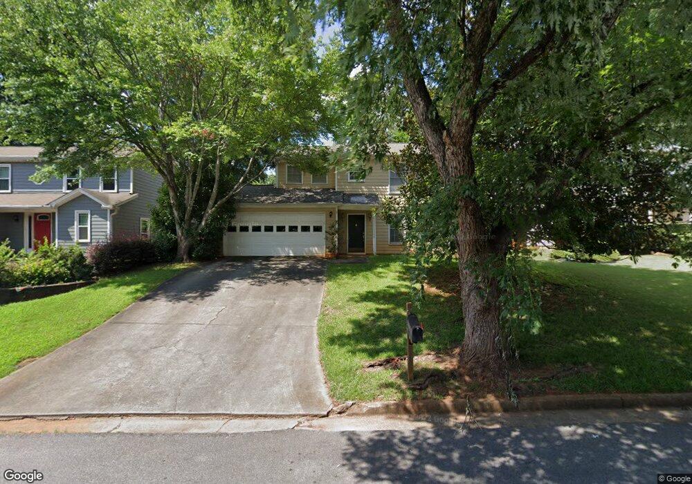
2786 Royal Bluff Decatur, GA 30030
Estimated Value: $467,267 - $544,000
2
Beds
3
Baths
1,531
Sq Ft
$324/Sq Ft
Est. Value
About This Home
This home is located at 2786 Royal Bluff, Decatur, GA 30030 and is currently estimated at $495,317, approximately $323 per square foot. 2786 Royal Bluff is a home located in DeKalb County with nearby schools including Avondale Elementary School, Druid Hills Middle School, and Druid Hills High School.
Ownership History
Date
Name
Owned For
Owner Type
Purchase Details
Closed on
Aug 28, 1998
Sold by
Dyer Karen A
Bought by
Conley Larry G
Current Estimated Value
Home Financials for this Owner
Home Financials are based on the most recent Mortgage that was taken out on this home.
Original Mortgage
$152,250
Outstanding Balance
$32,664
Interest Rate
6.95%
Mortgage Type
New Conventional
Estimated Equity
$462,653
Purchase Details
Closed on
Mar 15, 1993
Sold by
Kim Soo
Bought by
Dyer Karen A Michel L
Create a Home Valuation Report for This Property
The Home Valuation Report is an in-depth analysis detailing your home's value as well as a comparison with similar homes in the area
Home Values in the Area
Average Home Value in this Area
Purchase History
| Date | Buyer | Sale Price | Title Company |
|---|---|---|---|
| Conley Larry G | $157,000 | -- | |
| Dyer Karen A Michel L | $112,000 | -- |
Source: Public Records
Mortgage History
| Date | Status | Borrower | Loan Amount |
|---|---|---|---|
| Open | Conley Larry G | $152,250 | |
| Closed | Dyer Karen A Michel L | $0 |
Source: Public Records
Tax History Compared to Growth
Tax History
| Year | Tax Paid | Tax Assessment Tax Assessment Total Assessment is a certain percentage of the fair market value that is determined by local assessors to be the total taxable value of land and additions on the property. | Land | Improvement |
|---|---|---|---|---|
| 2024 | $4,690 | $165,840 | $50,040 | $115,800 |
| 2023 | $4,690 | $146,960 | $50,040 | $96,920 |
| 2022 | $4,225 | $147,520 | $50,000 | $97,520 |
| 2021 | $3,848 | $131,160 | $50,000 | $81,160 |
| 2020 | $3,766 | $127,400 | $50,000 | $77,400 |
| 2019 | $3,825 | $131,240 | $50,000 | $81,240 |
| 2018 | $3,096 | $109,560 | $23,520 | $86,040 |
| 2017 | $3,010 | $91,600 | $23,520 | $68,080 |
| 2016 | $2,824 | $86,520 | $23,520 | $63,000 |
| 2014 | $2,568 | $77,520 | $23,520 | $54,000 |
Source: Public Records
Map
Nearby Homes
- 2773 Craigie Ave
- 874 Ashwood Walk
- 2829 Ashwood Place
- 847 Regal Path Ln
- 725 Brown Place
- 827 Derrydown Way
- 2839 Ashbury Heights Rd
- 2630 Talley St Unit 326
- 2630 Talley St Unit 106
- 958 Forrest Blvd
- 230 New St Unit 2201-47
- 230 New St Unit 2201-4
- 1002 Forrest Blvd
- 2600 Talley St
- Olmstead Plan at New Talley Station - Stacks
- Dalton Plan at New Talley Station - Stacks
- McKoy Plan at New Talley Station - Stacks
- 451 S Columbia Dr
- 41 Clarendon Ave
- 2790 Royal Bluff
- 2782 Royal Bluff
- 2776 Royal Bluff
- 2794 Royal Bluff
- 2783 Craigie Ave
- 2777 Craigie Ave
- 2787 Craigie Ave
- 864 Wheatfields Ct
- 857 Wheatfields Place
- 2772 Royal Bluff
- 2793 Craigie Ave
- 2798 Royal Bluff
- 868 Wheatfields Ct
- 2769 Craigie Ave
- 861 Wheatfields Place
- 2797 Craigie Ave
- 2768 Royal Bluff
- 2771 Royal Bluff
- 858 Wheatfields Place
- 0 Craigie Ave Unit 8313464