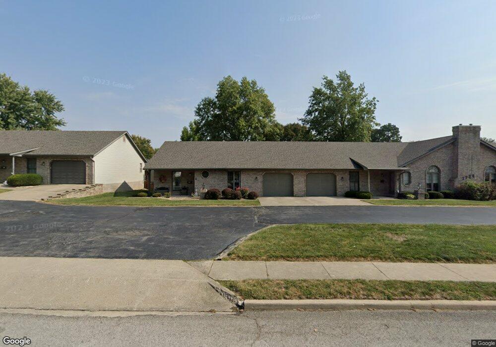
2787 E B Street Rd Unit B Belleville, IL 62221
Estimated Value: $209,067 - $258,000
--
Bed
--
Bath
1,547
Sq Ft
$151/Sq Ft
Est. Value
About This Home
This home is located at 2787 E B Street Rd Unit B, Belleville, IL 62221 and is currently estimated at $233,267, approximately $150 per square foot. 2787 E B Street Rd Unit B is a home located in St. Clair County with nearby schools including Whiteside Elementary School, Whiteside Middle School, and Zion Lutheran School Belleville.
Ownership History
Date
Name
Owned For
Owner Type
Purchase Details
Closed on
Dec 20, 2010
Sold by
Villas Of Chenot Condominium Association
Bought by
Marks Robert J and Marks Darlene
Current Estimated Value
Purchase Details
Closed on
May 26, 2006
Sold by
Spies Brenda
Bought by
Marks Robert J and Marks Darlene J
Home Financials for this Owner
Home Financials are based on the most recent Mortgage that was taken out on this home.
Original Mortgage
$79,000
Interest Rate
6.35%
Mortgage Type
Purchase Money Mortgage
Purchase Details
Closed on
Aug 27, 2003
Sold by
Spruce Hill Inc
Bought by
Gerkin Emil F
Create a Home Valuation Report for This Property
The Home Valuation Report is an in-depth analysis detailing your home's value as well as a comparison with similar homes in the area
Home Values in the Area
Average Home Value in this Area
Purchase History
| Date | Buyer | Sale Price | Title Company |
|---|---|---|---|
| Marks Robert J | -- | None Available | |
| Marks Robert J | $149,000 | Freedom Title | |
| Gerkin Emil F | $133,000 | -- |
Source: Public Records
Mortgage History
| Date | Status | Borrower | Loan Amount |
|---|---|---|---|
| Previous Owner | Marks Robert J | $79,000 |
Source: Public Records
Tax History Compared to Growth
Tax History
| Year | Tax Paid | Tax Assessment Tax Assessment Total Assessment is a certain percentage of the fair market value that is determined by local assessors to be the total taxable value of land and additions on the property. | Land | Improvement |
|---|---|---|---|---|
| 2024 | $1,922 | $54,873 | $7,755 | $47,118 |
| 2023 | $1,973 | $52,149 | $7,649 | $44,500 |
| 2022 | $1,882 | $47,494 | $6,966 | $40,528 |
| 2021 | $1,925 | $45,545 | $6,680 | $38,865 |
| 2020 | $2,219 | $42,415 | $6,221 | $36,194 |
| 2019 | $2,083 | $41,756 | $6,434 | $35,322 |
| 2018 | $1,949 | $40,690 | $6,270 | $34,420 |
| 2017 | $2,027 | $39,607 | $6,103 | $33,504 |
| 2016 | $2,015 | $38,242 | $5,893 | $32,349 |
| 2014 | $2,091 | $42,099 | $11,214 | $30,885 |
| 2013 | $2,282 | $42,099 | $11,214 | $30,885 |
Source: Public Records
Map
Nearby Homes
- 300 Sundew Dr
- 2608 E B Street Rd
- 2021 Killarney Dr
- 220 Anderson Ln
- 5 Calypso Ct
- 307 Shannon Ln
- 2237 Monterey Dr
- 2226 Wendy Way Dr
- 1828 West Blvd Unit B
- 71 Magnolia Dr
- 2125 E B St
- 120 Williamsburg Dr
- 3217 Millbrook Dr
- 2505 E Main St
- 58 Shady Ln
- 3233 Scepter Ct
- 2122 E Belle Ave
- 2134 E Belle Ave
- 2000 E C St
- 1922 E C St
- 2791 E B Street Rd Unit A
- 2783 E B Street Rd
- 2779 E B Street Rd Unit D
- 2771 E B Street Rd Unit F
- 313 Largo Dr
- 328 Sundew Dr
- 312 Largo Dr
- 2825 E B Street Rd
- 2767 E B Street Rd Unit G
- 333 Sundew Dr
- 2763 E B Street Rd Unit H
- 308 Largo Dr
- 324 Sundew Dr
- 2759 E B Street Rd
- 305 Largo Dr
- 2755 E B Street Rd Unit J
- 329 Sundew Dr
- 304 Largo Dr
- 320 Sundew Dr
- 325 Sundew Dr