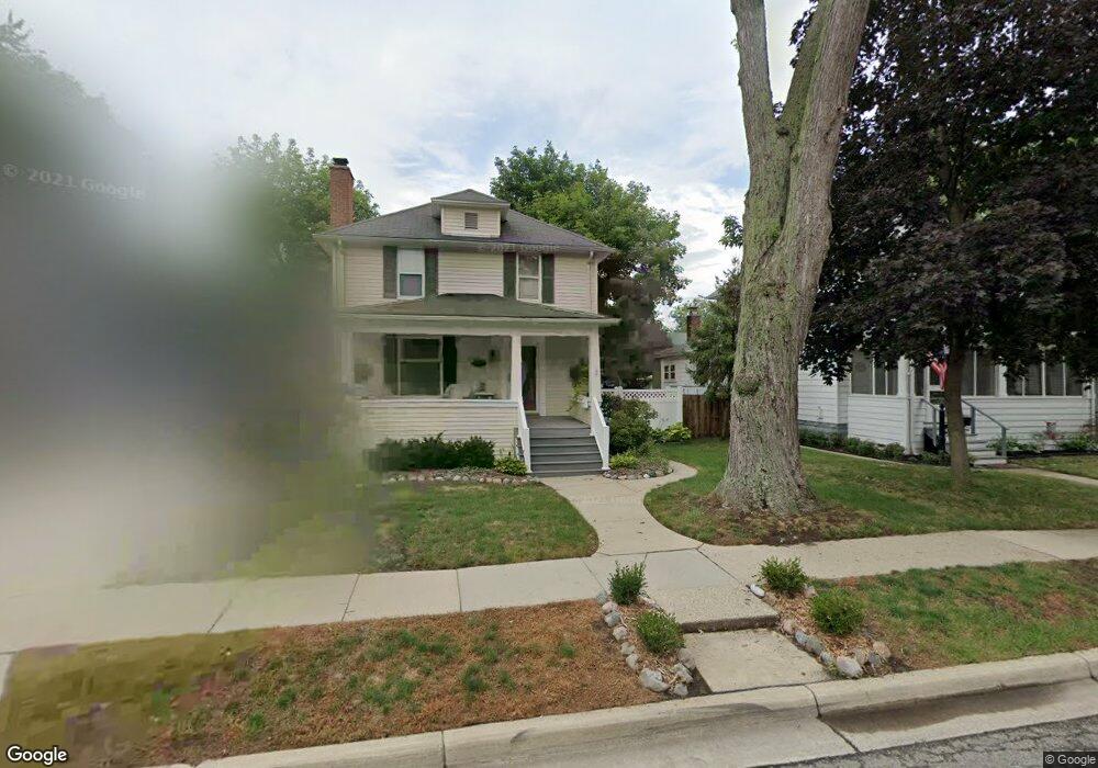
279 Blunk St Plymouth, MI 48170
Estimated Value: $507,943 - $652,000
3
Beds
2
Baths
1,650
Sq Ft
$362/Sq Ft
Est. Value
About This Home
This home is located at 279 Blunk St, Plymouth, MI 48170 and is currently estimated at $596,736, approximately $361 per square foot. 279 Blunk St is a home located in Wayne County with nearby schools including Canton High School, Bird Elementary School, and West Middle School.
Ownership History
Date
Name
Owned For
Owner Type
Purchase Details
Closed on
Nov 11, 2024
Sold by
Morelli Timothy N and Morelli Margaret E
Bought by
Margaret Morelli Revocable Trust and Morelli
Current Estimated Value
Purchase Details
Closed on
Mar 5, 2014
Sold by
Morelli Timothy N and Morelli Margaret E
Bought by
Morelli Timothy N and Morlli Margaret E
Purchase Details
Closed on
Jun 15, 2011
Sold by
Morelli Timothy N and Morelli Margaret E
Bought by
Morelli Timothy N and Morelli Margaret E
Create a Home Valuation Report for This Property
The Home Valuation Report is an in-depth analysis detailing your home's value as well as a comparison with similar homes in the area
Home Values in the Area
Average Home Value in this Area
Purchase History
| Date | Buyer | Sale Price | Title Company |
|---|---|---|---|
| Margaret Morelli Revocable Trust | -- | None Listed On Document | |
| Margaret Morelli Revocable Trust | -- | None Listed On Document | |
| Morelli Timothy N | -- | Fidelity National Title | |
| Morelli Timothy N | -- | None Available |
Source: Public Records
Tax History Compared to Growth
Tax History
| Year | Tax Paid | Tax Assessment Tax Assessment Total Assessment is a certain percentage of the fair market value that is determined by local assessors to be the total taxable value of land and additions on the property. | Land | Improvement |
|---|---|---|---|---|
| 2025 | $5,826 | $235,500 | $0 | $0 |
| 2024 | $5,826 | $227,600 | $0 | $0 |
| 2023 | $5,675 | $210,300 | $0 | $0 |
| 2022 | $6,015 | $199,100 | $0 | $0 |
| 2021 | $5,829 | $197,400 | $0 | $0 |
| 2020 | $5,814 | $191,300 | $0 | $0 |
| 2019 | $5,119 | $177,800 | $0 | $0 |
| 2018 | $4,971 | $167,900 | $0 | $0 |
| 2017 | $1,053 | $167,200 | $0 | $0 |
| 2016 | $5,416 | $161,900 | $0 | $0 |
| 2015 | $12,405 | $152,960 | $0 | $0 |
| 2013 | $12,017 | $133,590 | $0 | $0 |
| 2011 | -- | $114,270 | $0 | $0 |
Source: Public Records
Map
Nearby Homes
- 396 Blunk St
- 199 Arthur St
- 324 N Harvey St
- 188 N Harvey St
- 295 Pacific St
- 443 N Harvey St
- 42384 Gateway Dr
- 730 Penniman Ave Unit 205
- 1330 Junction St
- 416 N Sheldon Rd
- 801 W Ann Arbor Trail Unit 306
- 553 Jener Place
- 190 Hamilton St
- 668 Maple St
- 163 Hamilton St
- 660 Maple St
- 636 Maple St
- 609 Herald St
- 644 Maple St
- 315 N Sydney Ct