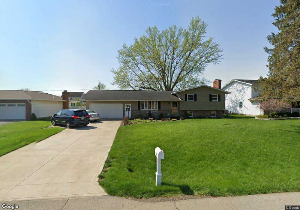
279 Brenton Dr Newark, OH 43055
Estimated Value: $336,011 - $349,000
3
Beds
2
Baths
2,064
Sq Ft
$166/Sq Ft
Est. Value
About This Home
This home is located at 279 Brenton Dr, Newark, OH 43055 and is currently estimated at $342,003, approximately $165 per square foot. 279 Brenton Dr is a home located in Licking County with nearby schools including Legend Elementary School, Liberty Middle School, and Newark High School.
Ownership History
Date
Name
Owned For
Owner Type
Purchase Details
Closed on
Jul 31, 2002
Sold by
Arnold Max W
Bought by
Houghton Jeffrey R and Houghton Teri L
Current Estimated Value
Home Financials for this Owner
Home Financials are based on the most recent Mortgage that was taken out on this home.
Original Mortgage
$95,200
Outstanding Balance
$40,716
Interest Rate
6.7%
Mortgage Type
New Conventional
Estimated Equity
$301,287
Create a Home Valuation Report for This Property
The Home Valuation Report is an in-depth analysis detailing your home's value as well as a comparison with similar homes in the area
Home Values in the Area
Average Home Value in this Area
Purchase History
| Date | Buyer | Sale Price | Title Company |
|---|---|---|---|
| Houghton Jeffrey R | $119,000 | -- |
Source: Public Records
Mortgage History
| Date | Status | Borrower | Loan Amount |
|---|---|---|---|
| Open | Houghton Jeffrey R | $95,200 |
Source: Public Records
Tax History Compared to Growth
Tax History
| Year | Tax Paid | Tax Assessment Tax Assessment Total Assessment is a certain percentage of the fair market value that is determined by local assessors to be the total taxable value of land and additions on the property. | Land | Improvement |
|---|---|---|---|---|
| 2024 | $2,946 | $82,400 | $24,960 | $57,440 |
| 2023 | $2,940 | $82,400 | $24,960 | $57,440 |
| 2022 | $2,621 | $65,390 | $16,840 | $48,550 |
| 2021 | $2,748 | $65,390 | $16,840 | $48,550 |
| 2020 | $2,814 | $65,390 | $16,840 | $48,550 |
| 2019 | $2,433 | $54,500 | $14,040 | $40,460 |
| 2018 | $2,434 | $0 | $0 | $0 |
| 2017 | $2,219 | $0 | $0 | $0 |
| 2016 | $2,062 | $0 | $0 | $0 |
| 2015 | $2,106 | $0 | $0 | $0 |
| 2014 | $2,699 | $0 | $0 | $0 |
| 2013 | $1,993 | $0 | $0 | $0 |
Source: Public Records
Map
Nearby Homes
- 1649 W Turkey Run Dr
- 1631 W Turkey Run Dr
- 437 Hunters Ct
- 1954 Iselin St
- 1948 Jamesburg St
- 1993 Iselin St
- 1981 Iselin St
- 1949 Iselin St
- 1957 Iselin St
- 1973 Iselin St
- 1977 Iselin St
- 1989 Iselin St
- 1968 High Bridge St
- 1952 Jamesburg St
- 1821 Mount Vernon Rd
- 1831 Churchill Downs Rd
- 2026 Freehold St
- 2012 Edison St
- 1345 Sherwood Downs Rd W
- 152 Lincoln Dr
- 287 Brenton Dr
- 269 Brenton Dr
- 1655 W Turkey Run Dr
- 1660 E Turkey Run Dr
- 295 Brenton Dr
- 1654 E Turkey Run Dr
- 259 Brenton Dr
- 274 Brenton Dr
- 286 Brenton Dr
- 266 Brenton Dr
- 1643 W Turkey Run Dr
- 303 Brenton Dr
- 251 Brenton Dr
- 258 Brenton Dr
- 300 Brenton Dr
- 1656 W Turkey Run Dr
- 1656 W Turkey Run Dr Unit 2846
- 1637 W Turkey Run Dr
- 1657 E Turkey Run Dr
- 1646 W Turkey Run Dr