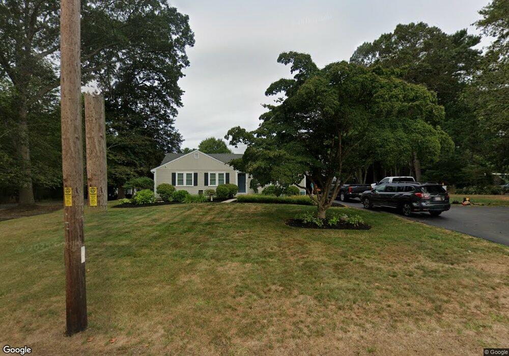
279 Broadway Hanover, MA 02339
Estimated Value: $1,055,000 - $1,540,068
4
Beds
5
Baths
4,104
Sq Ft
$327/Sq Ft
Est. Value
About This Home
This home is located at 279 Broadway, Hanover, MA 02339 and is currently estimated at $1,342,517, approximately $327 per square foot. 279 Broadway is a home located in Plymouth County with nearby schools including Hanover High School, Cadence Academy Preschool - Hanover, and Cardinal Cushing Centers.
Ownership History
Date
Name
Owned For
Owner Type
Purchase Details
Closed on
Jan 2, 2001
Sold by
Davis Susan F
Bought by
Paluzzi Lisa F
Current Estimated Value
Home Financials for this Owner
Home Financials are based on the most recent Mortgage that was taken out on this home.
Original Mortgage
$96,600
Outstanding Balance
$36,055
Interest Rate
7.7%
Mortgage Type
Purchase Money Mortgage
Estimated Equity
$1,306,462
Create a Home Valuation Report for This Property
The Home Valuation Report is an in-depth analysis detailing your home's value as well as a comparison with similar homes in the area
Home Values in the Area
Average Home Value in this Area
Purchase History
| Date | Buyer | Sale Price | Title Company |
|---|---|---|---|
| Paluzzi Lisa F | $138,000 | -- |
Source: Public Records
Mortgage History
| Date | Status | Borrower | Loan Amount |
|---|---|---|---|
| Open | Paluzzi Lisa F | $96,600 |
Source: Public Records
Tax History Compared to Growth
Tax History
| Year | Tax Paid | Tax Assessment Tax Assessment Total Assessment is a certain percentage of the fair market value that is determined by local assessors to be the total taxable value of land and additions on the property. | Land | Improvement |
|---|---|---|---|---|
| 2025 | $15,551 | $1,259,200 | $345,900 | $913,300 |
| 2024 | $14,812 | $1,153,600 | $345,900 | $807,700 |
| 2023 | $16,056 | $1,190,200 | $320,600 | $869,600 |
| 2022 | $16,165 | $1,060,000 | $307,900 | $752,100 |
| 2021 | $0 | $1,030,800 | $262,800 | $768,000 |
| 2020 | $0 | $1,030,500 | $274,400 | $756,100 |
| 2019 | $15,540 | $947,000 | $274,400 | $672,600 |
| 2018 | $14,672 | $901,200 | $274,400 | $626,800 |
| 2017 | $0 | $845,800 | $267,200 | $578,600 |
| 2016 | $13,534 | $802,700 | $248,600 | $554,100 |
| 2015 | $11,557 | $715,600 | $234,900 | $480,700 |
Source: Public Records
Map
Nearby Homes
- 186 Elm St
- 180 Elm St
- 28 Old Shipyard Ln
- 20 Meadow Brook Rd
- 55 Shipyard Ln
- 26 Church St
- 14 Longwood Ln Unit 14
- 114 Graham Hill Dr
- 172 Washington St
- 7 Farmside Dr
- 133 Brigantine Cir
- 265 Silver St
- 261 Washington St
- 250 Center St
- 51 Cervelli Farm Dr
- 37 Dr
- 23 Cervelli Farm Dr
- 38 Cervelli Farm Dr
- 9 Cervelli Farm Dr
- 218 Schoosett St
- 273 Broadway
- 287 Broadway
- 255 Broadway
- 7 Broad Oak Way
- 299 Broadway
- 245 Broadway
- 245 Broadway Unit 2C
- 262 Broadway
- 237 Broadway
- 292 Broadway
- 280 Broadway
- 248 Broadway
- 254 Broadway
- 254 Broadway Unit 1
- 317 Broadway
- 15 Broad Oak Way
- 22 Broad Oak Way
- 22 Broad Oak Way Unit B
- 22 Broad Oak Way Unit A
- 304 Broadway