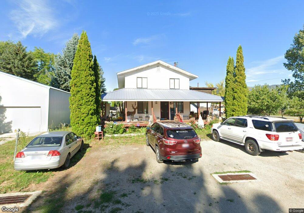
279 Cedar St Ponderay, ID 83852
Estimated Value: $420,629 - $689,000
4
Beds
2
Baths
2,504
Sq Ft
$235/Sq Ft
Est. Value
About This Home
This home is located at 279 Cedar St, Ponderay, ID 83852 and is currently estimated at $587,657, approximately $234 per square foot. 279 Cedar St is a home located in Bonner County with nearby schools including Kootenai Elementary School, Sandpoint Middle School, and Sandpoint High School.
Ownership History
Date
Name
Owned For
Owner Type
Purchase Details
Closed on
May 22, 2020
Sold by
Osborne Darren Grey and Osborne Katie Sue
Bought by
Osborne Darren G
Current Estimated Value
Home Financials for this Owner
Home Financials are based on the most recent Mortgage that was taken out on this home.
Original Mortgage
$198,000
Outstanding Balance
$177,662
Interest Rate
3.3%
Mortgage Type
New Conventional
Estimated Equity
$409,995
Purchase Details
Closed on
Mar 10, 2017
Sold by
Umali Tabitha
Bought by
Osborne Darren Grey and Osborne Katie Sue
Home Financials for this Owner
Home Financials are based on the most recent Mortgage that was taken out on this home.
Original Mortgage
$195,395
Interest Rate
4.15%
Mortgage Type
FHA
Create a Home Valuation Report for This Property
The Home Valuation Report is an in-depth analysis detailing your home's value as well as a comparison with similar homes in the area
Home Values in the Area
Average Home Value in this Area
Purchase History
| Date | Buyer | Sale Price | Title Company |
|---|---|---|---|
| Osborne Darren G | -- | Titleone | |
| Osborne Darren Grey | -- | First American Title Sandpoi |
Source: Public Records
Mortgage History
| Date | Status | Borrower | Loan Amount |
|---|---|---|---|
| Open | Osborne Darren G | $198,000 | |
| Closed | Osborne Darren Grey | $195,395 |
Source: Public Records
Tax History Compared to Growth
Tax History
| Year | Tax Paid | Tax Assessment Tax Assessment Total Assessment is a certain percentage of the fair market value that is determined by local assessors to be the total taxable value of land and additions on the property. | Land | Improvement |
|---|---|---|---|---|
| 2025 | $1,595 | $365,645 | $131,375 | $234,270 |
| 2024 | $2,309 | $326,822 | $115,979 | $210,843 |
| 2023 | $1,842 | $409,377 | $115,979 | $293,398 |
| 2022 | $2,334 | $396,962 | $103,564 | $293,398 |
| 2021 | $1,689 | $267,667 | $58,282 | $209,385 |
| 2020 | $1,839 | $249,017 | $43,188 | $205,829 |
| 2019 | $1,321 | $225,699 | $43,188 | $182,511 |
| 2018 | $1,266 | $203,111 | $39,250 | $163,861 |
| 2017 | $1,266 | $189,789 | $0 | $0 |
| 2016 | $2,195 | $172,470 | $0 | $0 |
Source: Public Records
Map
Nearby Homes
- 279 Birch
- 96 4th St
- 430 6th St
- 655 Oak Ave
- 55 Carnelian Ave
- 357 Jasper Loop
- 296 Jasper Loop
- 303 Jasper Loop
- 193 Ponder Point Ln
- 50 Carnelian Ave Unit 102
- 50 Carnelian Ave
- Lot 12 Dustarr Ln
- LOT 2 Dustarr Ln
- LOT 10 Dustarr Ln
- Lot 3 Dustarr Ln
- LOT 9 Dustarr Ln
- Lot 11 Dustarr Ln
- Lot 13 Dustarr Ln
- 116 Dustarr Ln