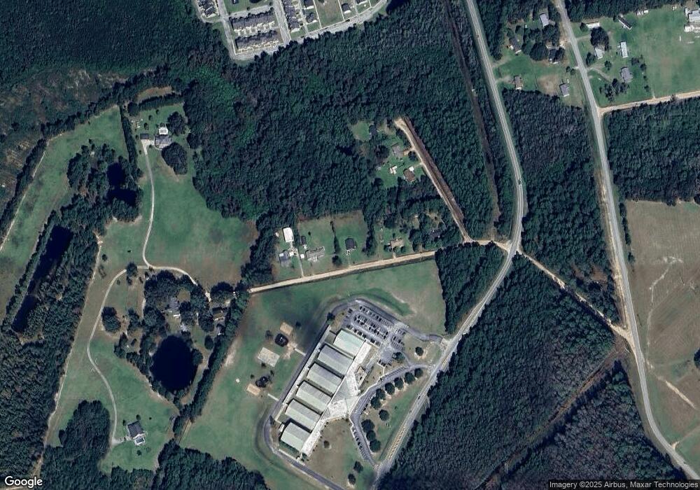
279 Davidson Plantation Rd Hinesville, GA 31313
Estimated Value: $221,234 - $245,000
3
Beds
2
Baths
1,597
Sq Ft
$145/Sq Ft
Est. Value
About This Home
This home is located at 279 Davidson Plantation Rd, Hinesville, GA 31313 and is currently estimated at $232,309, approximately $145 per square foot. 279 Davidson Plantation Rd is a home located in Liberty County with nearby schools including Waldo Pafford Elementary School, Lewis Frasier Middle School, and Bradwell Institute.
Ownership History
Date
Name
Owned For
Owner Type
Purchase Details
Closed on
Jul 1, 2008
Sold by
Precourt James E
Bought by
Tellado Lewis S
Current Estimated Value
Home Financials for this Owner
Home Financials are based on the most recent Mortgage that was taken out on this home.
Original Mortgage
$130,752
Outstanding Balance
$84,181
Interest Rate
6.03%
Mortgage Type
New Conventional
Estimated Equity
$148,128
Purchase Details
Closed on
Dec 5, 2003
Sold by
Precourt James E
Bought by
Precourt James E and Precourt Melissa
Purchase Details
Closed on
Oct 2, 1999
Sold by
Showalter Todd A
Bought by
Precourt James E
Purchase Details
Closed on
Jul 17, 1992
Bought by
Showalter Todd A
Create a Home Valuation Report for This Property
The Home Valuation Report is an in-depth analysis detailing your home's value as well as a comparison with similar homes in the area
Home Values in the Area
Average Home Value in this Area
Purchase History
| Date | Buyer | Sale Price | Title Company |
|---|---|---|---|
| Tellado Lewis S | $128,000 | -- | |
| Precourt James E | -- | -- | |
| Precourt James E | $68,500 | -- | |
| Showalter Todd A | $59,500 | -- |
Source: Public Records
Mortgage History
| Date | Status | Borrower | Loan Amount |
|---|---|---|---|
| Open | Tellado Lewis S | $130,752 |
Source: Public Records
Tax History Compared to Growth
Tax History
| Year | Tax Paid | Tax Assessment Tax Assessment Total Assessment is a certain percentage of the fair market value that is determined by local assessors to be the total taxable value of land and additions on the property. | Land | Improvement |
|---|---|---|---|---|
| 2024 | $2,474 | $55,639 | $3,000 | $52,639 |
| 2023 | $2,474 | $49,950 | $3,000 | $46,950 |
| 2022 | $1,597 | $40,176 | $3,000 | $37,176 |
| 2021 | $1,421 | $35,739 | $3,000 | $32,739 |
| 2020 | $1,440 | $36,177 | $3,000 | $33,177 |
| 2019 | $1,521 | $36,186 | $3,000 | $33,186 |
| 2018 | $1,404 | $36,624 | $3,000 | $33,624 |
| 2017 | $1,220 | $37,063 | $3,000 | $34,063 |
| 2016 | $1,340 | $37,501 | $3,000 | $34,501 |
| 2015 | $1,424 | $37,501 | $3,000 | $34,501 |
| 2014 | $1,424 | $39,496 | $3,000 | $36,496 |
| 2013 | -- | $35,761 | $3,000 | $32,761 |
Source: Public Records
Map
Nearby Homes
- 269 Brightleaf Cir
- 225 Rendell Ln
- 307 Lumpkin Ln
- 2563 Zachary Ct
- 2716 Java Ct
- 0 Airport Rd Unit 325633
- 0 Curtis Rd Unit 163007
- 0 Curtis Rd Unit SA339536
- 302 Largo Ct
- 644 Piedmont Ave
- 110 Brightleaf Cir
- 219 Augusta Way
- 34 Daylily Ct
- 206 Brightleaf Cir
- 185 Brightleaf Cir
- 213 Augusta Way
- 150 Grandview Dr
- 78 Daylily Ct
- 266 Brightleaf Cir
- 572 Brightleaf Cir
- 237 Davidson Plantation Rd
- 76 Lauran Dr
- 203 Davidson Plantation Rd
- 337 Davidson Plantation Rd
- 100 Lauran Dr Unit 7
- 100 Lauran Dr
- 171 Brightleaf Cir
- 134 Brightleaf Cir
- 85 Brightleaf Cir
- 386 Brightleaf Cir
- 369 Brightleaf Cir
- 124 Lauran Dr
- 418 Davidson Plantation Rd
- 408 Davidson Plantation Rd
- 477 Davidson Plantation Rd
- 827 Terrell Dr
- 702 Tattnall Dr
- 704 Tattnall Dr
- 706 Tattnall Dr
- 926 Tattnall Dr
