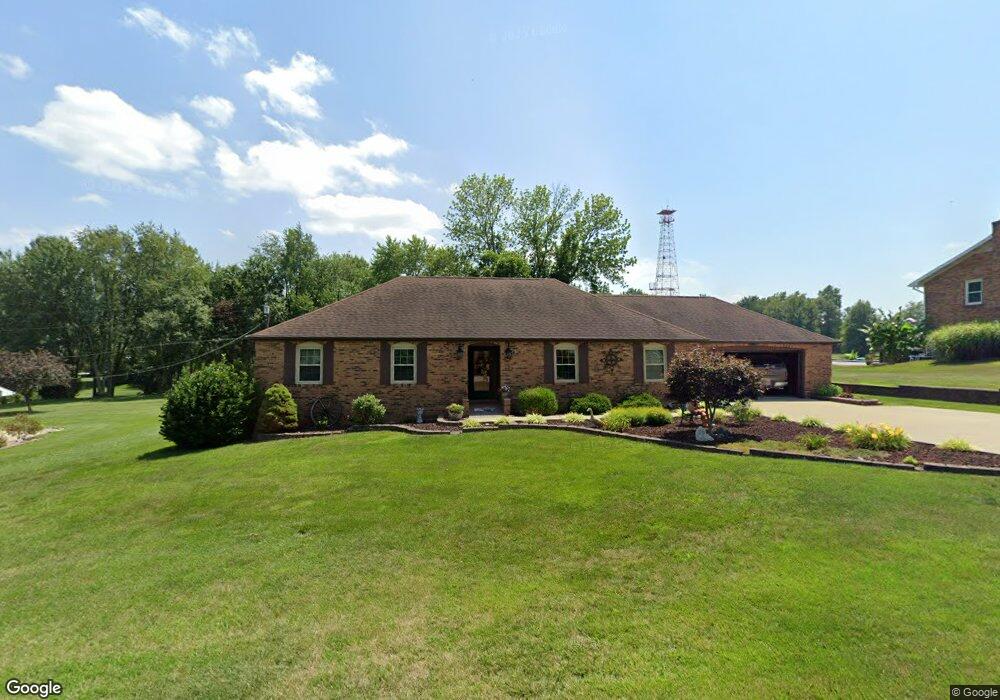
279 E 780 S Fort Branch, IN 47648
Estimated Value: $257,175 - $288,000
3
Beds
2
Baths
1,658
Sq Ft
$164/Sq Ft
Est. Value
About This Home
This home is located at 279 E 780 S, Fort Branch, IN 47648 and is currently estimated at $272,544, approximately $164 per square foot. 279 E 780 S is a home located in Gibson County with nearby schools including Gibson Southern High School and Holy Cross School.
Create a Home Valuation Report for This Property
The Home Valuation Report is an in-depth analysis detailing your home's value as well as a comparison with similar homes in the area
Home Values in the Area
Average Home Value in this Area
Tax History Compared to Growth
Tax History
| Year | Tax Paid | Tax Assessment Tax Assessment Total Assessment is a certain percentage of the fair market value that is determined by local assessors to be the total taxable value of land and additions on the property. | Land | Improvement |
|---|---|---|---|---|
| 2024 | $2,166 | $224,200 | $19,000 | $205,200 |
| 2023 | $1,620 | $173,600 | $19,000 | $154,600 |
| 2022 | $1,689 | $168,900 | $19,000 | $149,900 |
| 2021 | $1,475 | $147,500 | $19,000 | $128,500 |
| 2020 | $1,445 | $144,000 | $19,000 | $125,000 |
| 2019 | $1,425 | $144,000 | $19,000 | $125,000 |
| 2018 | $1,516 | $151,100 | $19,000 | $132,100 |
| 2017 | $1,445 | $150,900 | $19,000 | $131,900 |
| 2016 | $1,331 | $144,800 | $19,000 | $125,800 |
| 2014 | $1,051 | $127,900 | $19,000 | $108,900 |
| 2013 | -- | $129,000 | $19,000 | $110,000 |
Source: Public Records
Map
Nearby Homes
- 205 S Us Highway 41
- 209 S Main St
- 603 E Park St
- 806 E Park St
- 211 W Locust St Unit 2
- 403 N West St
- 6000 S Us Hwy 41 N
- 206 W Gibson St
- 301 S 4th Ave
- 525 S 8th Ave
- 10160 S Quail Crossing
- 11088 S Owensville Rd
- 2352 E Warrenton Rd
- 7075 S 500 W
- 3103 Torboy Dr
- 4715 Violet Dr
- 3011 Torboy Dr
- 4812 Haventree Dr
- 3104 Torboy Dr
- 3050 Torboy Dr