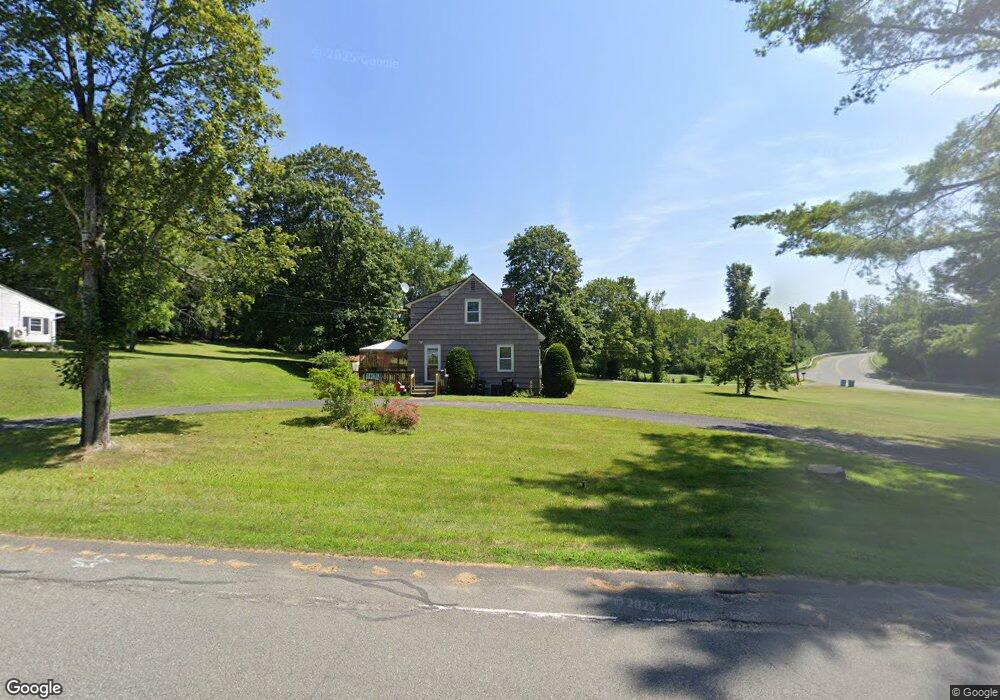
279 Eleanor Rd Pittsfield, MA 01201
Estimated Value: $353,000 - $399,000
3
Beds
2
Baths
1,224
Sq Ft
$303/Sq Ft
Est. Value
About This Home
This home is located at 279 Eleanor Rd, Pittsfield, MA 01201 and is currently estimated at $370,694, approximately $302 per square foot. 279 Eleanor Rd is a home located in Berkshire County with nearby schools including John T. Reid Middle School, Taconic High School, and St Mark School.
Create a Home Valuation Report for This Property
The Home Valuation Report is an in-depth analysis detailing your home's value as well as a comparison with similar homes in the area
Home Values in the Area
Average Home Value in this Area
Tax History Compared to Growth
Tax History
| Year | Tax Paid | Tax Assessment Tax Assessment Total Assessment is a certain percentage of the fair market value that is determined by local assessors to be the total taxable value of land and additions on the property. | Land | Improvement |
|---|---|---|---|---|
| 2025 | $5,524 | $307,900 | $81,400 | $226,500 |
| 2024 | $5,362 | $290,600 | $81,400 | $209,200 |
| 2023 | $4,981 | $271,900 | $81,400 | $190,500 |
| 2022 | $4,440 | $239,200 | $81,400 | $157,800 |
| 2021 | $4,158 | $216,000 | $81,400 | $134,600 |
| 2020 | $3,968 | $201,300 | $71,400 | $129,900 |
| 2019 | $3,554 | $183,000 | $66,400 | $116,600 |
| 2018 | $3,608 | $180,300 | $66,400 | $113,900 |
| 2017 | $3,359 | $171,100 | $61,400 | $109,700 |
| 2016 | $3,215 | $171,400 | $61,400 | $110,000 |
| 2015 | $3,095 | $171,400 | $61,400 | $110,000 |
Source: Public Records
Map
Nearby Homes
- 208 Jason St
- 47 Gale Ave
- 8 Samson Ave
- 93 Roselyn Dr
- 1012 West St
- 61 Tor Ct
- 497 Gale Ave
- 499 Gale Ave
- 32 Mead Ave
- 103 Stearns Ave
- 90 Jones Ave
- 26 Churchill Crest
- 0 Jones Ave
- 44 Churchill Crest Unit 44
- 46 Churchill Crest Unit 46
- 60 Churchill Crest
- 712 Barker Rd
- 471 West St
- 20 Greenway St
- 139 Gamwell Ave