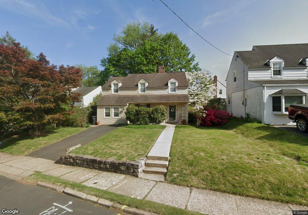
279 Forrest Ave Elkins Park, PA 19027
Estimated Value: $410,000 - $519,000
3
Beds
2
Baths
1,391
Sq Ft
$321/Sq Ft
Est. Value
About This Home
This home is located at 279 Forrest Ave, Elkins Park, PA 19027 and is currently estimated at $446,308, approximately $320 per square foot. 279 Forrest Ave is a home located in Montgomery County with nearby schools including McKinley School, Abington Middle School, and Abington Senior High School.
Ownership History
Date
Name
Owned For
Owner Type
Purchase Details
Closed on
Jul 30, 2007
Sold by
Mines Kathleen T and Mines Timothy R
Bought by
Cotter Margaret H and Cotter Erick T
Current Estimated Value
Home Financials for this Owner
Home Financials are based on the most recent Mortgage that was taken out on this home.
Original Mortgage
$76,250
Outstanding Balance
$48,426
Interest Rate
6.72%
Estimated Equity
$397,882
Purchase Details
Closed on
Aug 15, 1997
Sold by
Rosenberger Rodman M and Vanvoorhees Peter C
Bought by
Mines Timothy R and Mines Kathleen T
Create a Home Valuation Report for This Property
The Home Valuation Report is an in-depth analysis detailing your home's value as well as a comparison with similar homes in the area
Home Values in the Area
Average Home Value in this Area
Purchase History
| Date | Buyer | Sale Price | Title Company |
|---|---|---|---|
| Cotter Margaret H | $305,000 | None Available | |
| Mines Timothy R | $130,000 | -- |
Source: Public Records
Mortgage History
| Date | Status | Borrower | Loan Amount |
|---|---|---|---|
| Open | Cotter Margaret H | $76,250 | |
| Open | Cotter Margaret H | $228,750 |
Source: Public Records
Tax History Compared to Growth
Tax History
| Year | Tax Paid | Tax Assessment Tax Assessment Total Assessment is a certain percentage of the fair market value that is determined by local assessors to be the total taxable value of land and additions on the property. | Land | Improvement |
|---|---|---|---|---|
| 2025 | $6,109 | $131,920 | $41,650 | $90,270 |
| 2024 | $6,109 | $131,920 | $41,650 | $90,270 |
| 2023 | $5,854 | $131,920 | $41,650 | $90,270 |
| 2022 | $5,667 | $131,920 | $41,650 | $90,270 |
| 2021 | $5,362 | $131,920 | $41,650 | $90,270 |
| 2020 | $5,285 | $131,920 | $41,650 | $90,270 |
| 2019 | $5,285 | $131,920 | $41,650 | $90,270 |
| 2018 | $5,284 | $131,920 | $41,650 | $90,270 |
| 2017 | $5,129 | $131,920 | $41,650 | $90,270 |
| 2016 | $5,077 | $131,920 | $41,650 | $90,270 |
| 2015 | $4,774 | $131,920 | $41,650 | $90,270 |
| 2014 | $4,774 | $131,920 | $41,650 | $90,270 |
Source: Public Records
Map
Nearby Homes
- 276 Tulpehocken Ave Unit 64
- 990 Indian Creek Rd
- 150 West Ave
- 103 Forrest Ave
- 546 Bethan Rd
- 782 Jenkintown Rd
- 1209 Lenox Rd
- 632 Foxcroft Rd
- 8301 Cadwalader Ave
- 634 Green Briar Rd
- 8232 Forrest Ave
- 632 Meetinghouse Rd
- 681 Meetinghouse Rd Unit 15
- 8237 Brookside Rd
- 933 Fox Chase Rd
- 365 Cedar Rd Unit 20
- 341 Cedar Rd
- 8208 Forrest Ave
- 221 Marco Rd
- 657 Pembroke Rd
- 275 Forrest Ave
- 285 Forrest Ave
- 945 Crefeld Ave
- 941 Crefeld Ave
- 946 Jenkintown Rd
- 937 Crefeld Ave
- 292 Forrest Ave
- 269 Forrest Ave
- 298 Forrest Ave
- 954 Crefeld Ave
- 286 Forrest Ave
- 950 Crefeld Ave
- 290 Huron Ave
- 946 Crefeld Ave
- 933 Crefeld Ave
- 278 Forrest Ave
- 263 Forrest Ave
- 309 Forrest Ave
- 942 Crefeld Ave
- 353 Bar Harbor Rd