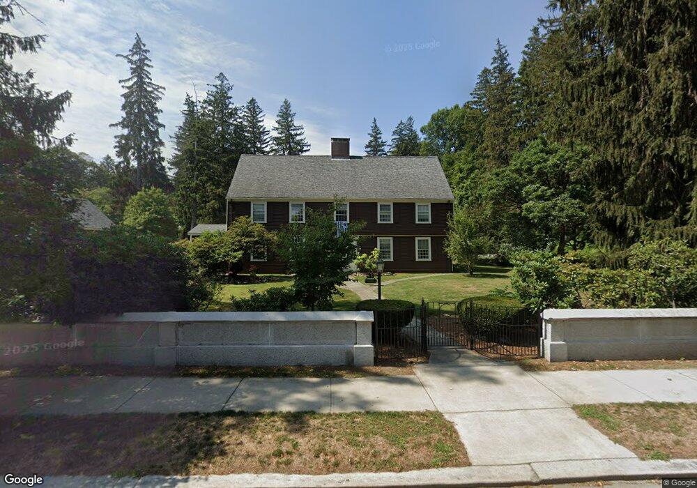
279 High St Newburyport, MA 01950
Estimated Value: $1,418,000 - $2,007,000
5
Beds
3
Baths
3,012
Sq Ft
$571/Sq Ft
Est. Value
About This Home
This home is located at 279 High St, Newburyport, MA 01950 and is currently estimated at $1,719,176, approximately $570 per square foot. 279 High St is a home located in Essex County with nearby schools including Francis T. Bresnahan Elementary School, Edward G. Molin Elementary School, and Rupert A. Nock Middle School.
Create a Home Valuation Report for This Property
The Home Valuation Report is an in-depth analysis detailing your home's value as well as a comparison with similar homes in the area
Home Values in the Area
Average Home Value in this Area
Tax History Compared to Growth
Tax History
| Year | Tax Paid | Tax Assessment Tax Assessment Total Assessment is a certain percentage of the fair market value that is determined by local assessors to be the total taxable value of land and additions on the property. | Land | Improvement |
|---|---|---|---|---|
| 2025 | $14,642 | $1,528,400 | $532,200 | $996,200 |
| 2024 | $14,089 | $1,413,100 | $484,900 | $928,200 |
| 2023 | $13,950 | $1,298,900 | $421,700 | $877,200 |
| 2022 | $12,980 | $1,080,800 | $353,200 | $727,600 |
| 2021 | $12,501 | $989,000 | $322,200 | $666,800 |
| 2020 | $11,984 | $933,300 | $322,200 | $611,100 |
| 2019 | $11,428 | $873,700 | $322,200 | $551,500 |
| 2018 | $10,961 | $826,600 | $307,500 | $519,100 |
| 2017 | $10,705 | $795,900 | $293,000 | $502,900 |
| 2016 | $10,787 | $805,600 | $279,000 | $526,600 |
| 2015 | $10,747 | $805,600 | $279,000 | $526,600 |
Source: Public Records
Map
Nearby Homes
- 287 1/2 High St
- 138 Low St
- 288 Merrimac St
- 13 Broad St
- 110 Low St
- 27 Warren St Unit 1
- 266 Merrimac St Unit F
- 42 Myrtle Ave
- 17 Alberta Ave
- 19 Jefferson St
- 1 Jefferson St
- 14 Dexter Ln Unit B
- 14 Dexter Ln Unit A
- 6 Storey Ave
- 158 Merrimac St Unit 3
- 45 Boardman St Unit 1
- 41 Washington St Unit B
- 44 Washington St Unit C
- 126 Merrimac St Unit 35
- 232 Low St Unit 7