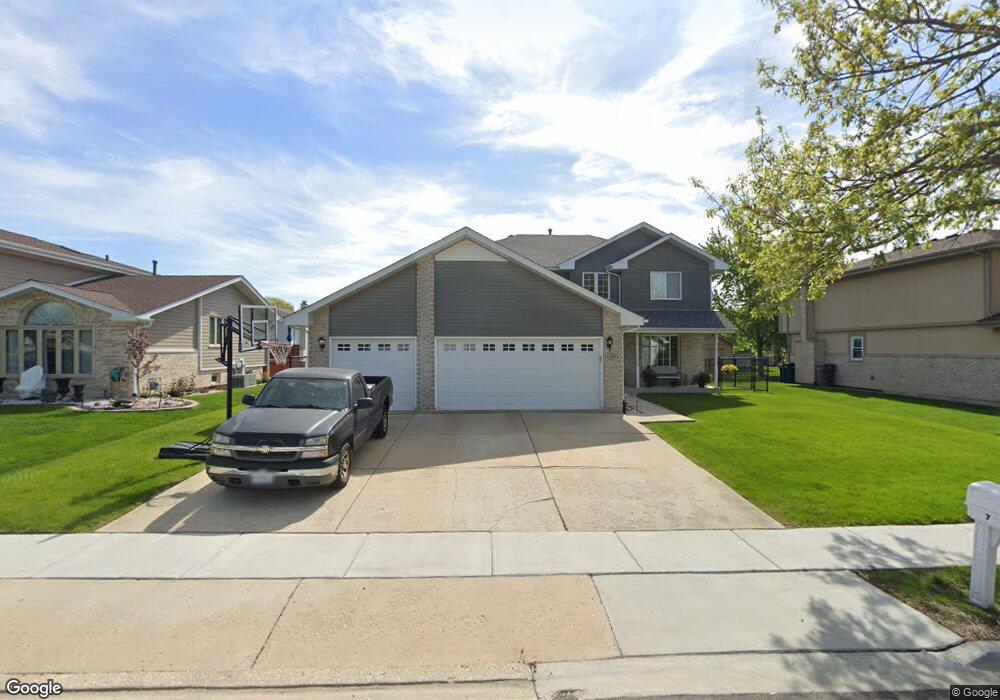
279 Jamestown Ct Romeoville, IL 60446
Estimated Value: $345,960 - $447,000
--
Bed
1
Bath
2,334
Sq Ft
$171/Sq Ft
Est. Value
About This Home
This home is located at 279 Jamestown Ct, Romeoville, IL 60446 and is currently estimated at $399,490, approximately $171 per square foot. 279 Jamestown Ct is a home located in Will County with nearby schools including Robert C. Hill Elementary School, A. Vito Martinez Middle School, and Romeoville High School.
Ownership History
Date
Name
Owned For
Owner Type
Purchase Details
Closed on
Jun 16, 2009
Sold by
Darcy Laurie A
Bought by
Darcy Laurie A and Darcy Revocable Livin Laurie A
Current Estimated Value
Purchase Details
Closed on
Jul 6, 2001
Sold by
Standard Bank & Trust Company
Bought by
Darcy Laurie A
Home Financials for this Owner
Home Financials are based on the most recent Mortgage that was taken out on this home.
Original Mortgage
$85,000
Outstanding Balance
$32,781
Interest Rate
7.15%
Estimated Equity
$366,709
Create a Home Valuation Report for This Property
The Home Valuation Report is an in-depth analysis detailing your home's value as well as a comparison with similar homes in the area
Home Values in the Area
Average Home Value in this Area
Purchase History
| Date | Buyer | Sale Price | Title Company |
|---|---|---|---|
| Darcy Laurie A | -- | None Available | |
| Darcy Laurie A | $190,000 | Chicago Title Insurance Co |
Source: Public Records
Mortgage History
| Date | Status | Borrower | Loan Amount |
|---|---|---|---|
| Open | Darcy Laurie A | $85,000 |
Source: Public Records
Tax History Compared to Growth
Tax History
| Year | Tax Paid | Tax Assessment Tax Assessment Total Assessment is a certain percentage of the fair market value that is determined by local assessors to be the total taxable value of land and additions on the property. | Land | Improvement |
|---|---|---|---|---|
| 2024 | $9,802 | $113,278 | $25,807 | $87,471 |
| 2023 | $9,802 | $101,695 | $23,168 | $78,527 |
| 2022 | $8,318 | $89,399 | $20,367 | $69,032 |
| 2021 | $7,931 | $84,014 | $19,140 | $64,874 |
| 2020 | $7,712 | $81,252 | $18,511 | $62,741 |
| 2019 | $7,383 | $77,016 | $17,546 | $59,470 |
| 2018 | $6,746 | $69,906 | $15,926 | $53,980 |
| 2017 | $6,342 | $65,992 | $15,034 | $50,958 |
| 2016 | $5,988 | $61,848 | $14,090 | $47,758 |
| 2015 | $4,908 | $56,583 | $12,890 | $43,693 |
| 2014 | $4,908 | $49,752 | $12,047 | $37,705 |
| 2013 | $4,908 | $51,825 | $12,549 | $39,276 |
Source: Public Records
Map
Nearby Homes
- 923 E Savannah Dr Unit 2
- 939 E Savannah Dr
- 346 Wild Rose Ln
- 255 W Romeo Rd
- 1282 W Normantown Rd
- Lot 5 Weber Rd
- 1033 Key Largo Dr Unit M702
- 312 Fremont Ave
- 1086 Princeton Dr
- 322 Kent Ave
- Lot 2 Governors Hwy
- 0 N Weber Rd Unit MRD12364369
- 440 N Kelly Ct
- 487 N Anna Ln
- 408 Haller Ave
- 497 N Frieh Dr
- 343 Hale Ave
- 915 Brassfield Ave
- 947 Brassfield Ave
- 242 Tallman Ave
- 285 Jamestown Ct
- 273 Jamestown Ct
- 291 Jamestown Ct
- 282 Georgetown Ave
- 278 Jamestown Ct
- 286 Georgetown Ave Unit 1
- 272 Jamestown Ct
- 278 Georgetown Ave Unit 1
- 284 Jamestown Ct Unit 1
- 290 Georgetown Ave Unit 1
- 297 Jamestown Ct
- 274 Georgetown Ave
- 290 Jamestown Ct
- 296 Georgetown Ave
- 271 Heritage Pkwy Unit 1
- 302 Jamestown Ct
- 275 Heritage Pkwy
- 296 Jamestown Ct
- 255 Charleston Ave
- 253 Charleston Ave