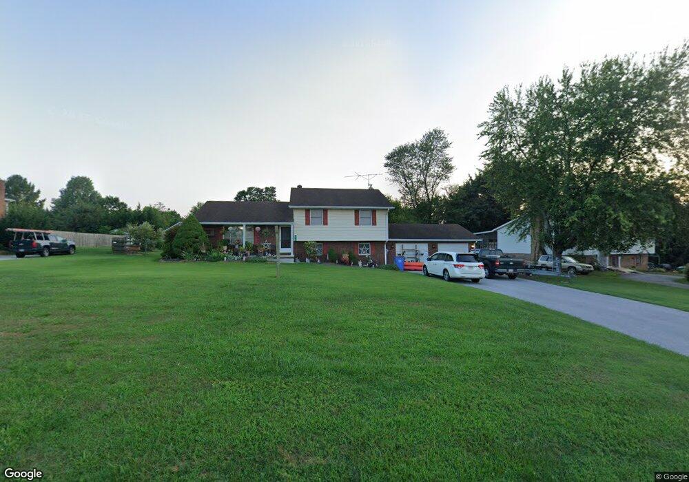
279 Kindig Rd Unit 4 Littlestown, PA 17340
Estimated Value: $271,000 - $328,000
3
Beds
2
Baths
1,342
Sq Ft
$228/Sq Ft
Est. Value
About This Home
This home is located at 279 Kindig Rd Unit 4, Littlestown, PA 17340 and is currently estimated at $305,594, approximately $227 per square foot. 279 Kindig Rd Unit 4 is a home located in Adams County with nearby schools including Rolling Acres El School, Maple Avenue Middle School, and Littlestown Senior High School.
Ownership History
Date
Name
Owned For
Owner Type
Purchase Details
Closed on
Dec 31, 2004
Sold by
Warner Joseph H and Warner Anita J
Bought by
Schaub Robert A and Adams Karen Ann
Current Estimated Value
Home Financials for this Owner
Home Financials are based on the most recent Mortgage that was taken out on this home.
Original Mortgage
$38,000
Outstanding Balance
$28,301
Interest Rate
5.81%
Mortgage Type
Credit Line Revolving
Estimated Equity
$277,293
Create a Home Valuation Report for This Property
The Home Valuation Report is an in-depth analysis detailing your home's value as well as a comparison with similar homes in the area
Home Values in the Area
Average Home Value in this Area
Purchase History
| Date | Buyer | Sale Price | Title Company |
|---|---|---|---|
| Schaub Robert A | $190,000 | -- |
Source: Public Records
Mortgage History
| Date | Status | Borrower | Loan Amount |
|---|---|---|---|
| Open | Schaub Robert A | $38,000 | |
| Open | Schaub Robert A | $152,000 |
Source: Public Records
Tax History Compared to Growth
Tax History
| Year | Tax Paid | Tax Assessment Tax Assessment Total Assessment is a certain percentage of the fair market value that is determined by local assessors to be the total taxable value of land and additions on the property. | Land | Improvement |
|---|---|---|---|---|
| 2025 | $4,104 | $216,800 | $54,200 | $162,600 |
| 2024 | $3,944 | $216,800 | $54,200 | $162,600 |
| 2023 | $3,845 | $216,800 | $54,200 | $162,600 |
| 2022 | $3,817 | $216,800 | $54,200 | $162,600 |
| 2021 | $3,681 | $216,800 | $54,200 | $162,600 |
| 2020 | $3,628 | $216,800 | $54,200 | $162,600 |
| 2019 | $3,550 | $216,800 | $54,200 | $162,600 |
| 2018 | $3,445 | $216,800 | $54,200 | $162,600 |
| 2017 | $3,337 | $216,800 | $54,200 | $162,600 |
| 2016 | -- | $216,800 | $54,200 | $162,600 |
| 2015 | -- | $216,800 | $54,200 | $162,600 |
| 2014 | -- | $216,800 | $54,200 | $162,600 |
Source: Public Records
Map
Nearby Homes
- 535 Lumber St
- 559 Lumber St
- 567 Lumber St
- 211 E King St
- 241 M St
- 61 E King St
- 106 E King St
- LOT 9 Mehring Rd
- 630 Mehring Rd Unit 4
- 115 Charles St
- 117 Charles St
- 41 Smith Cir
- 43 Ashfield Dr Unit 14
- 129 W King St
- 22 Rita Marie Ave
- 162 Newark St
- 140 Apple Grove Ln Unit 425
- 440 N Queen St
- 893 Georgetown Rd
- 161 Stoners Cir
- 265 Kindig Rd Unit 5
- 289 Kindig Rd Unit 3
- 253 Kindig Rd Unit 6
- 280 Kindig Rd Unit 7
- 297 Kindig Rd
- 309 Kindig Rd Unit 2
- 243 Kindig Rd Unit 7
- 260 Kindig Rd Unit 6
- 301 Kindig Rd Unit 12
- 317 Kindig Rd
- 240 Kindig Rd Unit 5
- 233 Kindig Rd Unit 8
- 220 Kindig Rd Unit 4
- 286 Kindig Rd
- 400 Kindig Rd Unit 1
- 99 W Summit Dr Unit 27
- 180 Kindig Rd Unit 2
- 399 Kindig Rd
- 93 W Summit Dr Unit 26
- 85 W Summit Dr Unit 25