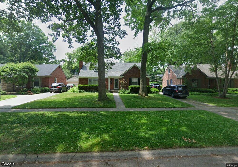
279 Lothrop Rd Grosse Pointe Farms, MI 48236
Estimated Value: $457,271 - $696,000
4
Beds
2
Baths
2,050
Sq Ft
$284/Sq Ft
Est. Value
About This Home
This home is located at 279 Lothrop Rd, Grosse Pointe Farms, MI 48236 and is currently estimated at $582,068, approximately $283 per square foot. 279 Lothrop Rd is a home located in Wayne County with nearby schools including Kerby Elementary School, Brownell Middle School, and Grosse Pointe South High School.
Ownership History
Date
Name
Owned For
Owner Type
Purchase Details
Closed on
Dec 29, 2010
Sold by
Sultzman David and Sultzman Linda
Bought by
Schatko Brian and Schatko Katherine
Current Estimated Value
Purchase Details
Closed on
Feb 27, 2009
Sold by
Yee Erwin W and Lam Sarah
Bought by
Sultzman David
Create a Home Valuation Report for This Property
The Home Valuation Report is an in-depth analysis detailing your home's value as well as a comparison with similar homes in the area
Home Values in the Area
Average Home Value in this Area
Purchase History
| Date | Buyer | Sale Price | Title Company |
|---|---|---|---|
| Schatko Brian | $225,000 | Capital Title Insurance Agen | |
| Sultzman David | $230,000 | Metropolitan Title Company |
Source: Public Records
Tax History Compared to Growth
Tax History
| Year | Tax Paid | Tax Assessment Tax Assessment Total Assessment is a certain percentage of the fair market value that is determined by local assessors to be the total taxable value of land and additions on the property. | Land | Improvement |
|---|---|---|---|---|
| 2025 | $3,658 | $227,800 | $0 | $0 |
| 2024 | $3,658 | $209,400 | $0 | $0 |
| 2023 | $3,485 | $194,300 | $0 | $0 |
| 2022 | $3,351 | $178,100 | $0 | $0 |
| 2021 | $6,149 | $170,000 | $0 | $0 |
| 2019 | $6,047 | $163,000 | $0 | $0 |
| 2018 | $3,095 | $155,900 | $0 | $0 |
| 2017 | $5,369 | $152,500 | $0 | $0 |
| 2016 | $5,628 | $146,400 | $0 | $0 |
| 2015 | $11,148 | $124,200 | $0 | $0 |
| 2013 | $10,800 | $108,000 | $0 | $0 |
| 2012 | $2,816 | $105,900 | $36,300 | $69,600 |
Source: Public Records
Map
Nearby Homes
- 302 Mount Vernon Ave
- 314 Mount Vernon Ave
- 317 Mount Vernon Ave
- 259 Mount Vernon Ave
- 343 Mount Vernon Ave
- 380 Merriweather Rd
- 218 Merriweather Rd
- 194 Charlevoix Ave
- 341 Mcmillan Rd
- 352 Mckinley Ave
- 276 Lewiston Rd
- 216 Ridge Rd
- 415 Lothrop Rd
- 265 Williams Ave
- 827 Fisher Rd
- 189 Cloverly Rd
- 351 Moselle Place
- 257 Ridge Rd
- 240 Mckinley Ave
- 233 Mcmillan Rd
- 275 Lothrop Rd
- 281 Lothrop Rd
- 271 Lothrop Rd
- 285 Lothrop Rd
- 278 Mount Vernon Ave
- 276 Mount Vernon Ave
- 280 Mount Vernon Ave
- 280 Mt Vernon
- 274 Mount Vernon Ave
- 282 Mount Vernon Ave
- 269 Lothrop Rd
- 291 Lothrop Rd
- 272 Mount Vernon Ave
- 286 Mount Vernon Ave Unit Bldg-Unit
- 278 Lothrop Rd
- 266 Mount Vernon Ave
- 282 Lothrop Rd
- 272 Mt Vernon
- 265 Lothrop Rd
- 290 Mount Vernon Ave Unit Bldg-Unit