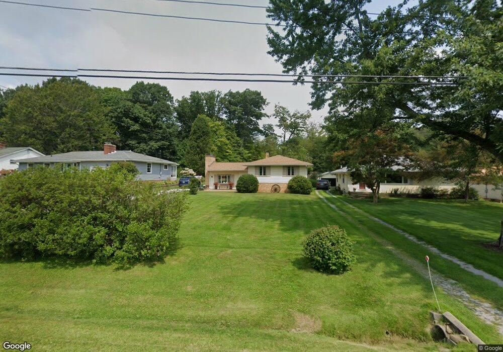
279 Maplewood Dr Alliance, OH 44601
Estimated Value: $190,000 - $238,000
3
Beds
3
Baths
1,006
Sq Ft
$207/Sq Ft
Est. Value
About This Home
This home is located at 279 Maplewood Dr, Alliance, OH 44601 and is currently estimated at $207,929, approximately $206 per square foot. 279 Maplewood Dr is a home located in Stark County with nearby schools including Alliance Elementary School at Rockhill, Alliance Intermediate School at Northside, and Alliance Middle School.
Ownership History
Date
Name
Owned For
Owner Type
Purchase Details
Closed on
Jul 17, 1995
Sold by
Mcdaniel Ronald E
Bought by
Kittle Donald J and Kittle Pamela
Current Estimated Value
Home Financials for this Owner
Home Financials are based on the most recent Mortgage that was taken out on this home.
Original Mortgage
$83,945
Interest Rate
7.79%
Mortgage Type
VA
Purchase Details
Closed on
Sep 29, 1994
Sold by
Vincent James E
Bought by
Mcdaniel Ronald E and Mcdaniel Susan
Home Financials for this Owner
Home Financials are based on the most recent Mortgage that was taken out on this home.
Original Mortgage
$53,100
Interest Rate
7.25%
Mortgage Type
New Conventional
Create a Home Valuation Report for This Property
The Home Valuation Report is an in-depth analysis detailing your home's value as well as a comparison with similar homes in the area
Home Values in the Area
Average Home Value in this Area
Purchase History
| Date | Buyer | Sale Price | Title Company |
|---|---|---|---|
| Kittle Donald J | $85,000 | -- | |
| Mcdaniel Ronald E | $62,500 | -- |
Source: Public Records
Mortgage History
| Date | Status | Borrower | Loan Amount |
|---|---|---|---|
| Closed | Kittle Donald J | $83,945 | |
| Previous Owner | Mcdaniel Ronald E | $53,100 |
Source: Public Records
Tax History
| Year | Tax Paid | Tax Assessment Tax Assessment Total Assessment is a certain percentage of the fair market value that is determined by local assessors to be the total taxable value of land and additions on the property. | Land | Improvement |
|---|---|---|---|---|
| 2025 | -- | $57,620 | $10,540 | $47,080 |
| 2024 | -- | $57,620 | $10,540 | $47,080 |
| 2023 | $1,127 | $37,210 | $9,030 | $28,180 |
| 2022 | $1,151 | $37,210 | $9,030 | $28,180 |
| 2021 | $1,507 | $37,210 | $9,030 | $28,180 |
| 2020 | $1,422 | $32,800 | $7,840 | $24,960 |
| 2019 | $1,402 | $32,800 | $7,840 | $24,960 |
Source: Public Records
Map
Nearby Homes
- 2705 Shunk Ave
- 2943 S Union Ave
- 2625 Belleflower Dr
- 3116 Ridgehill Ave
- 2406 S Union Ave
- 2372 S Union Ave
- 2405 Cherry Ave
- 856 Birchwood Dr
- 152 E Mill St
- 29 Colony Dr
- 31 Colony Dr
- 555 E Milton St
- 2464 S Freedom Ave
- 2580 Edgewood Ave
- 864 W College Rd
- 3709 S Union Ave
- 1016 Roseland Rd
- 853 Fairway Dr
- 2630 Blenheim Ave
- 3018 Blenheim Ave
- 271 Maplewood Dr
- 315 Maplewood Dr
- 253 Maplewood Dr
- 325 Maplewood Dr
- 345 Maplewood Dr
- 280 Maplewood Dr
- 258 Maplewood Dr
- 340 Maplewood Dr
- 221 Maplewood Dr
- 367 Maplewood Dr
- 234 Maplewood Dr
- 205 Maplewood Dr
- 336 Maplewood Dr
- 336 Maplewood Dr
- 379 Maplewood Dr
- 275 Linwood Dr
- 315 Linwood Dr
- 247 Linwood Dr
- 337 Linwood Dr
- 165 Maplewood Dr
Your Personal Tour Guide
Ask me questions while you tour the home.