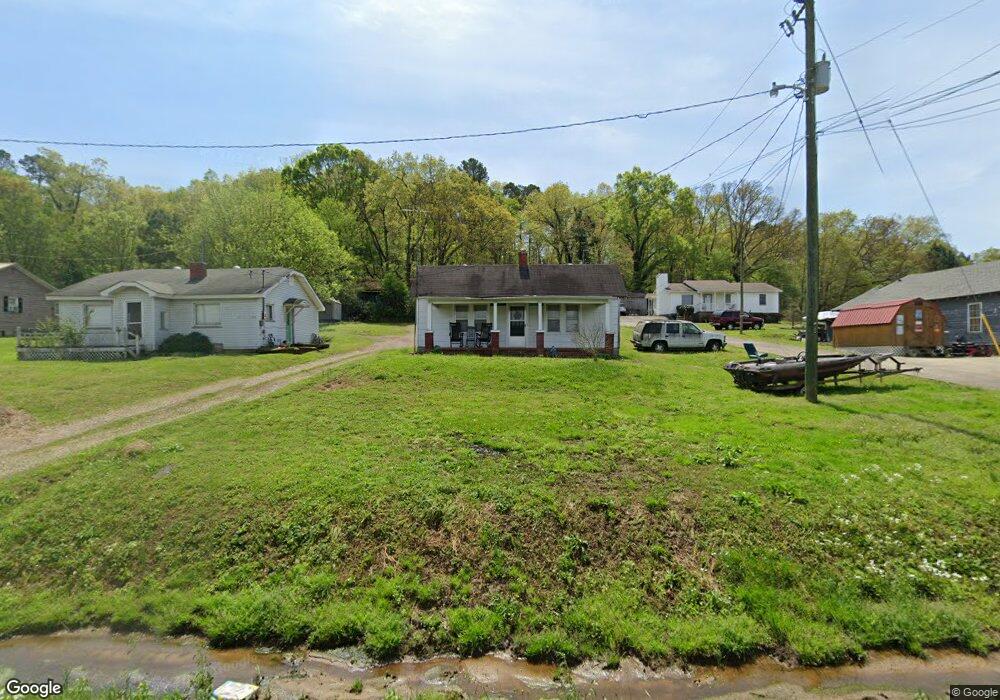
279 Prior Station Rd Cedartown, GA 30125
Estimated Value: $86,845 - $151,000
2
Beds
1
Bath
880
Sq Ft
$130/Sq Ft
Est. Value
About This Home
This home is located at 279 Prior Station Rd, Cedartown, GA 30125 and is currently estimated at $114,711, approximately $130 per square foot. 279 Prior Station Rd is a home located in Polk County with nearby schools including Cedar Christian School and Vineyard Harvester Christian Academy.
Ownership History
Date
Name
Owned For
Owner Type
Purchase Details
Closed on
Aug 25, 2023
Sold by
Mason Patricia P
Bought by
Pro Landing Ventures Llc
Current Estimated Value
Purchase Details
Closed on
Aug 31, 2022
Sold by
Pope Paul W
Bought by
Mason Patricia P
Purchase Details
Closed on
May 7, 1970
Sold by
Yarbrough Franklin
Bought by
Pope Paul W
Purchase Details
Closed on
Feb 9, 1968
Sold by
Hardy Walter
Bought by
Yarbrough Franklin
Purchase Details
Closed on
Nov 8, 1966
Sold by
Alexander Bobby E
Bought by
Hardy Walter
Purchase Details
Closed on
Feb 20, 1962
Bought by
Alexander Bobby E
Create a Home Valuation Report for This Property
The Home Valuation Report is an in-depth analysis detailing your home's value as well as a comparison with similar homes in the area
Home Values in the Area
Average Home Value in this Area
Purchase History
| Date | Buyer | Sale Price | Title Company |
|---|---|---|---|
| Pro Landing Ventures Llc | $70,000 | -- | |
| Mason Patricia P | -- | -- | |
| Pope Paul W | -- | -- | |
| Yarbrough Franklin | -- | -- | |
| Hardy Walter | -- | -- | |
| Alexander Bobby E | -- | -- |
Source: Public Records
Tax History Compared to Growth
Tax History
| Year | Tax Paid | Tax Assessment Tax Assessment Total Assessment is a certain percentage of the fair market value that is determined by local assessors to be the total taxable value of land and additions on the property. | Land | Improvement |
|---|---|---|---|---|
| 2024 | $474 | $22,697 | $2,838 | $19,859 |
| 2023 | $365 | $15,385 | $2,838 | $12,547 |
| 2022 | $252 | $12,631 | $1,892 | $10,739 |
| 2021 | $256 | $12,631 | $1,892 | $10,739 |
| 2020 | $256 | $12,631 | $1,892 | $10,739 |
| 2019 | $119 | $6,442 | $1,892 | $4,550 |
| 2018 | $118 | $6,291 | $1,892 | $4,399 |
| 2017 | $117 | $6,291 | $1,892 | $4,399 |
| 2016 | $112 | $6,126 | $1,728 | $4,399 |
| 2015 | $115 | $6,227 | $1,728 | $4,500 |
| 2014 | $116 | $6,227 | $1,728 | $4,500 |
Source: Public Records
Map
Nearby Homes
- 0 Old Potash Rd Unit 7675402
- 0 Old Potash Rd Unit 10636176
- 382 5th St
- 293 4th St
- 119 Jackson St
- 2460 Hidden Creek Rd
- 309 Walnut St
- 634 Georgia Ave
- 634 Georgia Ave Unit 123
- 1003 Fairview Ave
- 605 W Girard Ave
- 421 Wissahickon Ave
- 0 Mountain Home Rd Unit 1020-B 10351940
- 0 Mountain Home Rd Unit 1020-C 10351948
- 0 Mountain Home Rd Unit 1020-A 10351930
- 325 Fairview Ave
- 258 Chestnut St
- 305 N Cave Spring St
- 234 Brooks St
- 443 N Cave Spring St
- 271 Prior Station Rd
- 287 Prior Station Rd
- 263 Prior Station Rd
- 297 Prior Station Rd
- 253 Prior Station Rd
- 922 Canal St
- 319 Prior Station Rd
- 974 Canal St
- 323 Prior Station Rd
- 946 Canal St
- 341 Prior Station Rd
- 960 Canal St
- 355 Prior Station Rd
- 154 Ohio Dr
- 0 Ohio Dr Unit 7055344
- 0 Ohio Dr Unit 7055337
- 0 Ohio Dr Unit 7042503
- 0 Ohio Dr Unit 20038837
- 0 Ohio Dr Unit 7083002
- 0 Ohio Dr Unit Tract 8 8347005