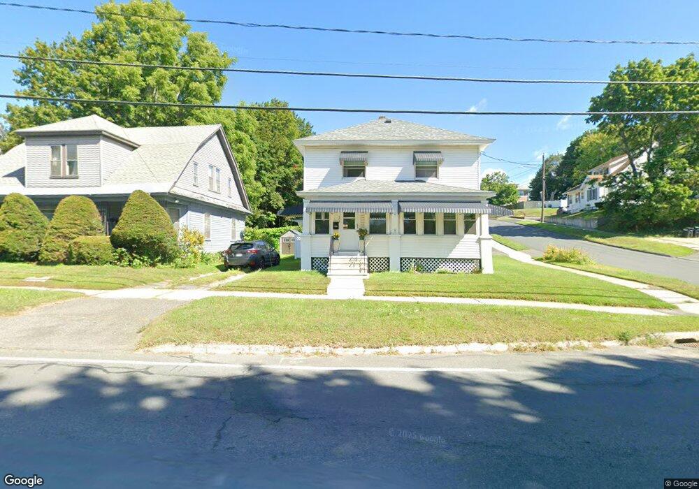
279 Springside Ave Pittsfield, MA 01201
Estimated Value: $247,780 - $287,000
3
Beds
1
Bath
1,456
Sq Ft
$183/Sq Ft
Est. Value
About This Home
This home is located at 279 Springside Ave, Pittsfield, MA 01201 and is currently estimated at $266,195, approximately $182 per square foot. 279 Springside Ave is a home located in Berkshire County with nearby schools including Morningside Community School, Theodore Herberg Middle School, and Pittsfield High School.
Ownership History
Date
Name
Owned For
Owner Type
Purchase Details
Closed on
Apr 4, 1980
Bought by
Arzt William R and Arzt Kathleen L
Current Estimated Value
Create a Home Valuation Report for This Property
The Home Valuation Report is an in-depth analysis detailing your home's value as well as a comparison with similar homes in the area
Home Values in the Area
Average Home Value in this Area
Purchase History
| Date | Buyer | Sale Price | Title Company |
|---|---|---|---|
| Arzt William R | $28,500 | -- |
Source: Public Records
Mortgage History
| Date | Status | Borrower | Loan Amount |
|---|---|---|---|
| Open | Arzt William R | $12,200 | |
| Closed | Arzt William R | $10,000 | |
| Closed | Arzt William R | $55,500 | |
| Closed | Arzt William R | $6,627 |
Source: Public Records
Tax History Compared to Growth
Tax History
| Year | Tax Paid | Tax Assessment Tax Assessment Total Assessment is a certain percentage of the fair market value that is determined by local assessors to be the total taxable value of land and additions on the property. | Land | Improvement |
|---|---|---|---|---|
| 2025 | $4,037 | $225,000 | $58,400 | $166,600 |
| 2024 | $3,723 | $201,800 | $58,400 | $143,400 |
| 2023 | $3,435 | $187,500 | $53,900 | $133,600 |
| 2022 | $3,144 | $169,400 | $53,900 | $115,500 |
| 2021 | $2,857 | $148,400 | $53,900 | $94,500 |
| 2020 | $2,655 | $134,700 | $43,100 | $91,600 |
| 2019 | $2,412 | $124,200 | $35,900 | $88,300 |
| 2018 | $2,425 | $121,200 | $35,900 | $85,300 |
| 2017 | $2,289 | $116,600 | $34,100 | $82,500 |
| 2016 | $2,163 | $115,300 | $34,100 | $81,200 |
| 2015 | $2,082 | $115,300 | $34,100 | $81,200 |
Source: Public Records
Map
Nearby Homes
- 41 Perrine Ave
- 40 Roland St
- LOT 20 Plunkett St
- 11 Stanley Ave
- 81 Dartmouth St Unit 205
- 81 Dartmouth St Unit 102
- 52 Brown St
- 48 Brown St
- 156 Draper Ave
- 24 Glenwood Ave
- 29 Glenwood Ave
- 98 Lincoln St
- 26 Springside Ave
- 9 Myrtle St
- 762 East St
- 46 Bossidy Dr
- 68 Orchard St
- 52 Bossidy Dr
- 14 Allessio St
- 326 Dalton Ave
- 275 Springside Ave
- 11 Norman Ave
- 273 Springside Ave
- 289 Springside Ave
- 2 & 4 Dickinson
- 78 Curtis Terrace
- 2 Dickinson Ave
- 271 Springside Ave
- 15 Norman Ave
- 12 Norman Ave
- 2 Dickinson Ave
- 209 Woodlawn Ave
- 72 Curtis Terrace
- 295 Springside Ave
- 75 Curtis Terrace
- 22 Dickinson Ave
- 207 Woodlawn Ave
- 73 Curtis Terrace
- 265 Springside Ave
- 20 Norman Ave