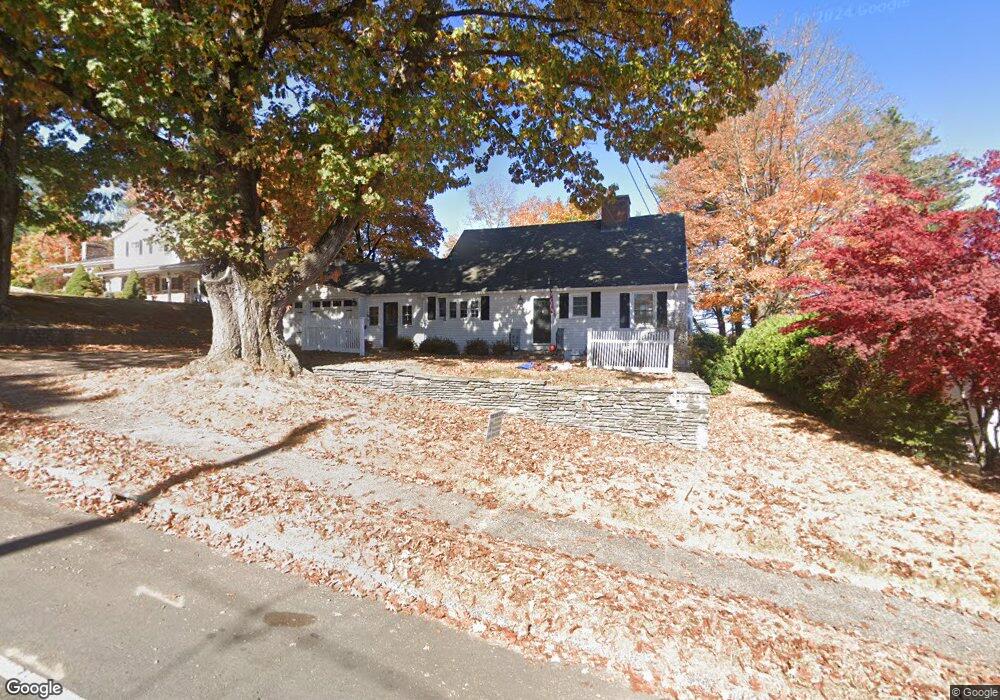
279 Steele St New Britain, CT 06052
Estimated Value: $318,000 - $343,916
3
Beds
2
Baths
1,512
Sq Ft
$221/Sq Ft
Est. Value
About This Home
This home is located at 279 Steele St, New Britain, CT 06052 and is currently estimated at $333,979, approximately $220 per square foot. 279 Steele St is a home located in Hartford County with nearby schools including Lincoln School, Slade Middle School, and Raymond Hill School.
Ownership History
Date
Name
Owned For
Owner Type
Purchase Details
Closed on
Jun 28, 2019
Sold by
Dorsey Dawn
Bought by
Dorsey Justin
Current Estimated Value
Home Financials for this Owner
Home Financials are based on the most recent Mortgage that was taken out on this home.
Original Mortgage
$160,050
Outstanding Balance
$140,733
Interest Rate
4%
Mortgage Type
Purchase Money Mortgage
Estimated Equity
$193,246
Purchase Details
Closed on
Mar 13, 2013
Sold by
Rollins Helen
Bought by
Dorsey Dawn
Create a Home Valuation Report for This Property
The Home Valuation Report is an in-depth analysis detailing your home's value as well as a comparison with similar homes in the area
Home Values in the Area
Average Home Value in this Area
Purchase History
| Date | Buyer | Sale Price | Title Company |
|---|---|---|---|
| Dorsey Justin | $165,000 | -- | |
| Dorsey Dawn | -- | -- |
Source: Public Records
Mortgage History
| Date | Status | Borrower | Loan Amount |
|---|---|---|---|
| Open | Dorsey Justin | $160,050 |
Source: Public Records
Tax History
| Year | Tax Paid | Tax Assessment Tax Assessment Total Assessment is a certain percentage of the fair market value that is determined by local assessors to be the total taxable value of land and additions on the property. | Land | Improvement |
|---|---|---|---|---|
| 2025 | $6,999 | $178,640 | $59,010 | $119,630 |
| 2024 | $7,072 | $178,640 | $59,010 | $119,630 |
| 2023 | $6,838 | $178,640 | $59,010 | $119,630 |
| 2022 | $6,078 | $122,780 | $27,160 | $95,620 |
| 2021 | $6,078 | $122,780 | $27,160 | $95,620 |
| 2020 | $6,144 | $121,660 | $27,160 | $94,500 |
| 2019 | $6,144 | $121,660 | $27,160 | $94,500 |
| 2018 | $6,144 | $121,660 | $27,160 | $94,500 |
| 2017 | $5,766 | $114,170 | $27,650 | $86,520 |
| 2016 | $5,766 | $114,170 | $27,650 | $86,520 |
| 2015 | $5,594 | $114,170 | $27,650 | $86,520 |
| 2014 | $5,594 | $114,170 | $27,650 | $86,520 |
Source: Public Records
Map
Nearby Homes
- 29 S Mountain Dr
- 76 S Mountain Dr Unit B
- 170 Garry Dr
- 55 Dogwood Dr
- 94 Pennsylvania Ave
- 962 Corbin Ave
- 8 Hickory Hill Rd
- 156 Reservoir Rd
- 134 Black Rock Ave
- 38 W End Ave
- 32 Garden St
- 340 Lincoln St
- 18 Woodruff Ct
- 207 Roslyn Dr
- 33 Colt St
- 112 Lincoln St
- 368 Reservoir Rd
- 26 Chamberlain St
- 134 Russwin Rd
- 7 Ledyard Rd
- 269 Steele St
- 287 Steele St
- 261 Steele St
- 299 Steele St
- 22 Round Hill Rd
- 276 Steele St
- 20 Knollwood Dr
- 288 Steele St
- 34 Round Hill Rd
- 268 Steele St
- 30 Knollwood Dr
- 0 Round Hill Rd
- 307 Steele St
- 44 Round Hill Rd
- 300 Steele St
- 9 S Mountain Dr
- 40 Knollwood Dr
- 245 Steele St
- 54 Round Hill Rd
- 310 Steele St
Your Personal Tour Guide
Ask me questions while you tour the home.