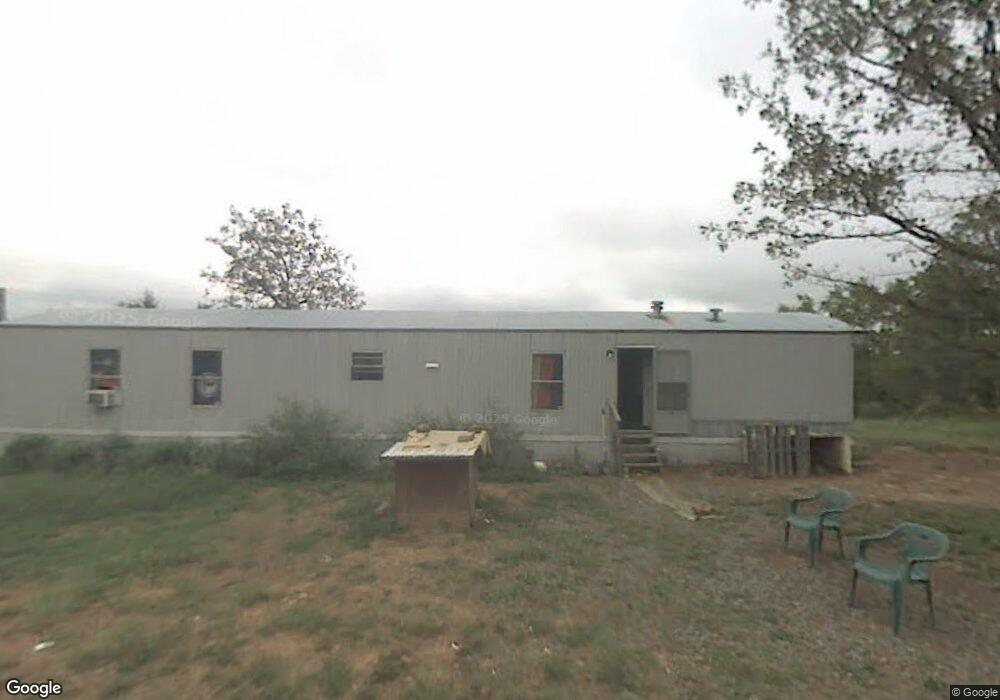
279 Tower Rd Conway, AR 72032
Estimated Value: $72,595 - $180,000
Studio
--
Bath
1,216
Sq Ft
$113/Sq Ft
Est. Value
About This Home
This home is located at 279 Tower Rd, Conway, AR 72032 and is currently estimated at $137,899, approximately $113 per square foot. 279 Tower Rd is a home with nearby schools including Vilonia Junior High School and Vilonia High School.
Ownership History
Date
Name
Owned For
Owner Type
Purchase Details
Closed on
Aug 21, 2023
Sold by
Commissioner Of State Lands
Bought by
Nolan Donavan R and Nolan Madison
Current Estimated Value
Purchase Details
Closed on
Mar 13, 2020
Sold by
Quality Homes
Bought by
Nolan Donavan R and Nolan Madison
Purchase Details
Closed on
Jun 23, 2011
Sold by
Powell Gardner Rodney and Powell Sandra Lynn
Bought by
Quality Homes
Purchase Details
Closed on
Aug 24, 2005
Bought by
Powell
Purchase Details
Closed on
Aug 23, 2005
Sold by
Goode Grant and Goode Lori
Bought by
Powell Gardner Rodney and Powell Sandra Lynn
Purchase Details
Closed on
May 3, 1995
Bought by
Goode
Purchase Details
Closed on
Sep 19, 1991
Bought by
Goode
Create a Home Valuation Report for This Property
The Home Valuation Report is an in-depth analysis detailing your home's value as well as a comparison with similar homes in the area
Home Values in the Area
Average Home Value in this Area
Purchase History
| Date | Buyer | Sale Price | Title Company |
|---|---|---|---|
| Nolan Donavan R | $168 | None Listed On Document | |
| Nolan Donavan R | $20,000 | None Available | |
| Quality Homes | -- | None Available | |
| Powell | $10,000 | -- | |
| Powell Gardner Rodney | $10,242 | None Available | |
| Goode | $1,000 | -- | |
| Goode | $2,000 | -- |
Source: Public Records
Tax History
| Year | Tax Paid | Tax Assessment Tax Assessment Total Assessment is a certain percentage of the fair market value that is determined by local assessors to be the total taxable value of land and additions on the property. | Land | Improvement |
|---|---|---|---|---|
| 2025 | $104 | $3,340 | $2,840 | $500 |
| 2024 | $99 | $3,340 | $2,840 | $500 |
| 2023 | $94 | $1,960 | $1,700 | $260 |
| 2022 | $45 | $1,960 | $1,700 | $260 |
| 2021 | $124 | $1,960 | $1,700 | $260 |
| 2020 | $117 | $1,800 | $1,700 | $100 |
| 2019 | $206 | $3,650 | $1,700 | $1,950 |
| 2018 | $199 | $3,650 | $1,700 | $1,950 |
| 2017 | $186 | $3,650 | $1,700 | $1,950 |
| 2016 | $173 | $2,970 | $1,700 | $1,270 |
| 2015 | $130 | $2,700 | $1,700 | $1,000 |
| 2014 | $160 | $1,700 | $1,700 | $0 |
Source: Public Records
Map
Nearby Homes
- 93 Rolling Manor Dr
- 00 Winding Branch Ln
- 43 Megan Ln
- 63 Stone Mountain Dr
- 196 Stone Mountain Rd
- 7 Logan Way
- 14 Rose Ln
- Tract 81 Aj Lewis Dr
- Tract 76 Aj Lewis Dr
- Tract 83 Aj Lewis Dr
- Tract 79 Aj Lewis Dr
- Tract 72 Aj Lewis Dr
- Tract 87 Aj Lewis Dr
- Tract 85 Aj Lewis Dr
- Tract 77 Aj Lewis Dr
- Tract 82 Aj Lewis Dr
- Tract 74 Aj Lewis Dr
- Tract 84 Aj Lewis Dr
- Tract 75 Aj Lewis Dr
- Tract 70 Aj Lewis Dr
- 275 Tower Rd
- 65 Rolling Manor Dr
- 75 Rolling Manor Dr
- 288 Tower Rd
- 289 Tower Rd
- 63 Rolling Manor Dr
- 300 Tower Rd
- 74 Rolling Manor Dr
- 190 Tower Rd
- 196 Tower Rd
- 56 Rolling Manor Dr
- 88 Rolling Manor Dr
- 102 Rolling Manor Dr
- 252 Tower Rd
- 311 Tower Rd
- 112 Rolling Manor Dr
- 46 Rolling Manor Dr
- 29 Rolling Manor Dr
- 29 Rolling Manor Dr
- 34 Winding Branch Ln
Your Personal Tour Guide
Ask me questions while you tour the home.