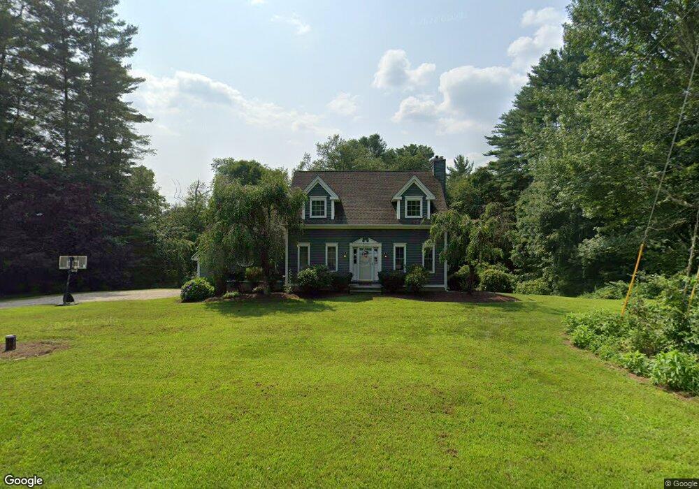
279 Wauregan Rd Brooklyn, CT 06234
Brooklyn NeighborhoodEstimated Value: $422,000 - $476,000
3
Beds
3
Baths
1,474
Sq Ft
$307/Sq Ft
Est. Value
About This Home
This home is located at 279 Wauregan Rd, Brooklyn, CT 06234 and is currently estimated at $452,521, approximately $307 per square foot. 279 Wauregan Rd is a home located in Windham County with nearby schools including Brooklyn Elementary School and Brooklyn Middle School.
Ownership History
Date
Name
Owned For
Owner Type
Purchase Details
Closed on
Oct 19, 2009
Sold by
Taylor Charles W and Taylor Donna V
Bought by
Cote Jason and Cote Jill E
Current Estimated Value
Home Financials for this Owner
Home Financials are based on the most recent Mortgage that was taken out on this home.
Original Mortgage
$229,591
Outstanding Balance
$150,378
Interest Rate
5.14%
Estimated Equity
$302,143
Purchase Details
Closed on
Jul 23, 2002
Sold by
Weaver Jeffrey A
Bought by
Taylor Charles W and Taylor Donna
Purchase Details
Closed on
Aug 20, 2001
Sold by
Zurowski Louise
Bought by
Weaver Jeffrey A
Create a Home Valuation Report for This Property
The Home Valuation Report is an in-depth analysis detailing your home's value as well as a comparison with similar homes in the area
Home Values in the Area
Average Home Value in this Area
Purchase History
| Date | Buyer | Sale Price | Title Company |
|---|---|---|---|
| Cote Jason | $225,000 | -- | |
| Cote Jason | $225,000 | -- | |
| Taylor Charles W | $203,561 | -- | |
| Taylor Charles W | $203,561 | -- | |
| Weaver Jeffrey A | $23,000 | -- | |
| Weaver Jeffrey A | $23,000 | -- |
Source: Public Records
Mortgage History
| Date | Status | Borrower | Loan Amount |
|---|---|---|---|
| Open | Weaver Jeffrey A | $229,591 | |
| Closed | Weaver Jeffrey A | $229,591 | |
| Previous Owner | Weaver Jeffrey A | $159,000 |
Source: Public Records
Tax History Compared to Growth
Tax History
| Year | Tax Paid | Tax Assessment Tax Assessment Total Assessment is a certain percentage of the fair market value that is determined by local assessors to be the total taxable value of land and additions on the property. | Land | Improvement |
|---|---|---|---|---|
| 2025 | $6,135 | $263,510 | $41,430 | $222,080 |
| 2024 | $4,783 | $161,900 | $31,200 | $130,700 |
| 2023 | $4,630 | $161,900 | $31,200 | $130,700 |
| 2022 | $4,449 | $161,900 | $31,200 | $130,700 |
| 2021 | $4,277 | $161,900 | $31,200 | $130,700 |
| 2020 | $4,332 | $149,800 | $38,500 | $111,300 |
| 2019 | $4,332 | $149,800 | $38,500 | $111,300 |
| 2018 | $4,208 | $149,800 | $38,500 | $111,300 |
| 2017 | $813 | $149,800 | $38,500 | $111,300 |
| 2016 | $3,946 | $149,800 | $38,500 | $111,300 |
| 2015 | $3,725 | $159,000 | $43,500 | $115,500 |
| 2014 | $3,725 | $159,000 | $43,500 | $115,500 |
Source: Public Records
Map
Nearby Homes
- 85 Bailey Woods Rd
- 153 Bluebird Ln
- 462 Wauregan Rd
- 414 Canterbury Rd
- 8 Old Tatnic Hill Rd
- 159 Old Tatnic Hill Rd
- 165 Old Tatnic Hill Rd
- 167 Old Tatnic Hill Rd
- 0 Wolf Den Rd Unit 24109020
- 14 Common Way Dr Unit 14
- 7 Hyde Rd
- 14 South St
- 133 Prince Hill Rd
- 66 South St
- 68 South St
- 72 South St
- 53 Carol Ave
- 31 Woodland Dr
- 106 Tripp Hollow Rd
- 0 Wauregan Rd NE Unit 24117158
- 291 Wauregan Rd
- 295 Wauregan Rd
- 42 Bailey Woods Rd
- 48 Bailey Woods Rd
- 261 Wauregan Rd
- 56 Bailey Woods Rd
- 36 Bailey Woods Rd
- 66 Bailey Woods Rd
- 251 Wauregan Rd
- 53 Bailey Woods Rd
- 69 Bailey Woods Rd
- 31 Bailey Woods Rd
- 59 Bailey Woods Rd
- 78 Bailey Woods Rd
- 47 Bailey Woods Rd
- 67 Bailey Woods Rd
- 239 Wauregan Rd
- 23 Bailey Woods Rd
- 41 Bailey Woods Rd
- 84 Bailey Woods Rd