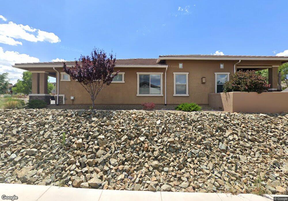
2790 Brooks Range Prescott, AZ 86301
Prescott Lakes NeighborhoodEstimated Value: $863,057 - $992,000
--
Bed
--
Bath
2,585
Sq Ft
$354/Sq Ft
Est. Value
About This Home
This home is located at 2790 Brooks Range, Prescott, AZ 86301 and is currently estimated at $914,264, approximately $353 per square foot. 2790 Brooks Range is a home with nearby schools including Granite Mountain Middle School, Abia Judd Elementary School, and Prescott Mile High Middle School.
Ownership History
Date
Name
Owned For
Owner Type
Purchase Details
Closed on
May 1, 2018
Sold by
Dh Pinnacle Iv Llc
Bought by
Arnold Richard D and Arnold Pamela S
Current Estimated Value
Home Financials for this Owner
Home Financials are based on the most recent Mortgage that was taken out on this home.
Original Mortgage
$236,635
Outstanding Balance
$203,938
Interest Rate
4.44%
Mortgage Type
New Conventional
Estimated Equity
$710,326
Purchase Details
Closed on
Oct 20, 2017
Sold by
Efo Pl Investors Llc
Bought by
Dh Pinnacle Iv Llc
Create a Home Valuation Report for This Property
The Home Valuation Report is an in-depth analysis detailing your home's value as well as a comparison with similar homes in the area
Home Values in the Area
Average Home Value in this Area
Purchase History
| Date | Buyer | Sale Price | Title Company |
|---|---|---|---|
| Arnold Richard D | $536,635 | Empire West Title Agency Llc | |
| Dh Pinnacle Iv Llc | $420,000 | Empire West Title Agency Llc |
Source: Public Records
Mortgage History
| Date | Status | Borrower | Loan Amount |
|---|---|---|---|
| Open | Arnold Richard D | $236,635 |
Source: Public Records
Tax History Compared to Growth
Tax History
| Year | Tax Paid | Tax Assessment Tax Assessment Total Assessment is a certain percentage of the fair market value that is determined by local assessors to be the total taxable value of land and additions on the property. | Land | Improvement |
|---|---|---|---|---|
| 2026 | $2,205 | $79,032 | -- | -- |
| 2024 | $2,159 | $83,225 | -- | -- |
| 2023 | $2,159 | $67,594 | $7,926 | $59,668 |
| 2022 | $2,129 | $51,881 | $7,934 | $43,947 |
| 2021 | $2,285 | $50,057 | $6,060 | $43,997 |
| 2020 | $2,295 | $0 | $0 | $0 |
| 2019 | $2,278 | $0 | $0 | $0 |
| 2018 | $250 | $0 | $0 | $0 |
| 2017 | $238 | $0 | $0 | $0 |
| 2016 | $240 | $0 | $0 | $0 |
| 2015 | -- | $0 | $0 | $0 |
| 2014 | -- | $0 | $0 | $0 |
Source: Public Records
Map
Nearby Homes
- 829 Royal Tulips St
- 830 Hoosier Pass
- 951 Louie St
- 2680 Trail Walk
- 1042 Louie St
- 5919 W Cir
- 5909 W Cedron (Lot 276) Cir
- 6008 W Cedron (Lot 269) Cir
- 5928 W Cedron (Lot 265) Cir
- 6053 W Vesta (Lot 263) Cir
- 6033 W Vesta (Lot 262) Cir
- 5880 W Vesta (Lot 252) Cir
- 968 Rosye View Ln
- 3000 Noble Star Dr
- 888 S Lakeview Dr
- 1662 Solstice Dr
- 1035 Craftsman Dr
- 1110 S Lakeview Dr
- 1753 Ascott St
- 1065 Craftsman Dr
- 2792 Brooks Range
- 1702 Ascott St
- 2794 Brooks Range
- 2801 Brooks Range
- 816 Royal Tulips St
- 857 Brookline Dr
- 815 Royal Tulips St
- 849 Brookline Dr
- 801 Chureo St
- 2796 Brooks Range
- 802 Chureo St
- 841 Brookline Dr
- 2789 Brooks Range
- 818 Royal Tulips St
- 817 Royal Tulips St
- 803 Chureo St
- 2787 Brooks Range
- 2798 Brooks Range
- 837 Brookline Dr
- 814 Chureo St