Estimated Value: $368,898 - $752,000
--
Bed
--
Bath
--
Sq Ft
523
Sq Ft Lot
About This Home
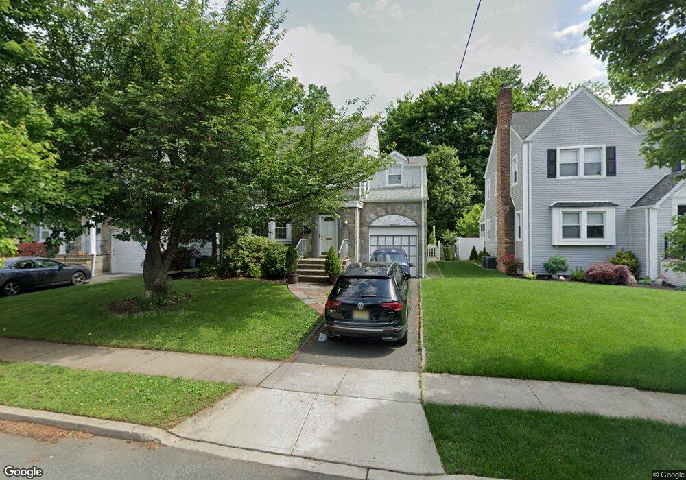
This home is located at 2791 Carol Rd, Union, NJ 07083 and is currently estimated at $633,725. 2791 Carol Rd is a home located in Union County with nearby schools including Battle Hill Elementary School, Burnet Middle School, and Union High School.
Ownership History
Date
Name
Owned For
Owner Type
Purchase Details
Closed on
May 16, 2008
Sold by
Axelrod Joseph and Axelrod Judith M
Bought by
Balkiewicz Albert M
Current Estimated Value
Home Financials for this Owner
Home Financials are based on the most recent Mortgage that was taken out on this home.
Original Mortgage
$373,085
Outstanding Balance
$237,013
Interest Rate
5.94%
Mortgage Type
Purchase Money Mortgage
Estimated Equity
$396,712
Create a Home Valuation Report for This Property
The Home Valuation Report is an in-depth analysis detailing your home's value as well as a comparison with similar homes in the area
Home Values in the Area
Average Home Value in this Area
Purchase History
| Date | Buyer | Sale Price | Title Company |
|---|---|---|---|
| Balkiewicz Albert M | $415,000 | Multiple |
Source: Public Records
Mortgage History
| Date | Status | Borrower | Loan Amount |
|---|---|---|---|
| Open | Balkiewicz Albert M | $373,085 |
Source: Public Records
Tax History Compared to Growth
Tax History
| Year | Tax Paid | Tax Assessment Tax Assessment Total Assessment is a certain percentage of the fair market value that is determined by local assessors to be the total taxable value of land and additions on the property. | Land | Improvement |
|---|---|---|---|---|
| 2025 | $12,293 | $55,000 | $20,800 | $34,200 |
| 2024 | $11,918 | $55,000 | $20,800 | $34,200 |
| 2023 | $11,918 | $55,000 | $20,800 | $34,200 |
| 2022 | $11,504 | $55,000 | $20,800 | $34,200 |
| 2021 | $11,225 | $55,000 | $20,800 | $34,200 |
| 2020 | $11,001 | $55,000 | $20,800 | $34,200 |
| 2019 | $10,853 | $55,000 | $20,800 | $34,200 |
| 2018 | $10,668 | $55,000 | $20,800 | $34,200 |
| 2017 | $10,511 | $55,000 | $20,800 | $34,200 |
| 2016 | $10,254 | $55,000 | $20,800 | $34,200 |
| 2015 | $10,084 | $55,000 | $20,800 | $34,200 |
| 2014 | $9,858 | $55,000 | $20,800 | $34,200 |
Source: Public Records
Map
Nearby Homes
- 1071 Battle Hill Terrace
- 1042 Battle Hill Terrace
- 2785 Larchmont Rd
- 2620 Eleanor Terrace
- 2641 Burns Place
- 1214 Carlton Terrace
- 980 Moessner Ave
- 2615 Burns Place
- 960 Moessner Ave
- 1270 Carlton Terrace
- 30 Washington Ave
- 2636 Frederick Terrace
- 19 Warner Ave
- 2 Bashford-B Unit B
- 1239 Rony Rd
- 2535 Standish Ave
- 17 Alvin Terrace
- 67 Battle Hill Ave
- 8 Bashford Ave Unit 8
- 2510 Crane Place
- 2795 Carol Rd
- 2789 Carol Rd
- 2787 Carol Rd
- 2799 Carol Rd
- 2779 Carol Rd
- 2803 Carol Rd
- 2792 Carol Rd
- 1094 Battle Hill Terrace
- 2798 Carol Rd
- 2775 Carol Rd
- 1093 Mayfair Rd
- 2807 Carol Rd
- 1093 Battle Hill Terrace
- 1086 Battle Hill Terrace
- 2773 Carol Rd
- 2811 Carol Rd
- 2772 Carol Rd
- 1087 Mayfair Rd
- 2808 Carol Rd
- 2765 Carol Rd