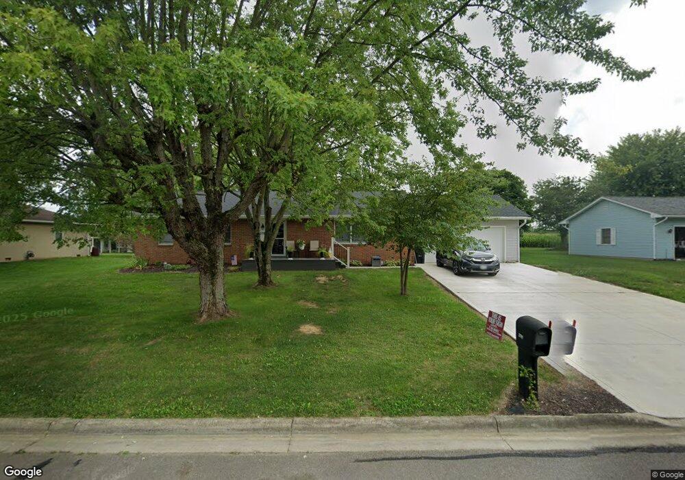
2791 Cornstalk Ave Ashville, OH 43103
Estimated Value: $287,000 - $301,077
3
Beds
2
Baths
1,528
Sq Ft
$191/Sq Ft
Est. Value
About This Home
This home is located at 2791 Cornstalk Ave, Ashville, OH 43103 and is currently estimated at $292,019, approximately $191 per square foot. 2791 Cornstalk Ave is a home located in Pickaway County.
Ownership History
Date
Name
Owned For
Owner Type
Purchase Details
Closed on
Aug 9, 2024
Sold by
Richards Jonathon M
Bought by
Douridas Victoria L and Richards Jonathon M
Current Estimated Value
Purchase Details
Closed on
Sep 9, 2022
Sold by
Douridas Victoria L
Bought by
Richards Jonathon M
Purchase Details
Closed on
Jul 17, 2020
Sold by
Hopper Barbara J
Bought by
Douridas Victoria L
Home Financials for this Owner
Home Financials are based on the most recent Mortgage that was taken out on this home.
Original Mortgage
$138,900
Interest Rate
3.1%
Mortgage Type
New Conventional
Create a Home Valuation Report for This Property
The Home Valuation Report is an in-depth analysis detailing your home's value as well as a comparison with similar homes in the area
Home Values in the Area
Average Home Value in this Area
Purchase History
| Date | Buyer | Sale Price | Title Company |
|---|---|---|---|
| Douridas Victoria L | -- | None Listed On Document | |
| Richards Jonathon M | -- | -- | |
| Douridas Victoria L | $178,900 | Northwest Advantage Ttl Agcy |
Source: Public Records
Mortgage History
| Date | Status | Borrower | Loan Amount |
|---|---|---|---|
| Previous Owner | Douridas Victoria L | $138,900 |
Source: Public Records
Tax History Compared to Growth
Tax History
| Year | Tax Paid | Tax Assessment Tax Assessment Total Assessment is a certain percentage of the fair market value that is determined by local assessors to be the total taxable value of land and additions on the property. | Land | Improvement |
|---|---|---|---|---|
| 2024 | -- | $72,850 | $10,130 | $62,720 |
| 2023 | $2,594 | $72,850 | $10,130 | $62,720 |
| 2022 | $2,040 | $53,460 | $8,290 | $45,170 |
| 2021 | $2,043 | $53,460 | $8,290 | $45,170 |
| 2020 | $1,710 | $53,460 | $8,290 | $45,170 |
| 2019 | $1,913 | $46,350 | $8,290 | $38,060 |
| 2018 | $1,632 | $46,350 | $8,290 | $38,060 |
| 2017 | $1,776 | $46,350 | $8,290 | $38,060 |
| 2016 | $1,668 | $44,080 | $8,290 | $35,790 |
| 2015 | $1,588 | $44,080 | $8,290 | $35,790 |
| 2014 | $1,734 | $44,080 | $8,290 | $35,790 |
| 2013 | $1,894 | $44,080 | $8,290 | $35,790 |
Source: Public Records
Map
Nearby Homes
- 16715 Pontiac Place
- 0 Little Walnut Rd
- 3055 Clifford Ave
- 5009 Roese Ave
- 30 Bazler Ln
- 94 Richard Ave
- 5069 Ashville Rd
- 77 Cromley St
- 61 Bortz St
- 170 Jefferson Ave
- 307 Honeysuckle St
- 302 Honeysuckle St
- 234 Dowler Dr
- 5050 S Walnut St
- 5049 Lee Rd
- 18825 Island Rd
- 5441 Morning Glory St Unit Lot 338
- 5439 Morning Glory St Unit Lot 337
- 5445 Morning Glory St Unit Lot 340
- 5435 Morning Glory St Unit Lot 335
- 2771 Cornstalk Ave
- 2815 Cornstalk Ave
- 2780 Cornstalk Ave
- 2800 Cornstalk Ave
- 2835 Cornstalk Ave
- 2751 Cornstalk Ave
- 2768 Cornstalk Ave
- 2820 Cornstalk Ave
- 2840 Cornstalk Ave
- 2740 Cornstalk Ave
- 2855 Cornstalk Ave
- 2860 Cornstalk Ave
- 16725 Hiawatha Ave
- 2724 Cornstalk Ave
- 2875 Cornstalk Ave
- 16705 Nokomis Cir
- 2665 Cornstalk Ave
- 2700 Cornstalk Ave
- 2895 Cornstalk Ave
- 16700 Nokomis Cir