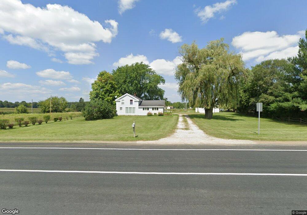
27928 E Red Arrow Hwy Paw Paw, MI 49079
Estimated Value: $306,000 - $358,000
4
Beds
3
Baths
1,752
Sq Ft
$185/Sq Ft
Est. Value
About This Home
This home is located at 27928 E Red Arrow Hwy, Paw Paw, MI 49079 and is currently estimated at $323,743, approximately $184 per square foot. 27928 E Red Arrow Hwy is a home located in Van Buren County with nearby schools including Paw Paw Early Elementary School, Paw Paw Later Elementary School, and Paw Paw Middle School.
Ownership History
Date
Name
Owned For
Owner Type
Purchase Details
Closed on
Dec 10, 2015
Sold by
Mcdade Mark F and Mcdade Nancy J
Bought by
Thompson Chad Nathan and Thompson Gayle Ann
Current Estimated Value
Purchase Details
Closed on
May 28, 2015
Sold by
Hawes Tammy
Bought by
Mcdade Mark F and Mcdade Nancy J
Purchase Details
Closed on
Oct 31, 2012
Sold by
Mcdade Mark and Mcdade Nancy
Bought by
Tawonian Tammy Hawes and Carpenter Lawrence
Purchase Details
Closed on
Feb 16, 2004
Sold by
Terpstra Jay Stewart
Bought by
Mcdade Mark F and Mcdade Nancy J
Create a Home Valuation Report for This Property
The Home Valuation Report is an in-depth analysis detailing your home's value as well as a comparison with similar homes in the area
Home Values in the Area
Average Home Value in this Area
Purchase History
| Date | Buyer | Sale Price | Title Company |
|---|---|---|---|
| Thompson Chad Nathan | $136,017 | Attorney | |
| Mcdade Mark F | $89,536 | None Available | |
| Tawonian Tammy Hawes | -- | None Available | |
| Mcdade Mark F | -- | -- |
Source: Public Records
Tax History Compared to Growth
Tax History
| Year | Tax Paid | Tax Assessment Tax Assessment Total Assessment is a certain percentage of the fair market value that is determined by local assessors to be the total taxable value of land and additions on the property. | Land | Improvement |
|---|---|---|---|---|
| 2025 | $3,595 | $115,500 | $0 | $0 |
| 2024 | $721 | $103,100 | $0 | $0 |
| 2023 | $686 | $86,200 | $0 | $0 |
| 2022 | $3,264 | $79,200 | $0 | $0 |
| 2021 | $3,145 | $75,300 | $14,200 | $61,100 |
| 2020 | $3,117 | $71,900 | $11,200 | $60,700 |
| 2019 | $2,944 | $67,200 | $67,200 | $0 |
| 2018 | $2,875 | $59,100 | $59,100 | $0 |
| 2017 | $2,817 | $55,100 | $0 | $0 |
| 2016 | $2,791 | $51,000 | $0 | $0 |
| 2015 | $1,454 | $51,000 | $0 | $0 |
| 2014 | $1,462 | $48,000 | $0 | $0 |
| 2013 | -- | $48,600 | $48,600 | $0 |
Source: Public Records
Map
Nearby Homes
- 52117 County Road 657
- 29055 E Red Arrow Hwy
- 25851 Pleasant Dr
- 25614 Marshall Dr
- 48522 Meadow Oak Trail
- 48265 Silver Oaks W
- 30694 Mission St
- Elements 2390 Plan at Vintage Point
- 55800 30th St
- 28313 58th Ave
- 51133 25th St
- 26321 Trestle Creek Ave
- 48692 Silver Oaks Blvd
- 25245 Vargas
- 48265 Silver Oaks W
- 48709 Silver Oaks Blvd
- 24537 Brownstone Blvd
- Integrity 1830 Plan at Silver Oaks
- Elements 2070 Plan at Silver Oaks - Elements
- Integrity 1610 Plan at Silver Oaks
- 27928 E Red Arrow Hwy
- 52260 County Road 657
- 27848 Red Arrow Hwy
- 27849 E Red Arrow Hwy
- 52387 County Road 657
- 28272 E Red Arrow Hwy
- 52555 County Road 657
- 51481 28th St
- 51481 28th St
- 28201 E Red Arrow Hwy
- 52558 County Road 657
- 52699 County Road 657
- 52734 County Road 657
- 27780 Manchester Cir
- 27742 Manchester Cir
- 27800 Manchester Cir
- 27700 Manchester Cir
- 52821 County Road 657
- 27812 Manchester Cir
- 27664 Manchester Cir
