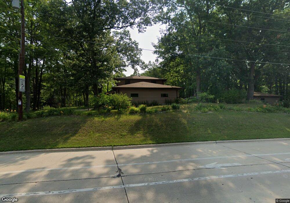
2793 Whippoorwill Dr Green Bay, WI 54304
Westside NeighborhoodEstimated Value: $380,000 - $453,000
--
Bed
--
Bath
--
Sq Ft
0.62
Acres
About This Home
This home is located at 2793 Whippoorwill Dr, Green Bay, WI 54304 and is currently estimated at $422,710. 2793 Whippoorwill Dr is a home located in Brown County with nearby schools including King Elementary School, Lombardi Middle School, and Southwest High School.
Ownership History
Date
Name
Owned For
Owner Type
Purchase Details
Closed on
Jun 1, 2023
Sold by
Wagner Robert E and Wagner Melida
Bought by
Wagner Kyle and Wagner Brittany
Current Estimated Value
Home Financials for this Owner
Home Financials are based on the most recent Mortgage that was taken out on this home.
Original Mortgage
$200,000
Interest Rate
6.39%
Mortgage Type
Land Contract Argmt. Of Sale
Purchase Details
Closed on
Aug 27, 2013
Sold by
Wagner Robert E and Wagner Melida
Bought by
Wagner Robert E and Revoca Melida Wagner
Create a Home Valuation Report for This Property
The Home Valuation Report is an in-depth analysis detailing your home's value as well as a comparison with similar homes in the area
Home Values in the Area
Average Home Value in this Area
Purchase History
| Date | Buyer | Sale Price | Title Company |
|---|---|---|---|
| Wagner Kyle | $300,000 | -- | |
| Wagner Robert E | -- | None Available |
Source: Public Records
Mortgage History
| Date | Status | Borrower | Loan Amount |
|---|---|---|---|
| Closed | Wagner Kyle | $200,000 |
Source: Public Records
Tax History Compared to Growth
Tax History
| Year | Tax Paid | Tax Assessment Tax Assessment Total Assessment is a certain percentage of the fair market value that is determined by local assessors to be the total taxable value of land and additions on the property. | Land | Improvement |
|---|---|---|---|---|
| 2024 | $6,669 | $349,500 | $66,000 | $283,500 |
| 2023 | $6,408 | $349,500 | $66,000 | $283,500 |
| 2022 | $6,238 | $349,500 | $66,000 | $283,500 |
| 2021 | $5,079 | $217,200 | $55,200 | $162,000 |
| 2020 | $5,109 | $217,200 | $55,200 | $162,000 |
| 2019 | $4,962 | $217,200 | $55,200 | $162,000 |
| 2018 | $4,839 | $217,200 | $55,200 | $162,000 |
| 2017 | $4,760 | $217,200 | $55,200 | $162,000 |
| 2016 | $4,689 | $217,200 | $55,200 | $162,000 |
| 2015 | $4,775 | $217,200 | $55,200 | $162,000 |
| 2014 | $4,954 | $217,200 | $55,200 | $162,000 |
| 2013 | $4,954 | $217,200 | $55,200 | $162,000 |
Source: Public Records
Map
Nearby Homes
- 1433 Baumgart Rd Unit 1435
- 2640 He Nis Ra Ln
- 3023 Crusade Ln
- 2550 He Nis Ra Ln
- 2768 Independence Dr
- 2060 Wintergreen Ct
- 2993 Fleetwood Dr
- 3097 S Sandstone Ct
- 3096 S Sandstone Ct
- 2044 Ann Ln
- 2441 Matchwood Ln
- 2439 W Point Rd
- 2466 Parkwood Dr
- 1602 W Crusade Ln
- 1940 Renaissance Ct
- 2060 Trissino Way
- 1680 Cormier Rd
- 1570 Mesa Dr
- 3102 Sandstone Ct
- 1973 Knotty Pine Dr
- 2785 Whippoorwill Dr
- 2794 Oakwood Dr
- 2782 Oakwood Dr
- 2771 Whippoorwill Dr
- 2796 Whippoorwill Dr
- 2786 Whippoorwill Dr
- 2772 Oakwood Dr
- 2776 Whippoorwill Dr
- 2763 Whippoorwill Dr
- 2766 Oakwood Dr
- 2789 He Nis Ra Ln
- 1615 S Point Rd
- 2764 Whippoorwill Dr
- 2783 He Nis Ra Ln
- 2777 He Nis Ra Ln
- 2755 Whippoorwill Dr
- 2771 He Nis Ra Ln
- 2754 Whippoorwill Dr
- 2765 He Nis Ra Ln
- 2745 Whippoorwill Dr