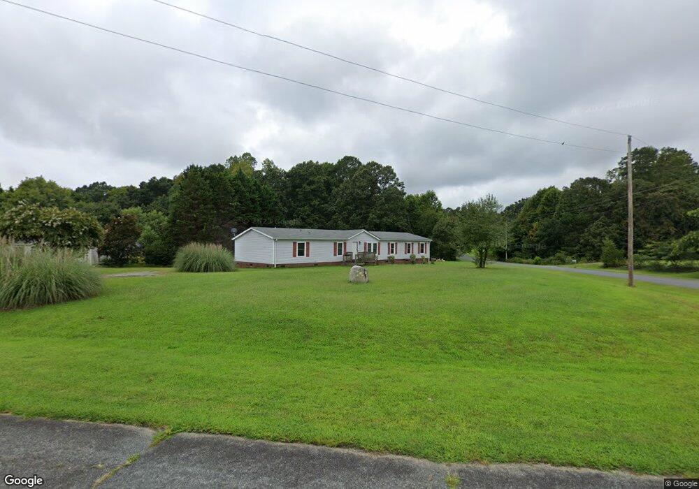
2793 Wingtip Ct Iron Station, NC 28080
Estimated Value: $224,000 - $419,000
4
Beds
2
Baths
2,067
Sq Ft
$143/Sq Ft
Est. Value
About This Home
This home is located at 2793 Wingtip Ct, Iron Station, NC 28080 and is currently estimated at $296,482, approximately $143 per square foot. 2793 Wingtip Ct is a home located in Lincoln County with nearby schools including Iron Station Elementary School, East Lincoln Middle School, and East Lincoln High School.
Ownership History
Date
Name
Owned For
Owner Type
Purchase Details
Closed on
Jul 12, 2006
Sold by
Key Builders Inc
Bought by
Perry Michael W and Perry Linda C Snead
Current Estimated Value
Home Financials for this Owner
Home Financials are based on the most recent Mortgage that was taken out on this home.
Original Mortgage
$93,500
Outstanding Balance
$54,175
Interest Rate
6.6%
Mortgage Type
New Conventional
Estimated Equity
$242,307
Purchase Details
Closed on
Jun 1, 2005
Sold by
Berryhill Linda K and Berryhill Donald L
Bought by
Deutsche Bank National Trust Co
Purchase Details
Closed on
Mar 10, 2000
Bought by
Berryhill Linda K
Purchase Details
Closed on
Nov 19, 1998
Bought by
Stewart Kenneth F
Create a Home Valuation Report for This Property
The Home Valuation Report is an in-depth analysis detailing your home's value as well as a comparison with similar homes in the area
Purchase History
| Date | Buyer | Sale Price | Title Company |
|---|---|---|---|
| Perry Michael W | $110,000 | None Available | |
| Deutsche Bank National Trust Co | $81,000 | None Available | |
| Berryhill Linda K | $24,900 | -- | |
| Stewart Kenneth F | $23,000 | -- |
Source: Public Records
Mortgage History
| Date | Status | Borrower | Loan Amount |
|---|---|---|---|
| Open | Perry Michael W | $93,500 |
Source: Public Records
Tax History
| Year | Tax Paid | Tax Assessment Tax Assessment Total Assessment is a certain percentage of the fair market value that is determined by local assessors to be the total taxable value of land and additions on the property. | Land | Improvement |
|---|---|---|---|---|
| 2025 | $1,134 | $160,551 | $28,575 | $131,976 |
| 2024 | $1,114 | $160,551 | $28,575 | $131,976 |
| 2023 | $1,087 | $160,551 | $28,575 | $131,976 |
| 2022 | $872 | $102,943 | $23,102 | $79,841 |
| 2021 | $872 | $102,943 | $23,102 | $79,841 |
| 2020 | $737 | $102,943 | $23,102 | $79,841 |
| 2019 | $737 | $102,943 | $23,102 | $79,841 |
| 2018 | $769 | $91,852 | $21,013 | $70,839 |
| 2017 | $668 | $91,852 | $21,013 | $70,839 |
| 2016 | $668 | $91,852 | $21,013 | $70,839 |
| 2015 | $741 | $91,852 | $21,013 | $70,839 |
| 2014 | $822 | $104,448 | $23,230 | $81,218 |
Source: Public Records
Map
Nearby Homes
- 821 Latrobe Dr
- 1987 & 1981 Magnolia Grove Rd
- 4242 John Ritchie Rd
- 1371 Alexis High Shoals Rd
- 1481 Depot St
- 1279 Craig Dr
- 4394 Mountain Creek Rd
- 6 Hager Mountain Ln
- 3132 Fox Den Cir
- 1259 Hardin Rd
- 1222 Hardin Rd
- 4435 Cornett Dr
- 162 Terry Lane Dr
- 5013 Angelina Dr
- 0001 Mayberry Rd
- 4106 Olga Ct
- 324 Old Hardin Rd
- 914 Spring Lake Dr
- 325 Holly Ridge Rd
- 310 Old Hardin Rd
- 2783 Wingtip Ct
- 2441 Longneck Dr
- 2771 Wingtip Ct
- 2420 Longneck Dr
- 2420 Long Neck Dr
- 2457 Longneck Dr
- 2419 Longneck Dr
- 2767 Wingtip Ct
- 2782 Wingtip Ct
- 2774 Wingtip Ct
- 2683 Hudson Poultry Rd
- 2471 Longneck Dr
- 2652 Hudson Poultry Rd
- 2697 Hudson Poultry Rd
- LOT19 Long Neck Dr
- 2797 Wingtip Ct
- 2486 Longneck Dr
- 2479 Longneck Dr
- 2909 Amethyst Ln
- 2709 Hudson Poultry Rd
Your Personal Tour Guide
Ask me questions while you tour the home.