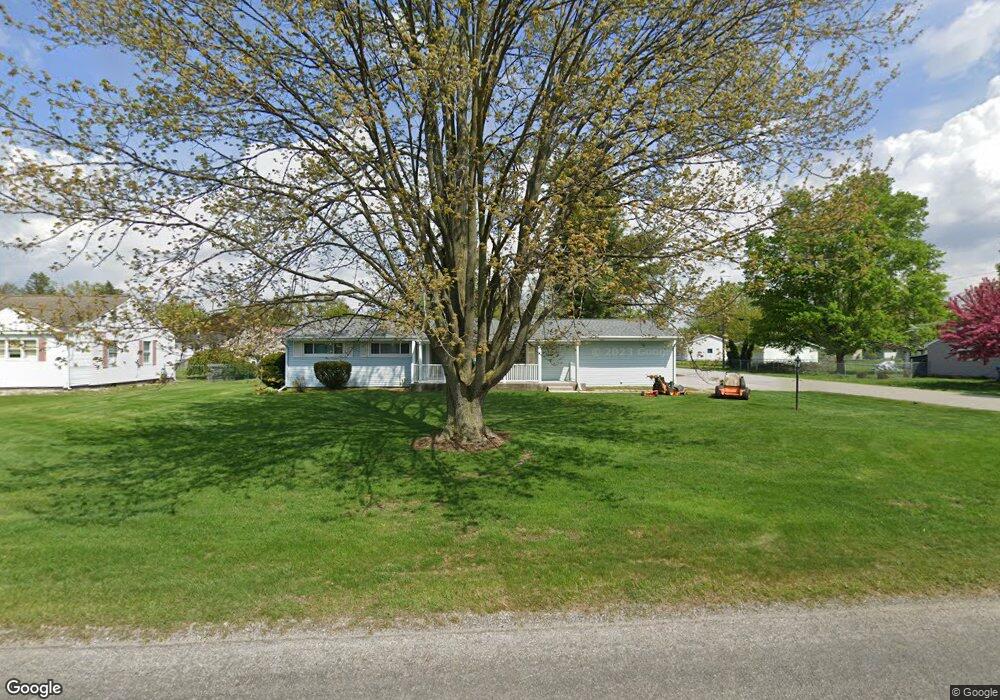
2795 Airport Rd Adrian, MI 49221
Estimated Value: $189,867 - $216,000
3
Beds
2
Baths
1,080
Sq Ft
$191/Sq Ft
Est. Value
About This Home
This home is located at 2795 Airport Rd, Adrian, MI 49221 and is currently estimated at $205,956, approximately $190 per square foot. 2795 Airport Rd is a home located in Lenawee County with nearby schools including Adrian High School and St. Stephen Lutheran School.
Ownership History
Date
Name
Owned For
Owner Type
Purchase Details
Closed on
Aug 26, 2020
Sold by
Mcvay Richard T
Bought by
Mcvay Richard T
Current Estimated Value
Purchase Details
Closed on
Apr 12, 2011
Sold by
Young Norman A and Young Sharon
Bought by
Mcvay Nathan T and Mcvay Holly
Home Financials for this Owner
Home Financials are based on the most recent Mortgage that was taken out on this home.
Original Mortgage
$67,200
Interest Rate
4.77%
Mortgage Type
New Conventional
Purchase Details
Closed on
Dec 26, 2006
Sold by
Tomko Regis S
Bought by
Young Norman A and Young Sharon
Home Financials for this Owner
Home Financials are based on the most recent Mortgage that was taken out on this home.
Original Mortgage
$112,000
Interest Rate
6.24%
Mortgage Type
New Conventional
Create a Home Valuation Report for This Property
The Home Valuation Report is an in-depth analysis detailing your home's value as well as a comparison with similar homes in the area
Home Values in the Area
Average Home Value in this Area
Purchase History
| Date | Buyer | Sale Price | Title Company |
|---|---|---|---|
| Mcvay Richard T | -- | None Available | |
| Mcvay Nathan T | $84,000 | Prestige Title Inc Agency Ll | |
| Young Norman A | $140,000 | None Available |
Source: Public Records
Mortgage History
| Date | Status | Borrower | Loan Amount |
|---|---|---|---|
| Previous Owner | Mcvay Nathan T | $67,200 | |
| Previous Owner | Young Norman A | $112,000 |
Source: Public Records
Tax History Compared to Growth
Tax History
| Year | Tax Paid | Tax Assessment Tax Assessment Total Assessment is a certain percentage of the fair market value that is determined by local assessors to be the total taxable value of land and additions on the property. | Land | Improvement |
|---|---|---|---|---|
| 2025 | $1,689 | $80,800 | $0 | $0 |
| 2024 | $976 | $73,500 | $0 | $0 |
| 2022 | $884 | $58,400 | $0 | $0 |
| 2021 | $1,537 | $56,300 | $0 | $0 |
| 2020 | $1,536 | $57,400 | $0 | $0 |
| 2019 | $132,962 | $49,100 | $0 | $0 |
| 2018 | $1,490 | $49,067 | $0 | $0 |
| 2017 | $1,436 | $48,757 | $0 | $0 |
| 2016 | $1,676 | $46,662 | $0 | $0 |
| 2014 | -- | $44,212 | $0 | $0 |
Source: Public Records
Map
Nearby Homes
- 2682 Elmwood Dr
- 1902 W Cadmus Rd
- 1692 Rivers Edge Ct
- 2018 Green Acres Dr
- 2029 Green Acres Dr
- 2023 Green Acres Dr
- 2027 Green Acres Dr
- 2015 Green Acres Dr
- 2012 Green Acres Dr
- 2010 Green Acres Dr
- 2008 Green Acres Dr
- 302 Lakewood Dr
- 1639 Rivers Edge Ct
- 802 Lakewood Dr
- 3224 Sand Creek Hwy
- 3079 Hillview Dr
- 3031 Planeview Dr
- 301 Ohio River Dr Unit LOT 52
- 1227 Sherman St
- 3520 Crestone Way
- 2223 Birchwood Dr
- 2779 Airport Rd
- 2831 Airport Rd
- 2847 Airport Rd
- 2767 Airport Rd
- 2865 Airport Rd
- 2796 Sharon Dr
- 2778 Sharon Dr
- 2881 Airport Rd
- 2766 Sharon Dr
- 2754 Sharon Dr
- 2729 Airport Rd
- 2000 Sharon Dr
- 2742 Sharon Dr
- 2769 Sharon Dr
- 2897 Airport Rd
- 2761 Sharon Dr
- 2833 Sharon Dr
- 2751 Sharon Dr
- 2870 Sharon Dr